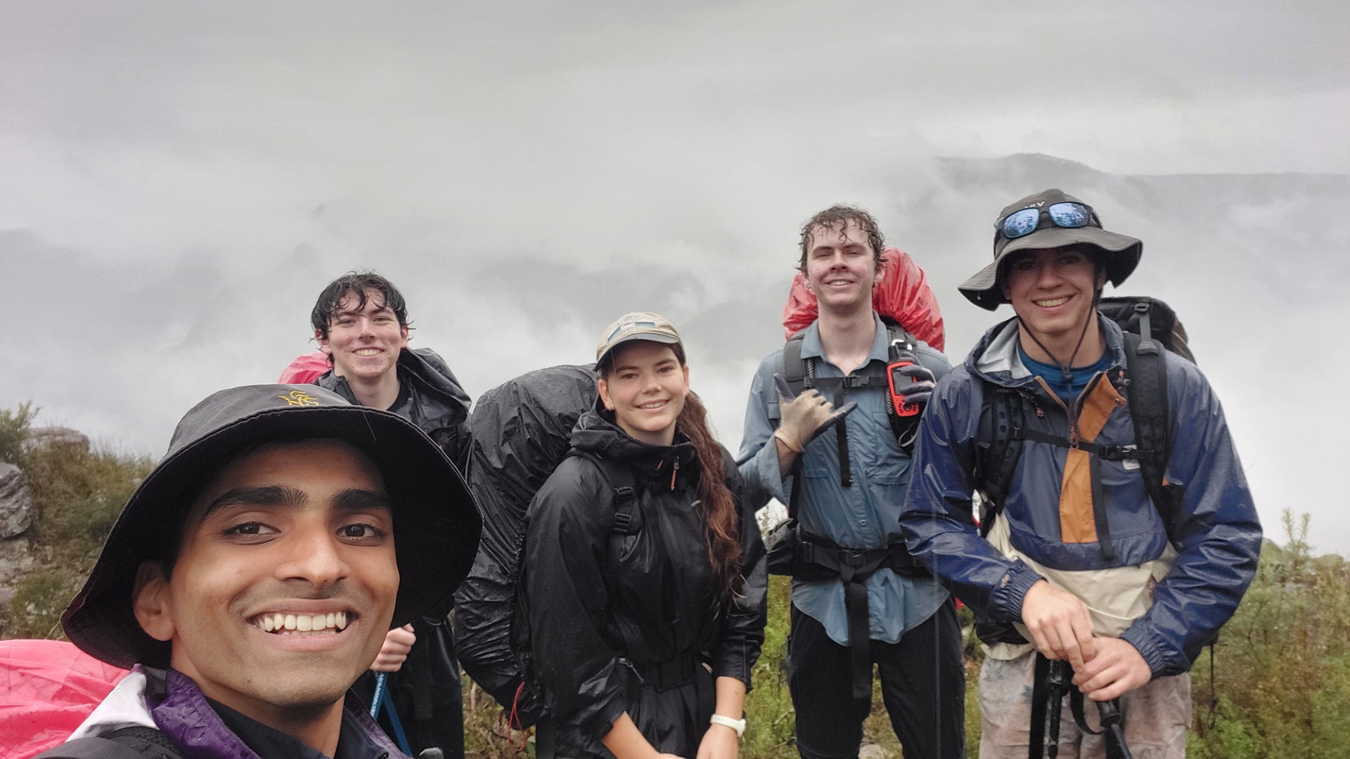
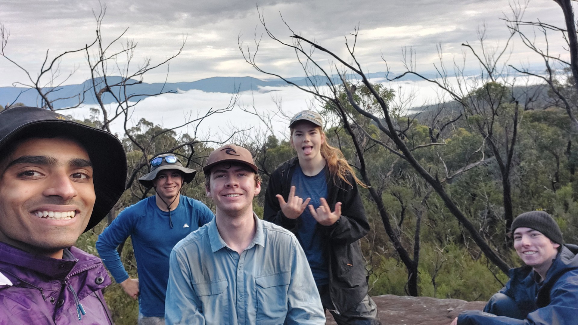
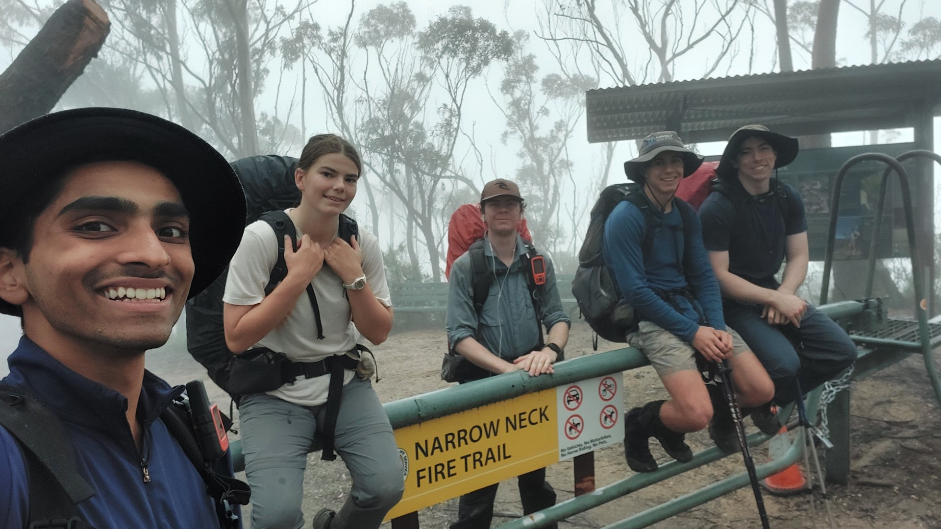
Party: Tara, Seamus, Campbell, Piet, Sudarshan (yours truly)
Photos by all of us. Click any photo to enlarge it.
The Sun is setting, and we’re setting up camp at the Kanangra Carpark. I’m in my tent when I hear a voice:
> “Does anybody have spare shoes?”
We reply no. This wasn’t a trip for such luxuries on the walk.
> “What about shoes to leave in the car, and use after the hike?”
Ah, doh. We could’ve brought them - but no worries, we’ll manage.
> “Ah, I forgot my shoes…”
This is Campbell. He’s a funny guy. He must be making a funny joke. We ignore and continue, however a minute or so passes and he’s still searching around.

Turns out that Mr Campbell here had forgotten his hiking boots at home!
One last car search is done, before I accompany Campbell on the 4-hour trip to the nearest shop that sells shoes, in the foggiest conditions I have ever driven in. Kmart Bathurst, truly the place to be. We pick up the only remotely suitable pair of shoes available (it was $35), and spend even more on petrol to get back to Kanangra.
The shoes are called the “Everlast Rochester Outdoor Shoe”, and I quote, are “crafted for spontaneous adventures”. How perfect!
If you’ve ever thought about doing a multiday hike in Kmart sneakers, read Campbell’s battle-tested Product Review at the end of this report. Genuinely amazing.
About the walk
Kanangra to Katoomba (K2K) is a hike that was very negatively affected by the 2019 bushfires, and for a few years, the bush regrowth made the walk incredibly hard to do. It had been put onto my “very distant backburner to-do list”, as I’d heard more negative than positive stories about the walk recently.
This changed when on my way back from a hike in Tasmania earlier this year (check out the trip report), I happened to meet a hiking trio from the Blue Mountains at the same hotel! One of them had recently completed K2K - and in discussions, I was informed that the conditions were actually deteriorating less harshly than they were a year prior. This pushed K2K further up my more immediate to-do list. Chatting around, we found a few others with similar ideas, and we decided to embark on it during our term break!
As a word of warning: this walk is really not for the inexperienced. Many portions of it are overgrown, and more than half the route requires constant active navigation to ensure you stay on the trail.
I make particular reference to this poorly written article from the TimeOut magazine. Their article implies that K2K is the most popular multiday hike in the entire state. This is objectively incorrect. That crown should go to one of several other routes (eg. Mt Solitary, The Main Range, parts of the GNW, Royal Coast Track, and many more).
Not to make any allegations, but I will point out that there is a link within that article with the utm_source set as ChatGPT (screenshot below).
The article mentions that it doesn’t have “boutique lodges at every turn” and that “you’ll be carrying most of what you need”. This strongly undersells the remoteness of this walk.
Several parties have had to be rescued along this route due to unpreparedness recently, or even factors genuinely out of their control, exacerbated by its remoteness.
To quote Caro Ryan, “The K2K route is described online as a classic 3-day trip in the southern Blue Mountains. This description was written before the fires and floods since 2019”.
If you are attempting this walk, please do adequate research and ensure you are prepared. Most reports don’t tell you their preparation: We carried food for an extra day, several forms of backup navigation, and several forms of communication. Extra water was carried every day in case we didn’t make camp that night. Extra layers of dry and warmth were carried in case the weather turned (which it did).
Despite Campbell's silly story, all of us have experience in overnight and offtrack hikes through the Budawangs, Blue Mountains, and Tasmania. This is a trip for experienced hikers in rough terrain with navigational skill. Do not just rely on your phone GPS.
In any case - K2K is a historical classic trip, and I knew I had to attempt it 😛. Preparation out of the way, to the report!
Campbell and I get back to Kanangra at about 9pm after slowly attempting to avoid the wildlife and potholes on the dirt road, while battling the 30metre visibility afforded by the fog. The others have already finished their dinner, and we are getting into bed soon after doing the same. It is now that we discover Seamus is an extremely early riser.
“When’s sunrise?” he asks. It’s 06:50am. “That means we can start walking at 06:30, wake up at 05:30!”
The rest of us (not so) kindly turn him down, and we decide to wake up at sunrise, to get walking around 8am.
Day 1
We have breakfast and fill up water. Packs are weighed, and we have weights of [18, 19, 21, 22] kilograms. Seamus comes in at 13kg so I gladly donate the First Aid kit to him.
We get walking at 08:31am 😆

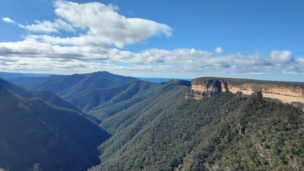
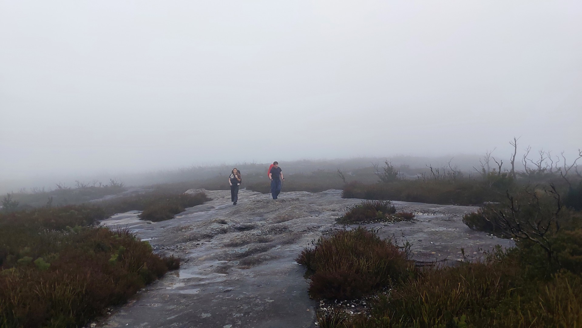
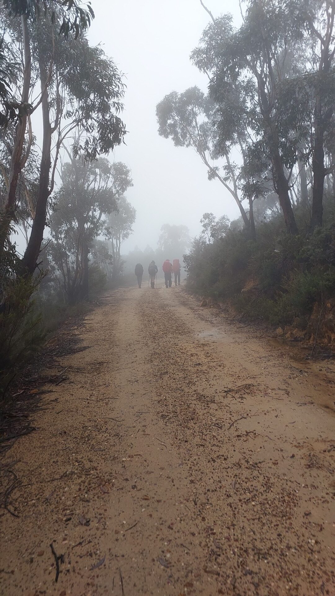
Quite spectacularly, the fog thins out as we reach Kanangra Walls lookout to provide us just enough view of the eponymous Kanangra Walls, the Thurat Spires, and Kanangra Creek. Unfortunately, within 10 minutes the fog thickened, and our brief stint at the lookout would be the only views we got for the entire day.
For the curious - I was back here a week later. Click here to see the views we should've gotten…
We soon made our way onto the Plateau Walk, playing Chicken with the rain and taking our raincoats off.
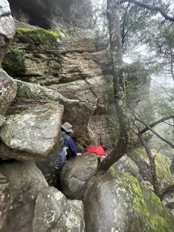
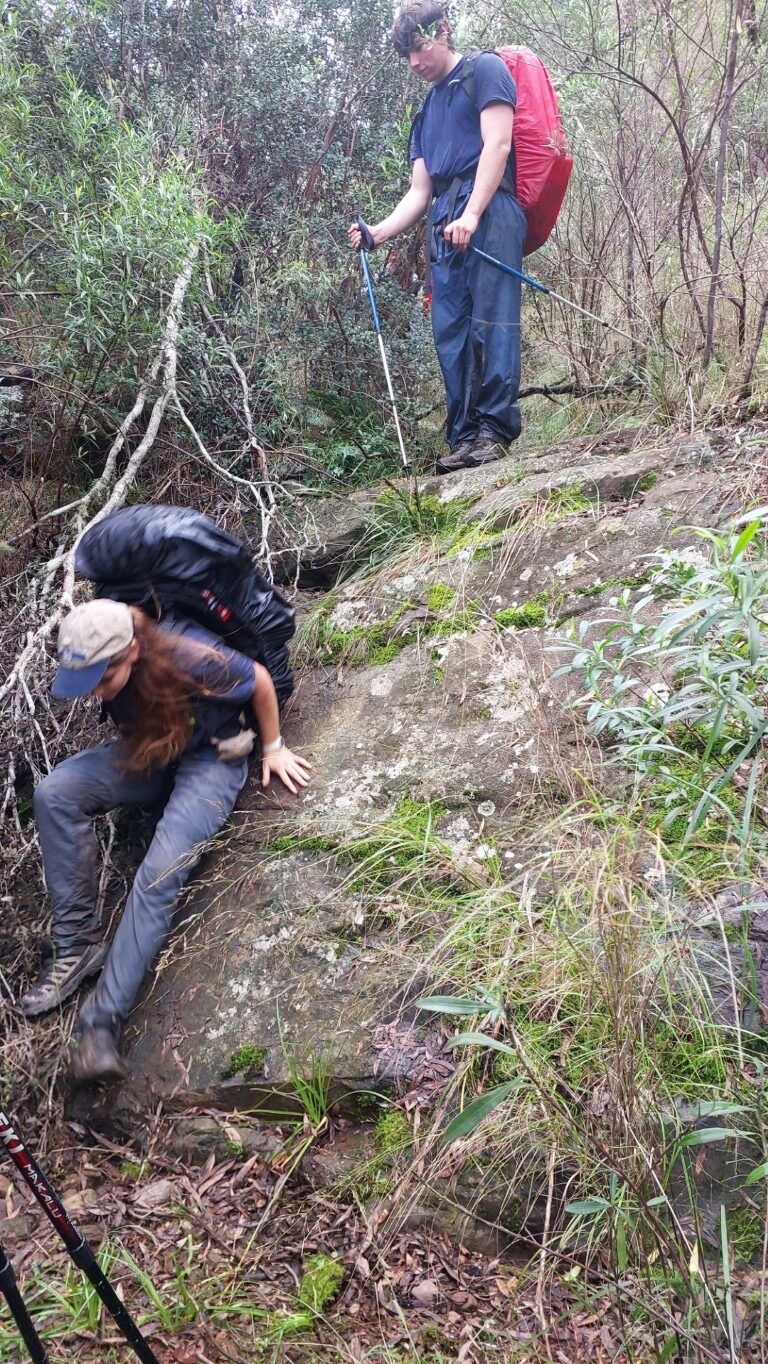
Our first real task was descending Gordon Smith Pass, and it was here that we all became intimately familiar with wet Kanangra granite. It was slipperier than soaped-up banana peels skidding down a water slide, and we tried not to succumb to the ground (I failed). In such concentrations, we missed the sharp turn the route made, and found ourselves sliding down a gully into a creekbed, but no matter - we caught our mistake within 100m and made our way back towards the track.
It’s mostly uneventful walking for a while, made only more dull by the invisibility through the fog. We make our way along the base of Crafts Wall. “We seem to have been going quite a while round this wall” I remark, “I wonder if we’ve overshot our turnoff?”.
Funnily enough, I asked that just 30 seconds after missing our turnoff - so we head back and down towards the saddle for Mount Berry. We enjoy a short break admiring the view at the false peak of Mount Berry, before clambering up the little chute onto the mountain, and down into Gabes Gap.
Gabes Gap is a nice open grassy patch with plenty of room for camping, and we push up to the main elevation climb of the day. Mt High and Mighty truly showed us how High and Mighty it was, and my legs enjoyed our lunch break at the top.
From here, it’s clambering over the rocky ridgetop, taking us all the way to Mount Cloudmaker. The rocks are incredibly slippery and surprisingly loose. At some point here, I see a small four-legged black thing scoot past us on the track. It’s very cat-sized, however we think it could potentially be a small wild boar too.
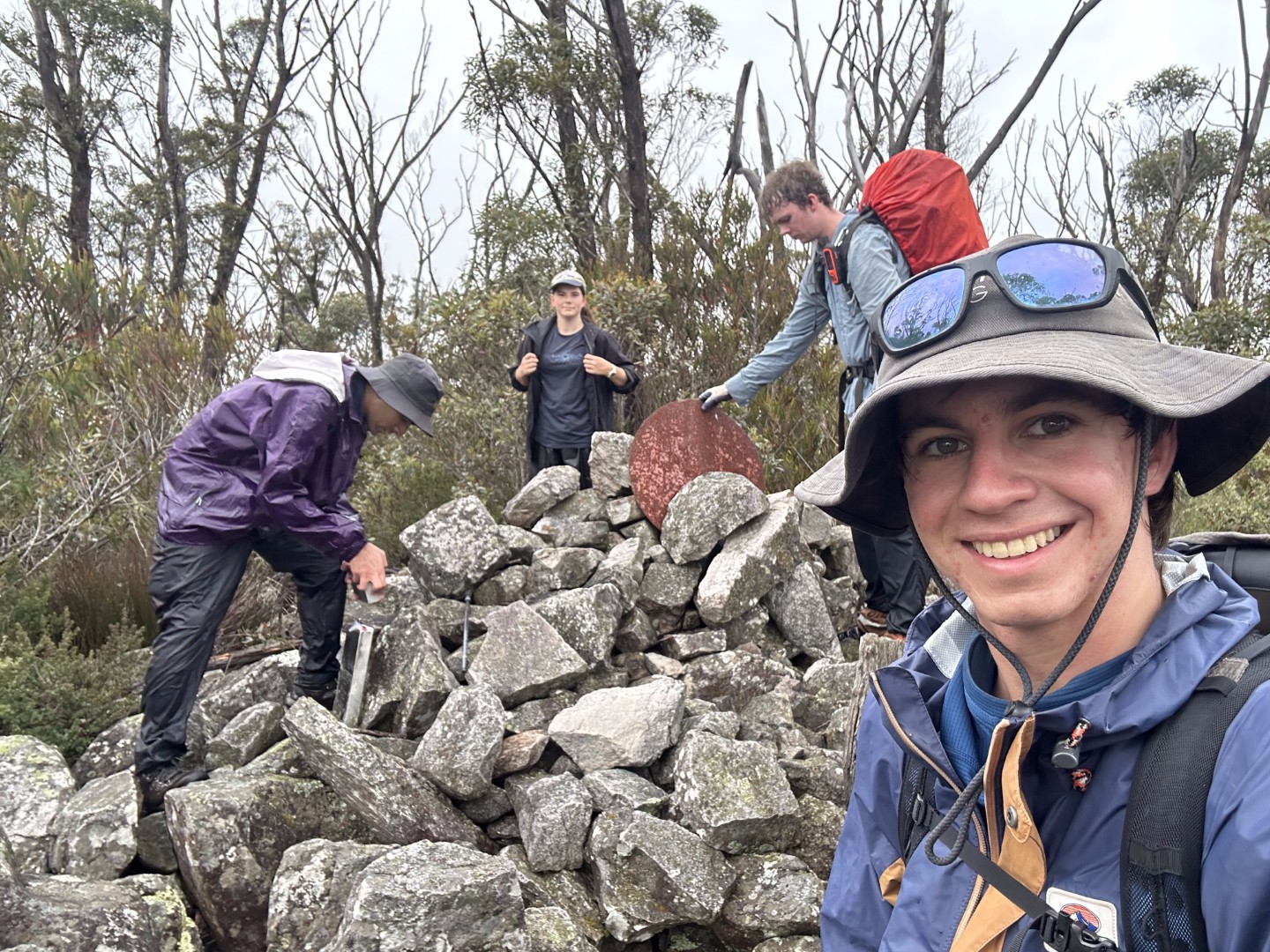
The numerous false peaks of Mt Cloudmaker really get us good, and at the point I thought we were at the final one, I got rumbled (that’s probably why it was named Rumble Knoll).
Cloudmaker truly lived up to its name, as we were greeted by yet more fog and a lack of views. We reach the logbook at 2:30pm, and are mildly saddened to find out that the book was replaced just last month - and we were only the 4th entry yet. I was hopeful to see how trafficked the route was since the fires. For the curious, we were the third group for K2K in the past 30 days.
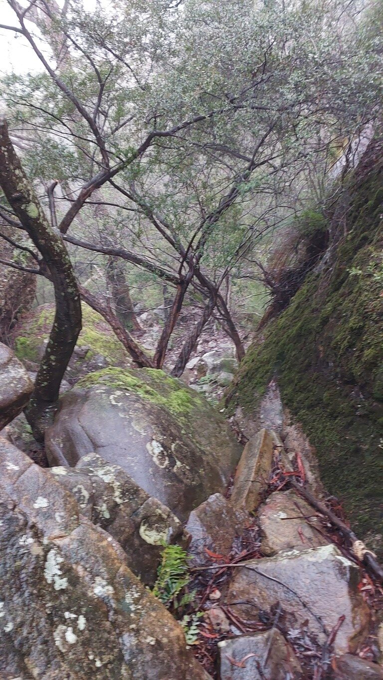
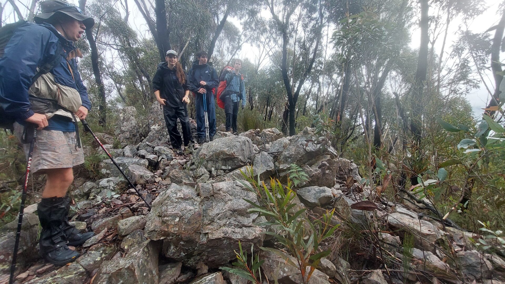
Up until here, we’d encountered barely any bush bashing (as prophesised). The two kilometres to Dex Creek were our first taste of the more vague track, and at least to me - I was pleasantly surprised. Generally relatively visible, and with a keen eye it was easy to stay on or close to the main track all the way.
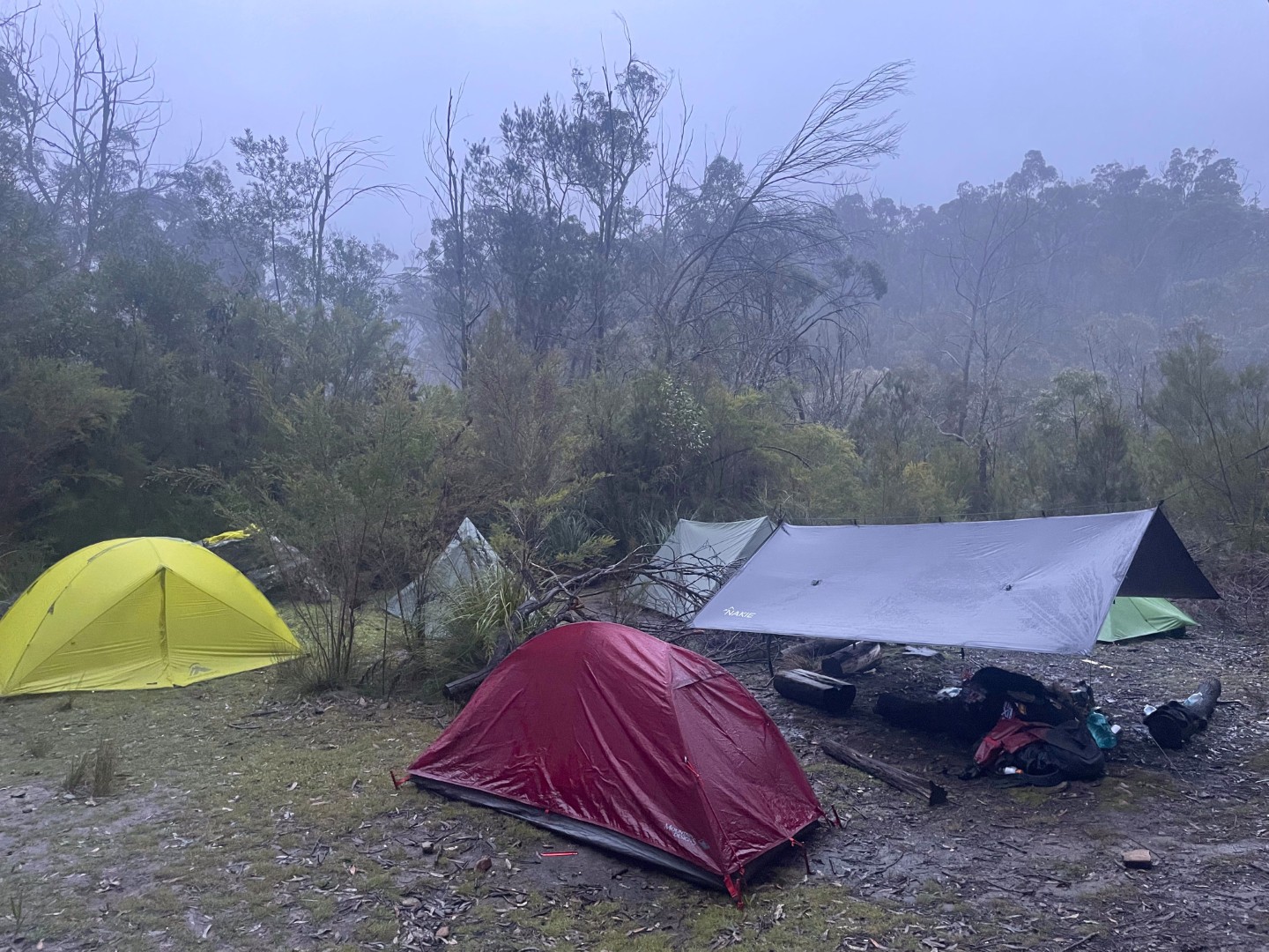
We reached camp at 3:30pm and set up our tents just in time for the rain to begin - and continue through the rest of the night. The water situation at camp was spectacular, and we had no trouble filling up from the creek.
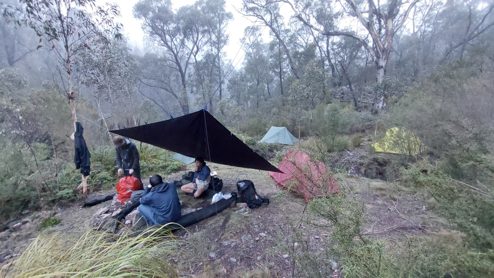
Day 2
Day 2 contained a crossing of the Coxs River - which has been known to get flooded after heavy rain. Thankfully, our rain was more of a persistent shower than a storm. I’d also gotten a message late last night that the day would be clear with minimal rain, which kept hopes high.
We awoke to Seamus playing music at 06:45, and a cry of “guys I can actually see the sky!”. This would’ve normally been adequate motivation for all of us to jump out of tents, but it also happened to be about 3 degrees overnight - so the warmth of a sleeping bag was more enticing 😆.
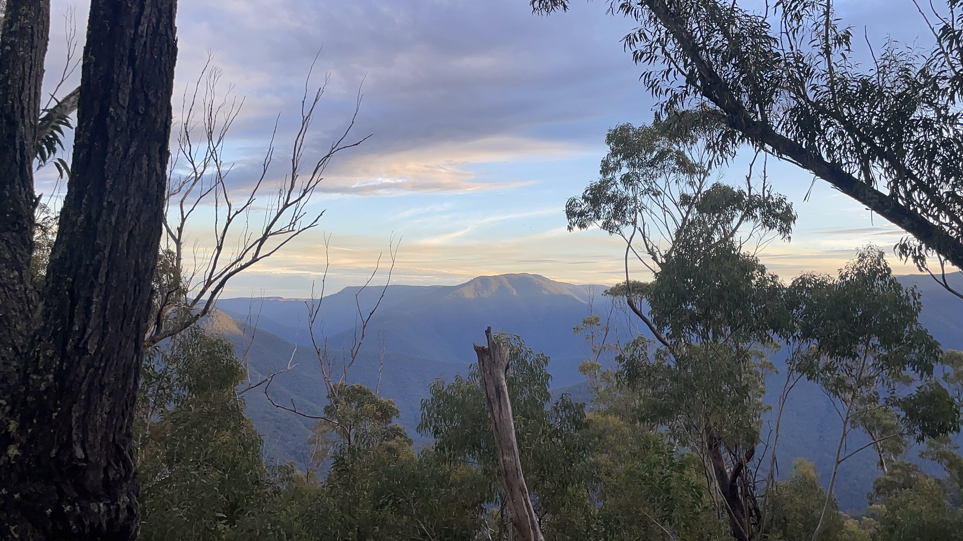
Our amazing track notes recommend we get an early start, and we depart at 08:30 - a whole minute earlier than the previous day! We enjoy the actually spectacular views from Carra Top, with low clouds shrouding the valley.
Exactly as said in the notes, the first hour of today was the worst we’d encountered so far. There was close to no track visible, and Campbell, Seamus, and I took turns at the front, punching through the bush in our desired direction.
We enjoyed a good view at the northern tip of Spot Height 953, before a short but extremely slippery scramble took us to the ridgeline traverse to Mt Strongleg. This section of the track, while still overgrown, was much easier to follow, and minimal map consulting was required.

The descent from Mt Strongleg (780m) to the Coxs River (150m) was the hardest part of the day. The first half up to about the 450m elevation line was slightly more open bush, with some careful route picking taking us along with minimal troubles.
From here the track all but disappeared into extremely dense bush, with me at the front attempting to forge a way along the steep thorny slope. This is probably the worst bush I’ve ever had the misfortune of travelling through? We eventually found ourselves in a little gully and used that to provide a slightly nicer (but slipperier) route down the final 50m of elevation we had to lose.
90 minutes after departing Mt Strongleg, we arrived at the Coxs River, and were relieved to find it in a very crossable state. The current was pretty slow, and it was between knee and waist deep in sections. Most of us opted for a (painful and rocky) barefoot crossing, while Campbell sauntered through in his completely saturated and partially disintegrating Kmart shoes.
We enjoyed a lovely lunch break by the river, but unfortunately took too long - for it was 14:45 by the time we departed again.
The track up towards Mount Yellow Dog was the steepest and longest climb of the entire trip, and just under 2 hours later, we enjoyed a lovely sunset at the summit.
Much to my displeasure, we passed up a perfectly cromulent campsite at the Splendour Rock junction. The rest of today was easy compared to the previous sections, and we decided to walk a few hours into the dark, with the aim of camping at Mobbs Swamp as planned.
The track was well defined as hoped, but with a few fallen logs to step over and plenty of bushes constantly fondling your face. Tara took the lead and I enjoyed not having to navigate. Being second in the conga line is great - I could entirely switch my brain off and mindlessly copy one footstep after the other.
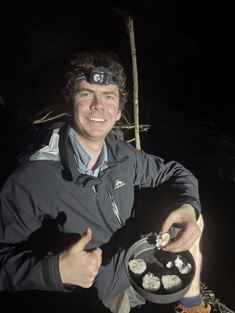
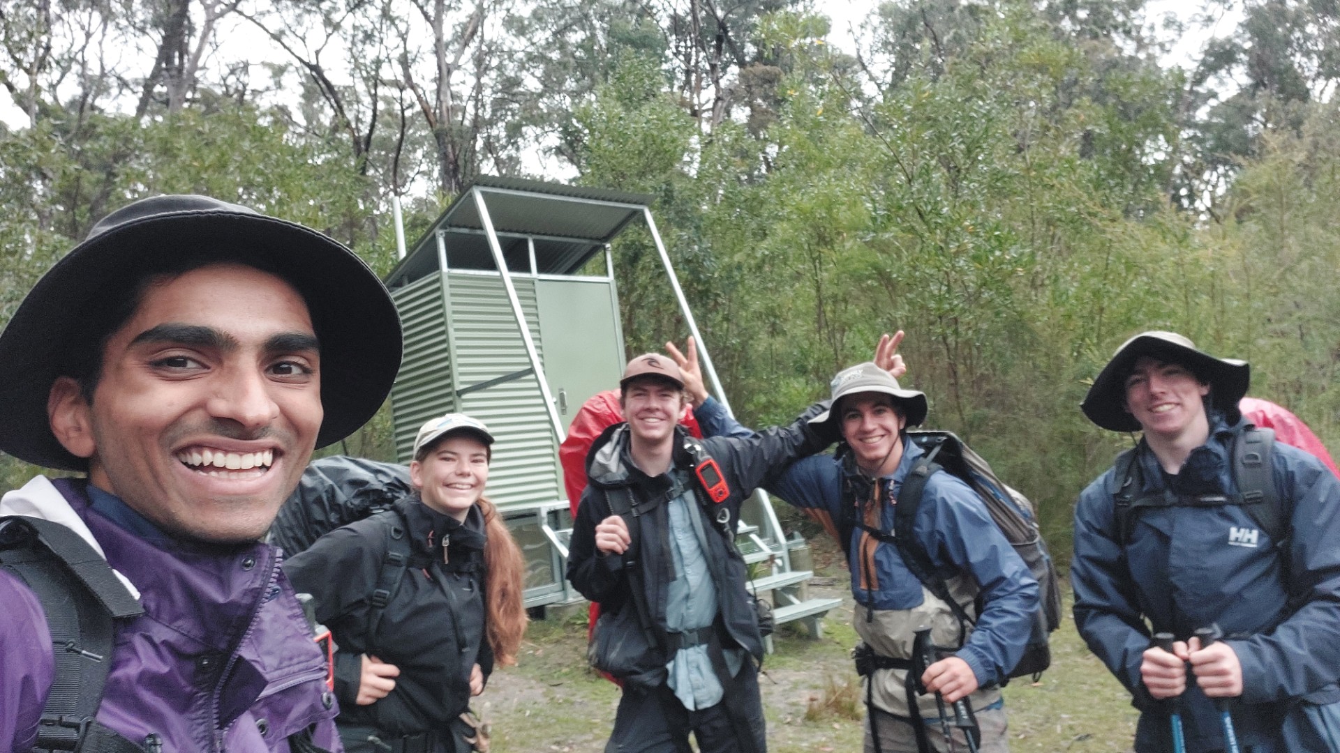
We reached camp at 6:45 and were immediately greeted by the mythical toilet awaiting our presence. One by one we made our offerings before settling into dinner for the night. Campbell makes Sushi and melted chocolate/cheese tortillas.
Just to make sure we didn’t get too comfy though, this campsite was full of leeches. Thankfully they were more stupid than hungry and didn’t catch on too much.
Day 3
We have a leisurely alarm, and wake up to “Oh my god there’s a FAT leech next to my tent”.
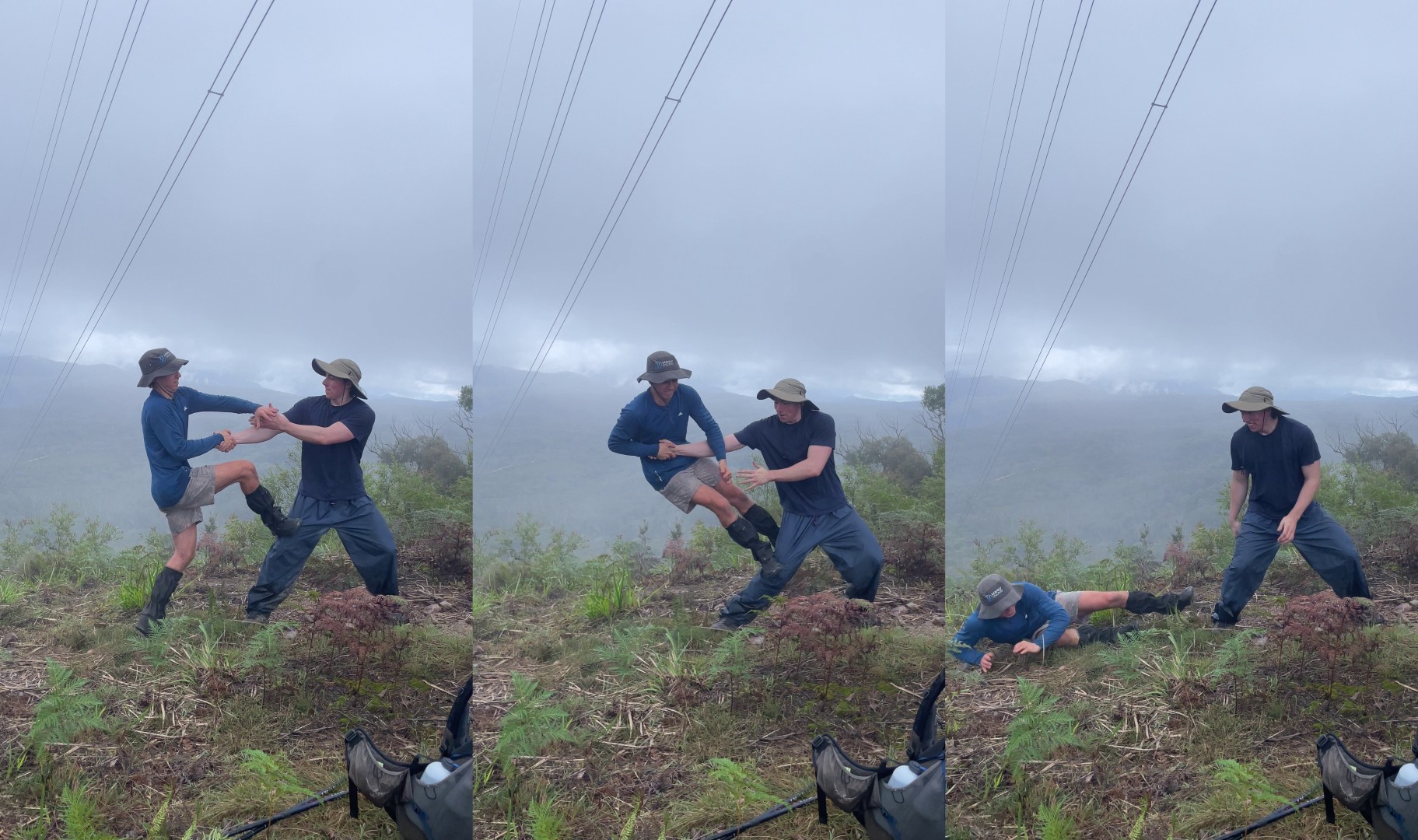
We depart at 09:15 and enjoy the flat well-defined track out to the base of Mount Debert. A short steep stint up the mountain takes us to the top with some views at the powerline clearing. Some gymnastics are attempted with varying success before we continue down a short rocky scramble and towards Narrow Neck, as more fog settles in 🙄. I wonder if the ladders will be safe to climb with a full pack in this weather.
The whole day, Seamus has been having trouble with several leeches trying to get him, and a few have succeeded. The rest of us have had significantly fewer bites. Seamus is in shorts. The rest of us are in long pants. Now, the scientific among you may say that “correlation is not causation” but I definitely see a pattern.
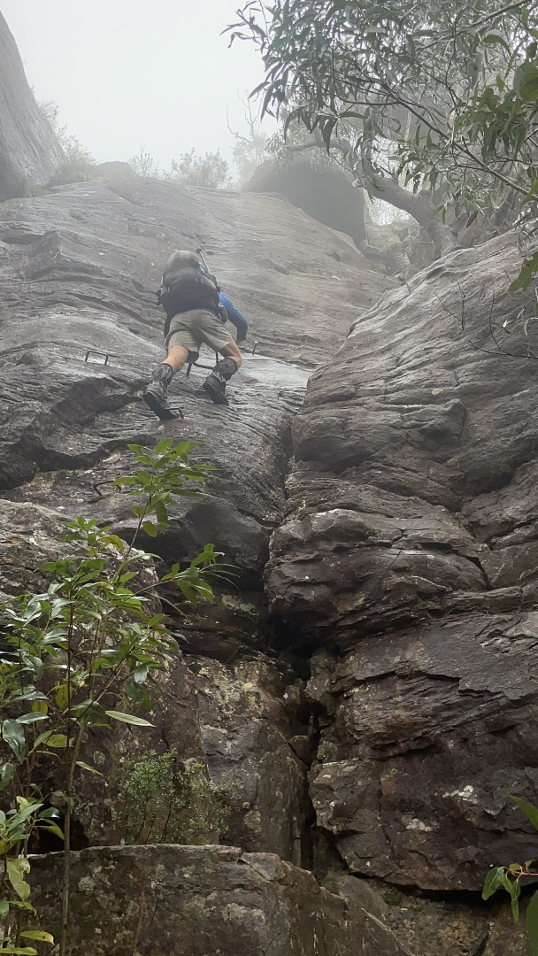
Anyhow, Tarros Ladders are thankfully less exposed than I expected, and we all happily make our way up the metal rungs. Good fun, though the flat rungs were a bit slippery in the wet.
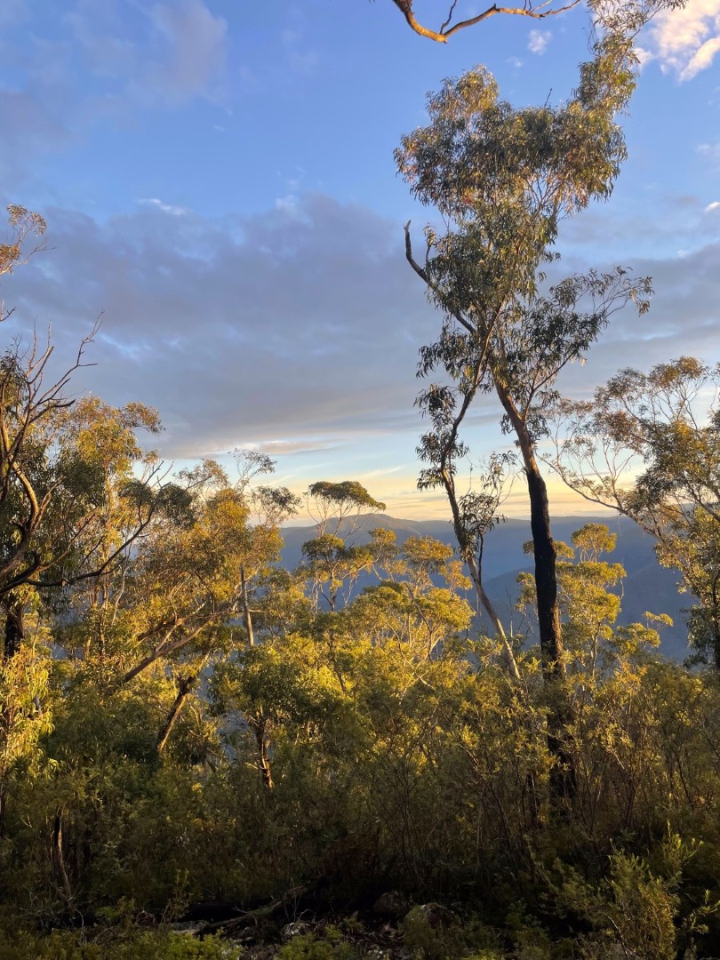
We continue making our way up to the firetrail and reach it just around noon, perfectly timed for lunch. We enjoy an hour’s break at the lovely Clear Hill lookout, aptly named so. It was almost as if someone had taken the views and then cleared the entire canvas!


I enjoy a hot meal in the cold weather, before we set off on the final leg of the journey - this section is generally known to be quite a slog.
12 kilometres of hard compacted firetrail, made worse by the thick fog. Probably the most mind-numbing energy-sucking awful hurty walk I’ve done. The ground was hard and we had heavy packs, and we couldn’t see more than 100m into the distance.

We finally reached the locked gate at 15:45. K2K officially over! Three more kilometres brought us to the car, and we stopped at Dominos for a post-hike feed.
All in all, Days 1 and 2 were interesting. It wasn’t a particularly notable walk, though with better weather it might have been more enjoyable. I would potentially consider reattempting it in the distant future with a bit more fitness under my belt and in better weather. For now however, the slog at the end kind of makes it not worth it.
A special shoutout to Declan the absolute legend for picking up our car from Kanangra Walls and returning it to Katoomba. Truly the hero of this trip and saved us an extra 300km of driving to go collect it.
Everlast Mens Rochester Outdoor Shoes
A product review by Campbell
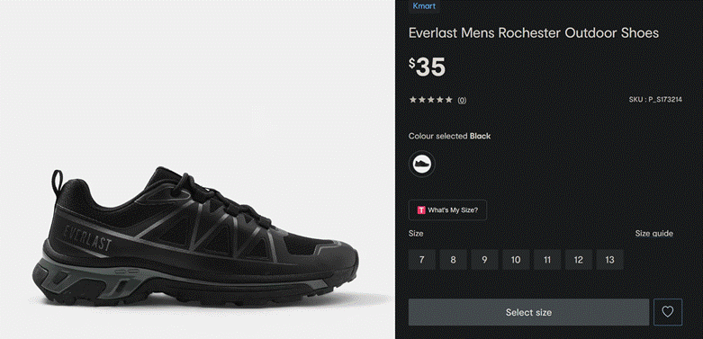
The Everlast Mens Rochester “Outdoor Shoes” cost me $35 at Kmart Bathurst. In hindsight, I should have just withdrawn $35 cash from an ATM and taped the notes to my feet for the duration of the hike. At least then I might have had one or two Queen Lizzy’s left over at the end to spend on a cheeky kebab at Katoomba, plus it would also have been more comfortable.
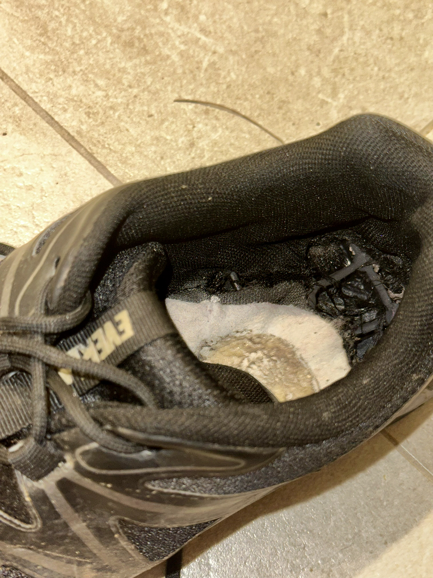
I will say that the Rochesters exceeded expectations in some ways. It appears that Everlasts now Last longer than Ever, because they survived a whopping 30 kilometres of medium-hard walking before the insole detached from the outsole. Yes, the insole was glued directly to the outsole, and no, there is no cushioning in the shoe whatsoever. Also, the insole is less than 1mm thick and can be approximated by a sheet of air.
Speaking of air, the outsole is comprised of 50% rubber and 50% nothing. It’s a lattice structure with giant gaping holes just waiting to burst your heel blisters. After walking on this Swiss-cheese-esque abomination for a day and a half, I felt like I was a contestant on Survivor doing the challenge where you stand barefoot on narrow wooden pegs for as long as you can. In my case, the wooden pegs were strapped to my feet and I couldn’t take them off until we got back to the cars in K-town.
At the top of Tarro’s Ladder I adopted what I like to call the high-heel technique, in which I began walking almost exclusively on the balls of my feet (haha balls). Did I mention Rochesters are also fantastic at Earthing? They really encouraged a connection between my toes and every single rock on the trail larger than a pea. All things considered, I’ll just treat this as a free foot massage and won’t bump the final score down any lower.
Today, from my original $35 investment, I’m left with two spare shoelaces and the possibility of bone spurs. This probably beats the alternative, which was doing K2K in Crocs (I’ll save that one for next month).
3/5 stars could be better
"If it's not on Strava, it didn't happen" - Seamus.
Except he forgot his watch so pestered the rest of us to record and share our tracks with him to combine them 😆