Preamble
Boree Log 🪵 is a club tradition dating back over 50 years! It's our twice annual camp held somewhere around Sydney and all club members are invited to come, with our amazing Trip Leaders running trips of all ability levels.
We thought we’d try something new this term. A mini Boree Log; A Boree Branch 🌿 if you will. The idea is having a getaway for our Trip Leaders and self-sufficient members to get together and do whatever awesome trips they please - and to their levels. Everyone for themselves and no organised club daytrips.
Amelia and I got organising - and it turned out to be a great success! We chose the Wolgan Valley - a lovely spot where the club used to host Boree Log pre-2019. But then came the fires, floods, and landslides, forcing us to use another location - as the singular road in and out of the valley was blocked for everyone except residents.
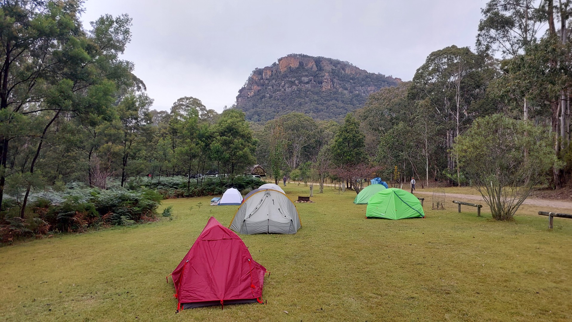
Despite the roadblock, the Newnes Hotel situated within the valley continued to operate. They would take guests to their cabins (or campground) by special escort, for a significant cost. With 40 interested people in the Boree Branch event however, splitting the fee was entirely viable and led to a lovely special event.
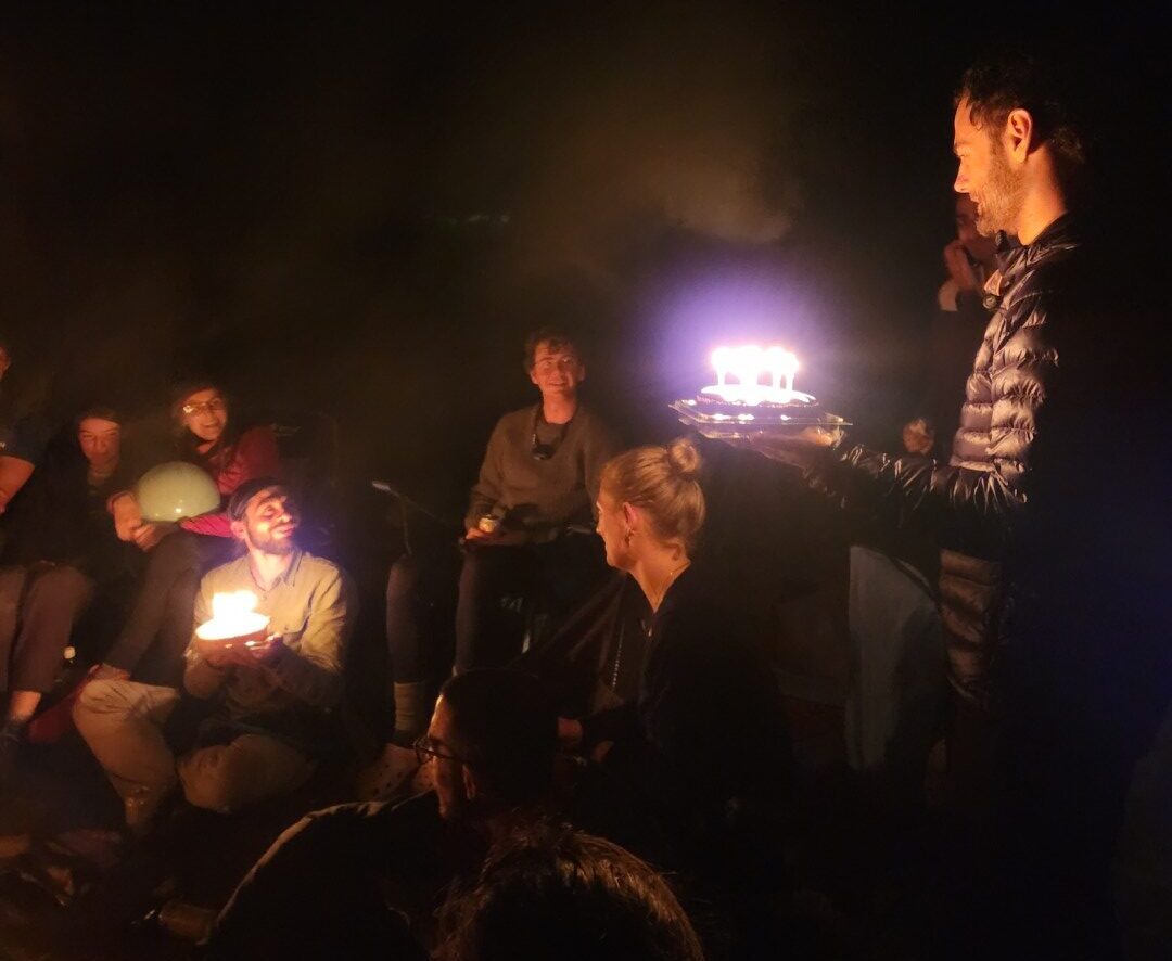
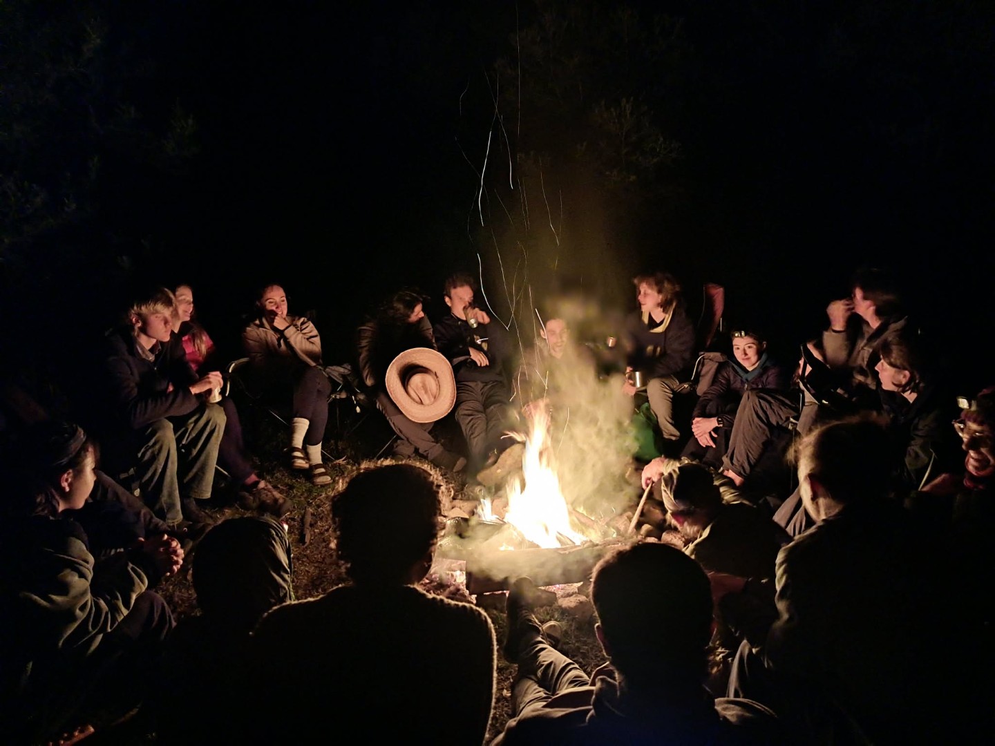
Everyone got up to super fun trips during the day, and we regrouped at night for some good fun around the campfire. Two birthdays happened to occur during the weekend, so we put on a little surprise party with snacks, cake, and dessert.
All in all a great event, and definitely a concept worth continuing in the future.
Donkey Mountain
In late 2015, Samuel May wrote a report on this website called “Get Your Ass To Donkey Mountain”. Besides the immediately eye-catching name (to which this report’s title pays homage), Donkey Mountain has been on my todo-list for a while. Samuel’s report has high praise about it, and the books by the legendary Michael Keats and Brian Fox have only absolutely raving reviews. “Heaven on earth” is an understating summary of their descriptions, and there is no shortage of similar reviews elsewhere.
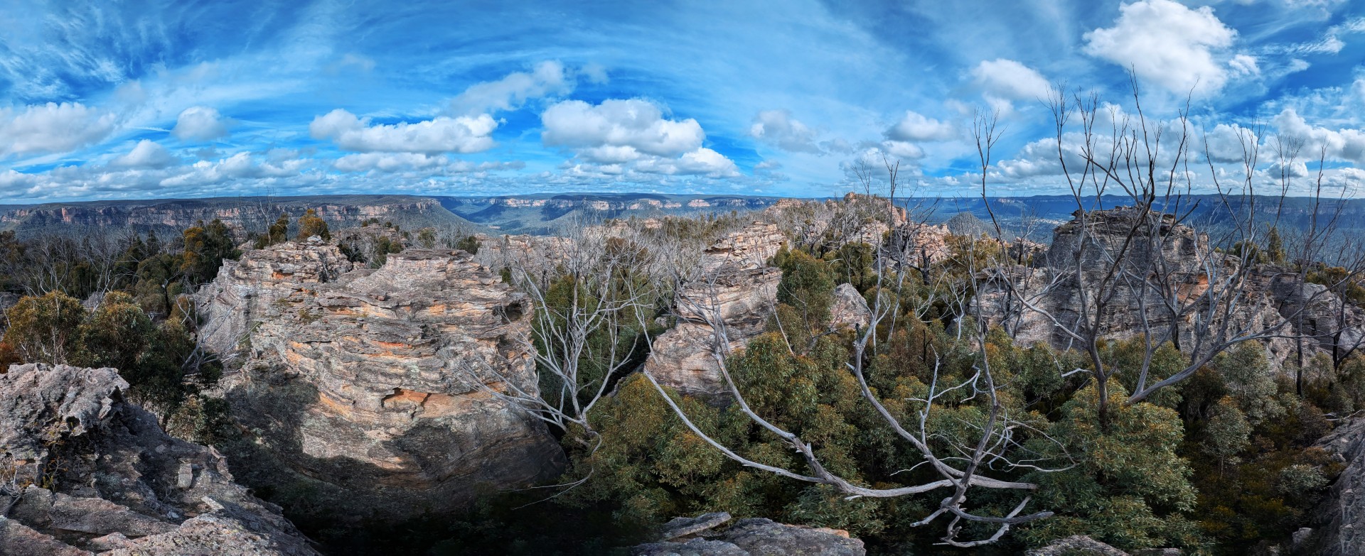
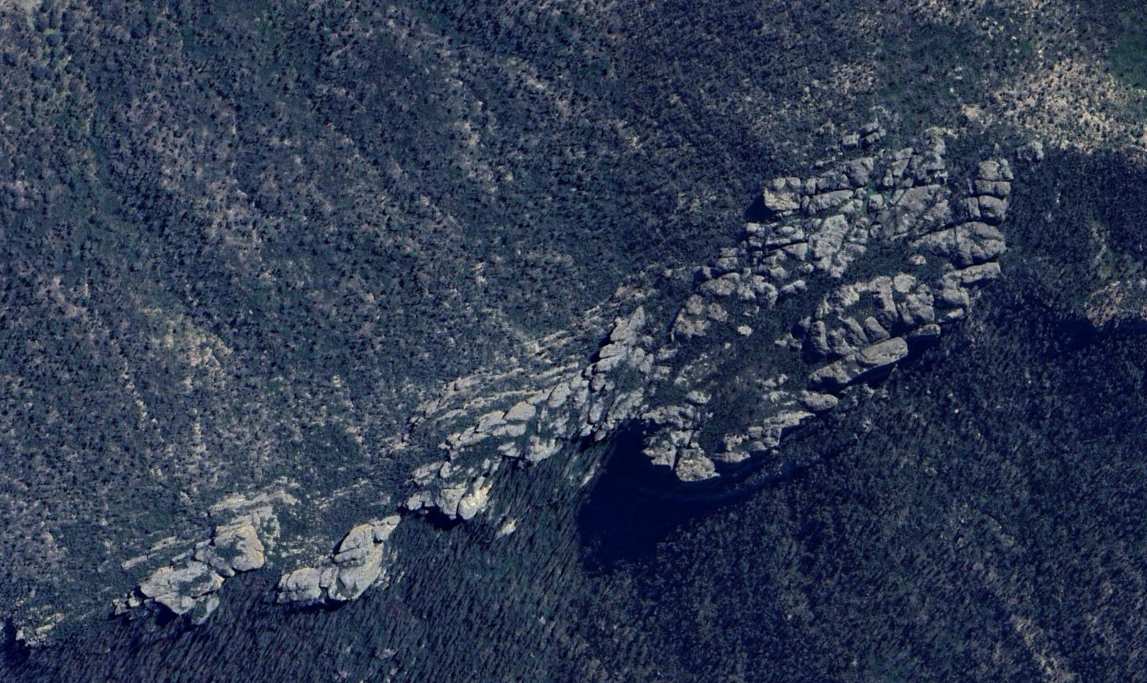
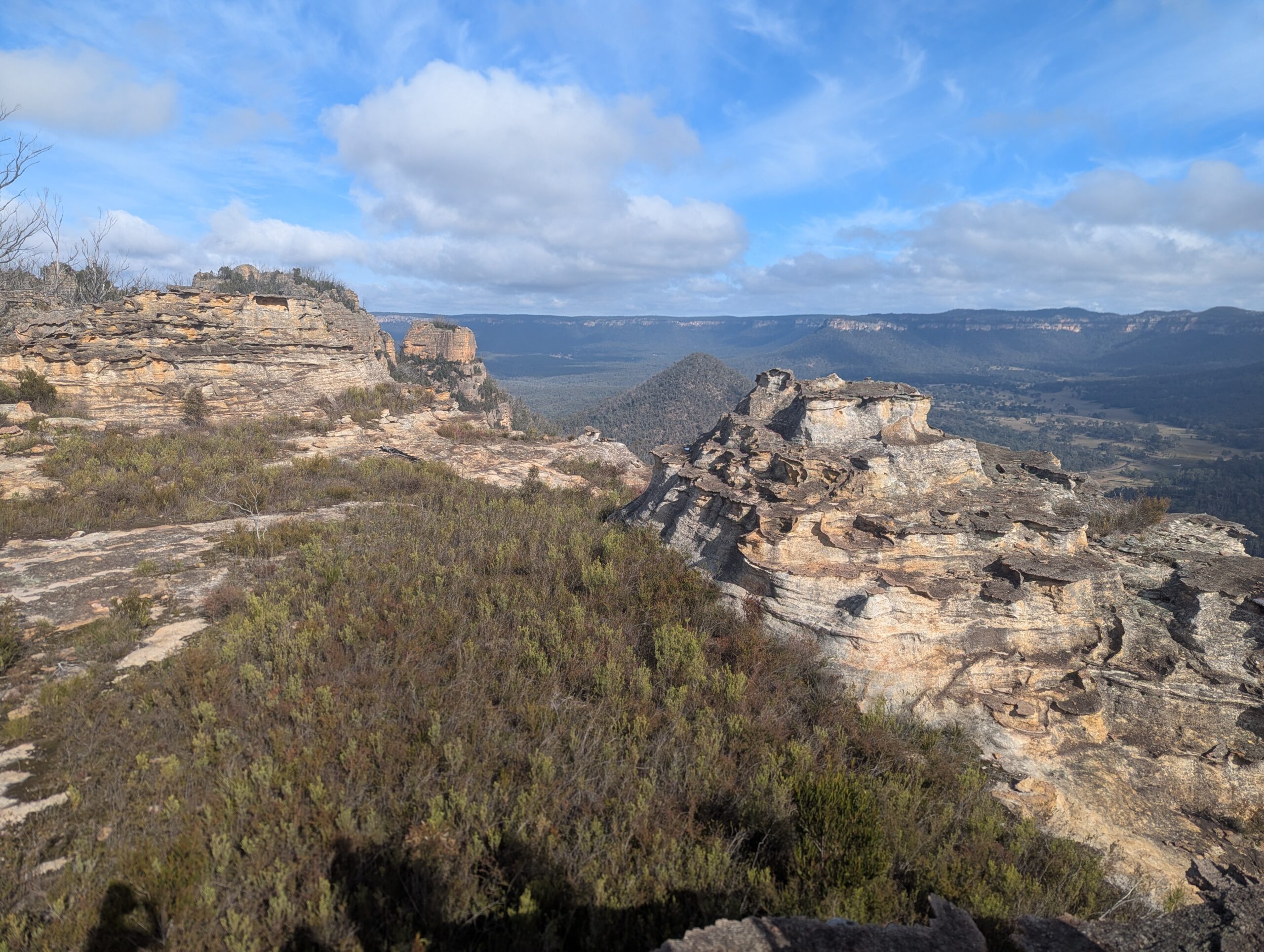
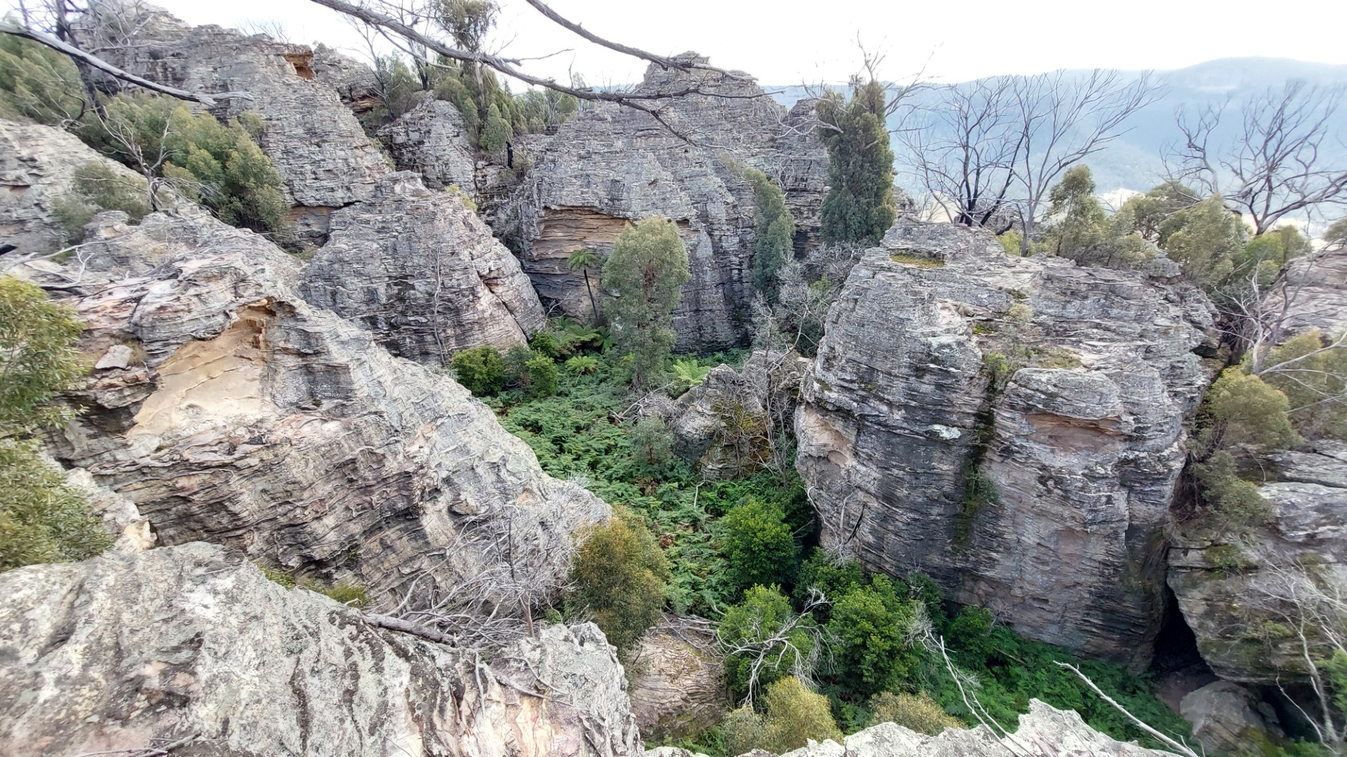
Donkey Mountain is a 1.5km long plateau, about 300m wide. You would think this would be easy to conquer in no time. How mistaken you are - for that 1.5km is chock full of intricate geological features: canyons, pagodas, slots, caves, chambers. A traverse may not take very long (give it a few hours at minimum), but to truly explore the area, you need several days.
With access finally available to Donkey Mountain, I knew I had to visit. In immediate contravention of the entire premise of the Boree Branch meetup, I posted a trip open to any other (adequately experienced) hikers keen to explore this area. 16 signups later, we split into two groups. One would try to walk end to end across the mountain, and the other would explore the “North East Maze” of the area. The latter is my group, detailed in this report.
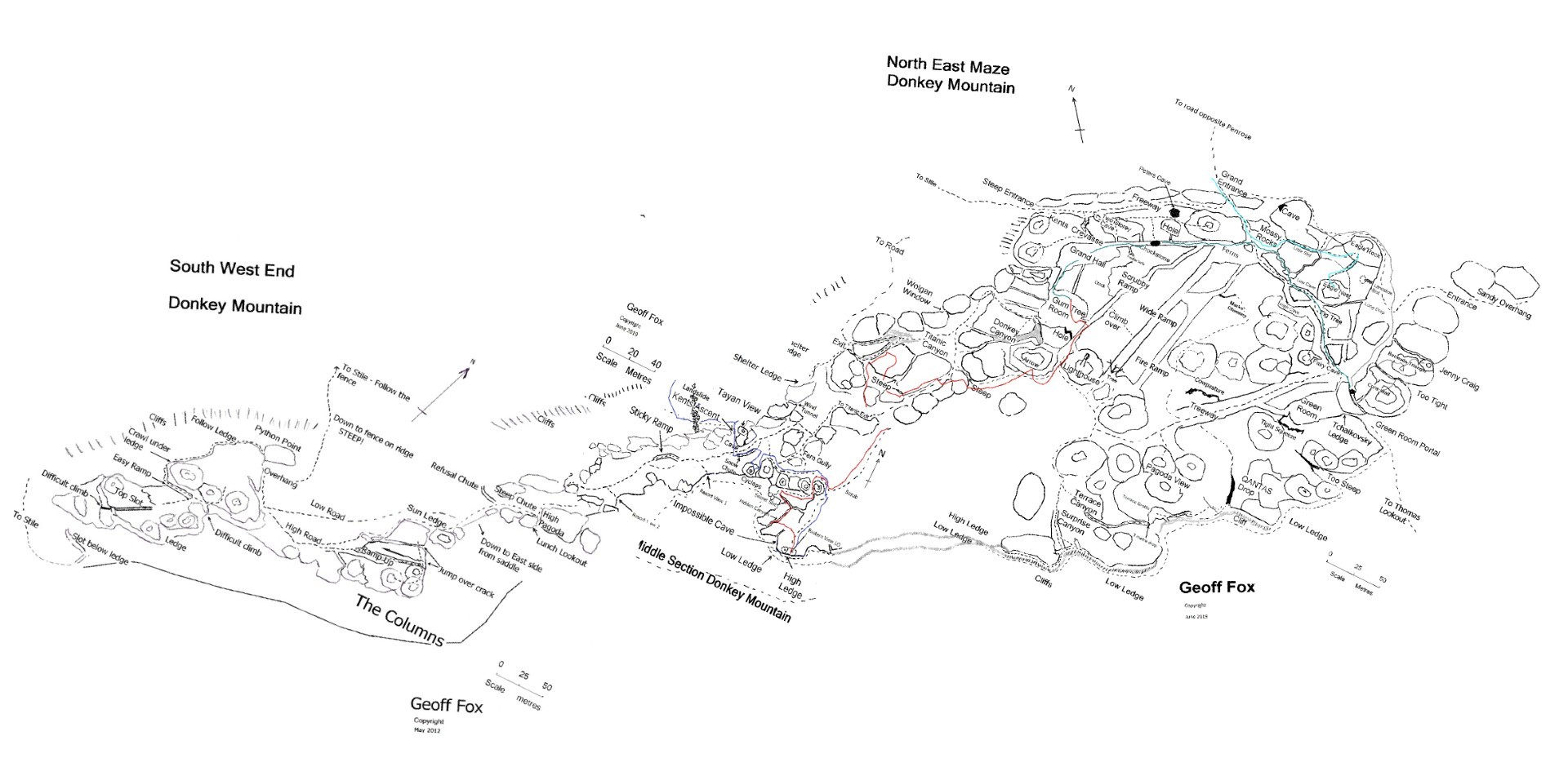
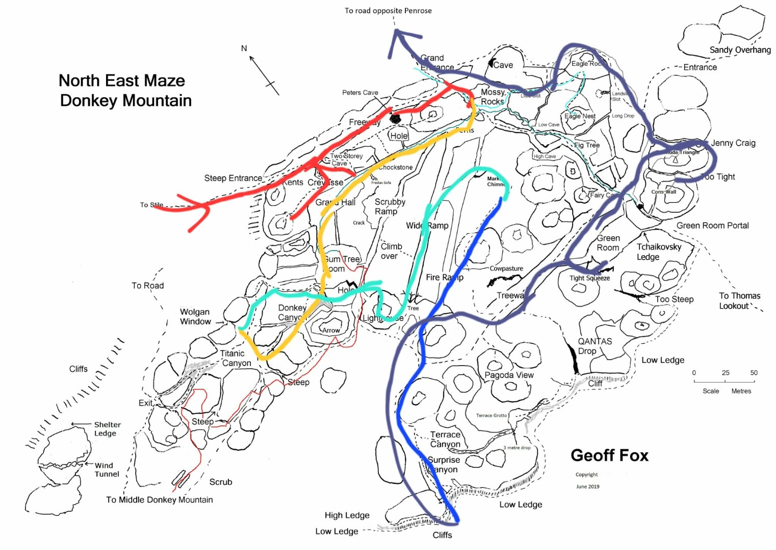
A special shoutout to Paul Ma’s photoblogs and the amazing sketch maps by Geoff Fox, which were an indispensable resource on our trip. Find them here.
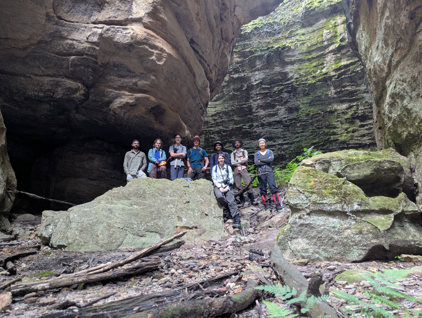
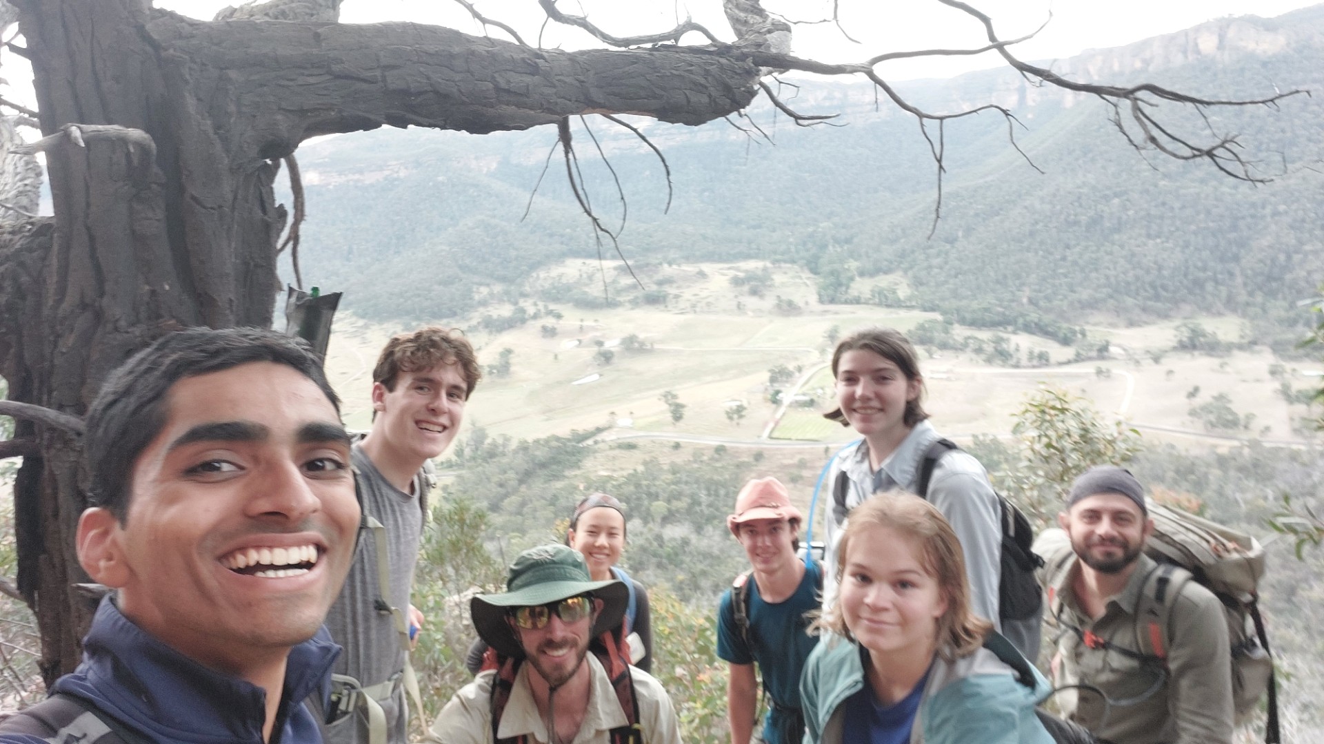
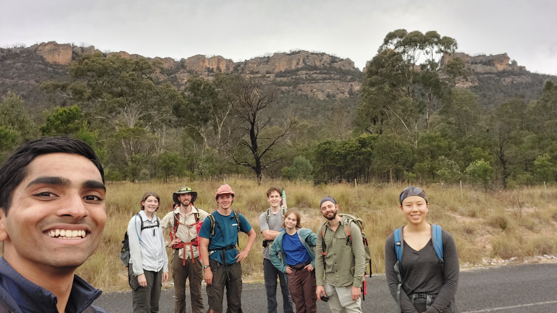
Party: Phoebe, Lachlan, Ellie, Angus, Noah, Piero, Nathalie, Sudarshan
Photos: Sudarshan, unless credited otherwise
We parked our cars at the Stile and departed at 08:30, making our way along the road for a kilometre, before turning into the bush to begin the steep ascent into the mountain. It starts off relatively easy, before really ramping up (teehee) in gradient, as you change from pushing through trees to using them to clamber up a scree slope instead. There are a few passes into the mountain - we were vaguely aiming for the one near the Grand Entrance.

We eventually hit an amazing chimney-like feature - and climbing up through it led us on top of the mountain and some spectacular views. Mission Success! We took some photos and cracked open a few snacks, ready to tackle on the rest of the mountain.
Left: Kent's Crevasse
Here we hit our first problem. We were perched on top of a large pagoda. Beneath us was a chamber full of trees. Our intuition said that was the Grand Hall - which would’ve been great, if we could actually get there. Unfortunately short of dropping 20m sheer down a cliff, there was no way in, and we were forced to backtrack down the chimney searching for another entrance. We later realised that the chimney was “Kents Crevasse”.
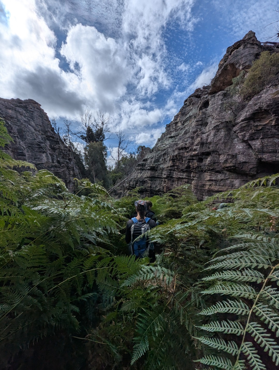
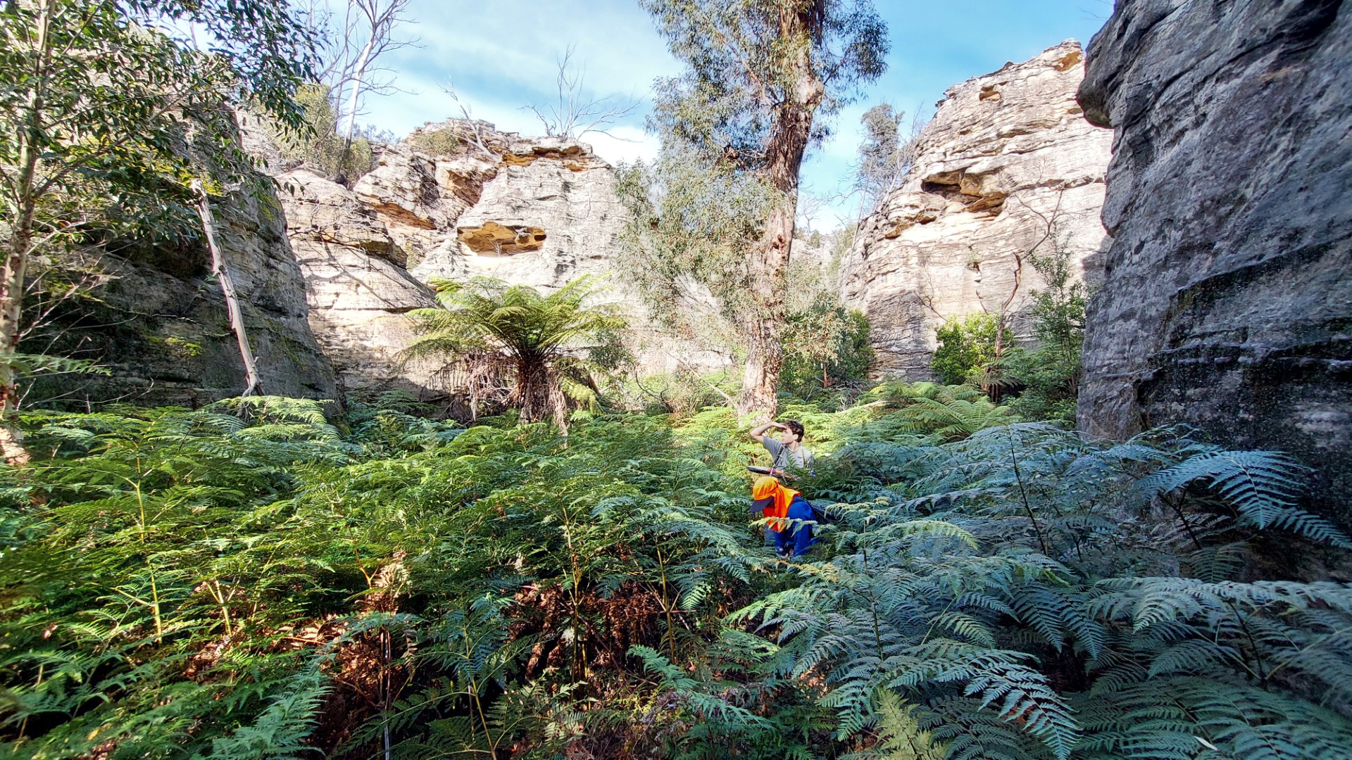
Eventually making our way through the Grand Entrance for real, we found ourselves in the large ferny area affectionately named Nettleville, while pushing through head-high ferns and getting scratched by lovely stinging nettle.
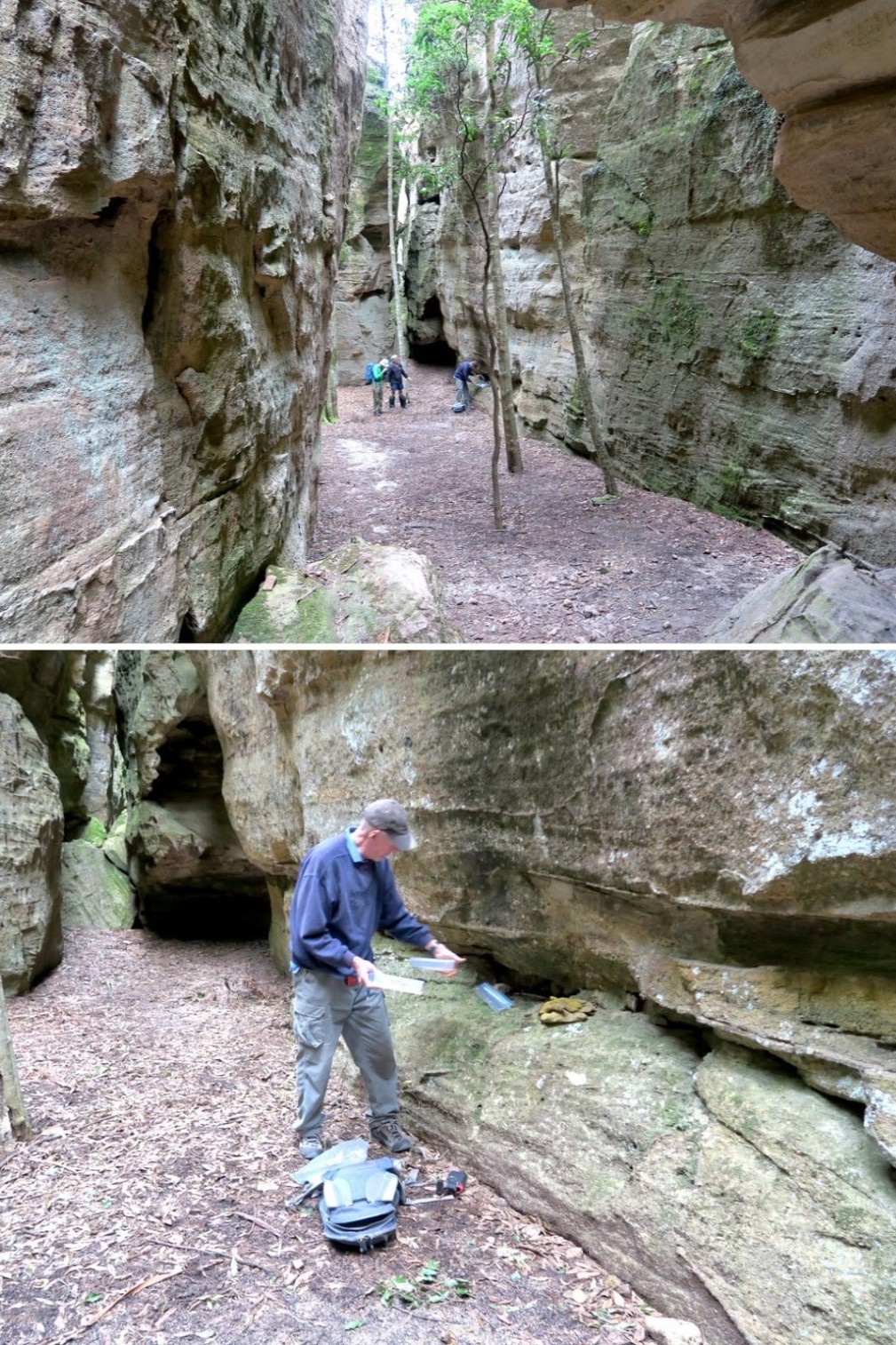
Through this ferny passage led us into a chamber. Now instinct told me this was the Grand Hall - however compared to the 2016 picture we were going off, the logbook was not in the promised location, and one of the trees did not match up. Disheartened, we were about to carry on, however the logbook was shortly spotted nestled underneath a small rock overhang!

There are lots of trip reports of people visiting Donkey Mountain on the internet. Notably though, it is devoid of reports since the 2019 fires. This is reflected in the logbook: 2020 and 2021 saw minimal visits due to Covid and fires, and there was a brief surge in 2022. The road closure in November that year put a stop in that, and there is only one logbook entry in each of the years since. Our group(s) are the second visit this year - and if the past is any indication, likely the last.
Beyond visiting the logbook, we had no concrete plans - so proceeded to just explore whatever chambers came next! We climbed our way over fallen logs and under boulders. Through ferns and bush, canyons and caves.
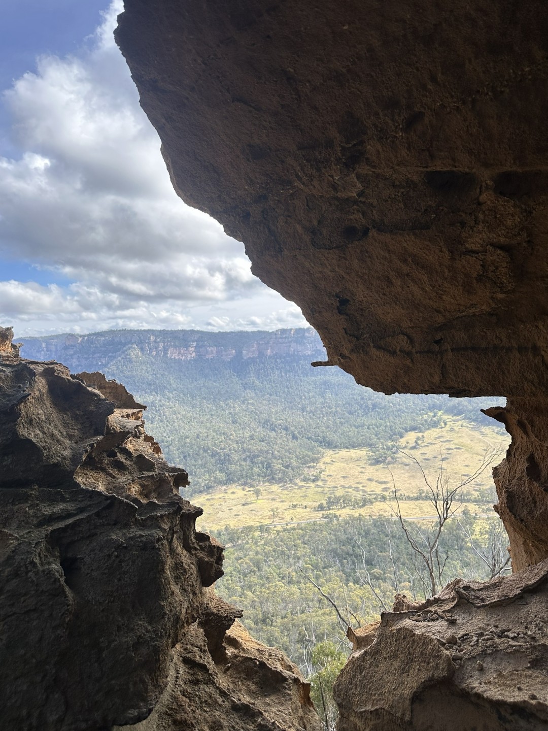
We found ourselves at the Wolgan Window. A lovely window among the rock, offering a view across the Wolgan Valley. Returning through Titanic Canyon, we took the high road, clambering up above the pagodas in search for a lunch spot.
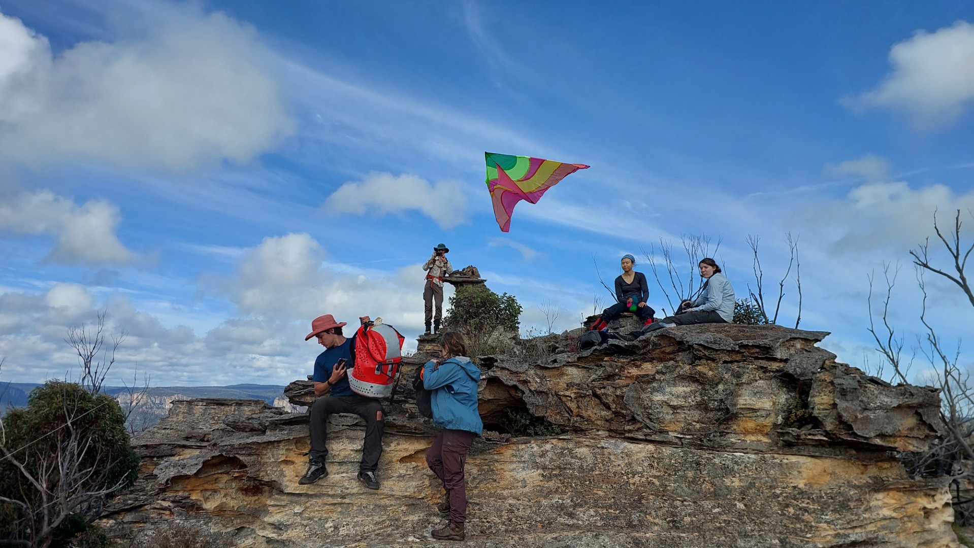
And indeed a spectacular lunch spot was found. We were at the "Lighthouse", an aptly named rock formation among the highest points on the mountain. Noah had brought a kite up and got a brief moment of airtime (unfortunately there wasn’t much wind), and we even got a sight of the other group on the far side of the mountain.

We continued down a Wide Ramp to Marks Chimney - where we pass bags up the crack before climbing up it. We loop back around near Lighthouse and towards Terrace Canyon. Some small navigational hiccups were had here, getting confused within the thicker trees and scrub in this section. We instead found ourselves at Surprise Canyon - and can only assume that’s exactly where the name came from.
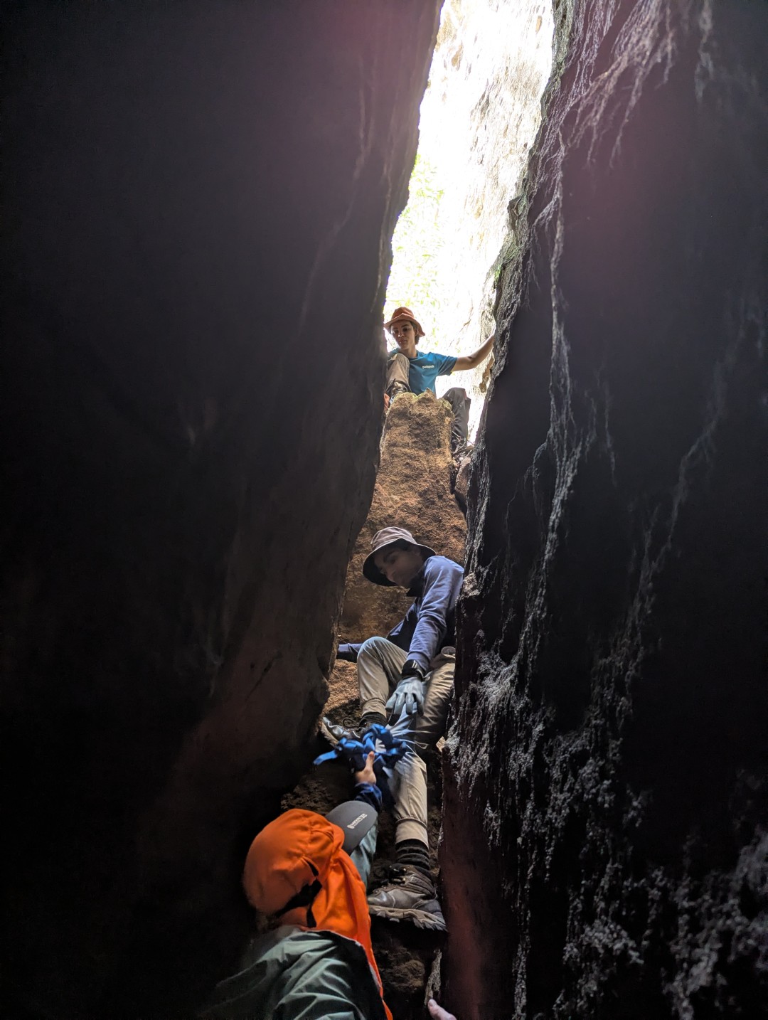
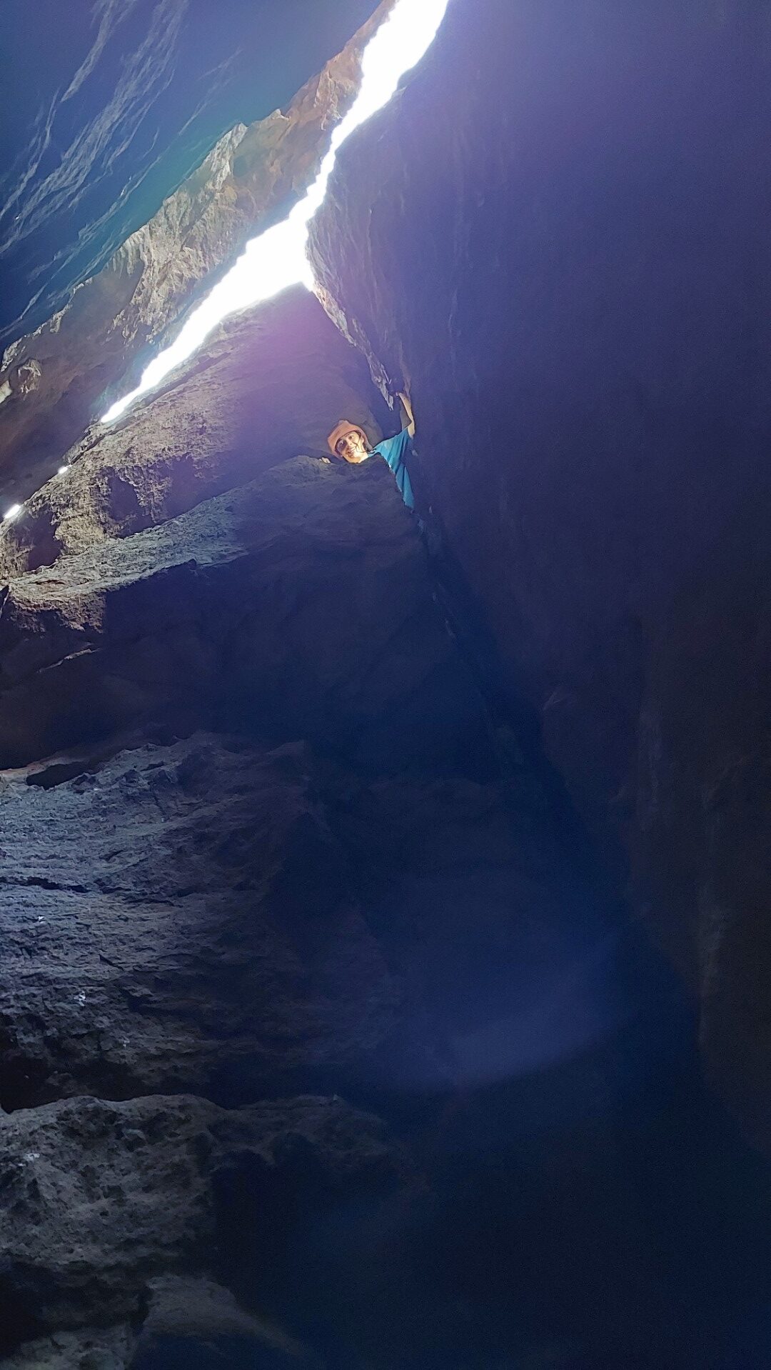
We backtracked out of Surprise Canyon and made our way down the Treeway into Tight Squeeze, a narrow cave-like passage burrowing into the ground for a few metres before popping out at a vista above the Green Room.
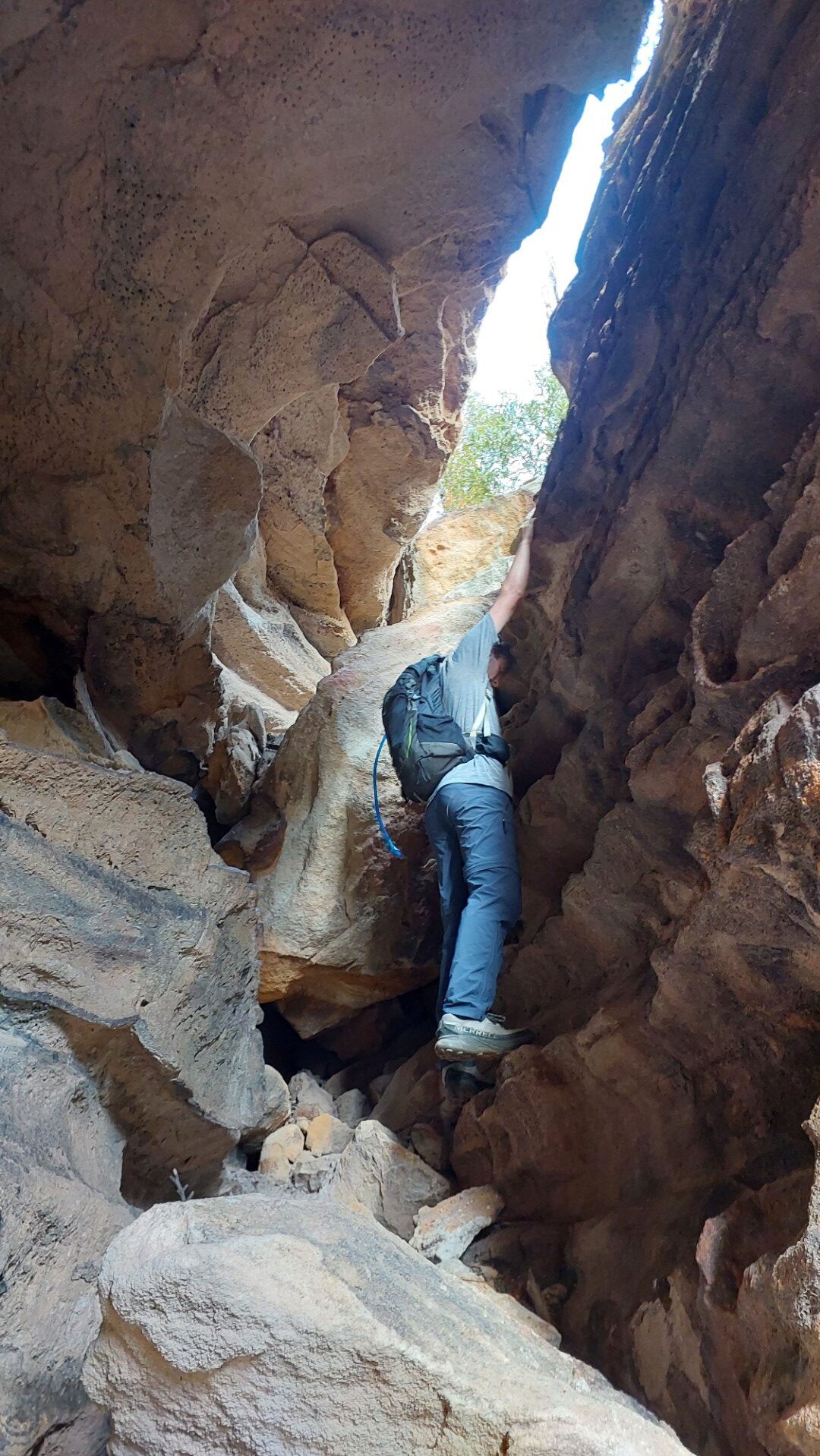
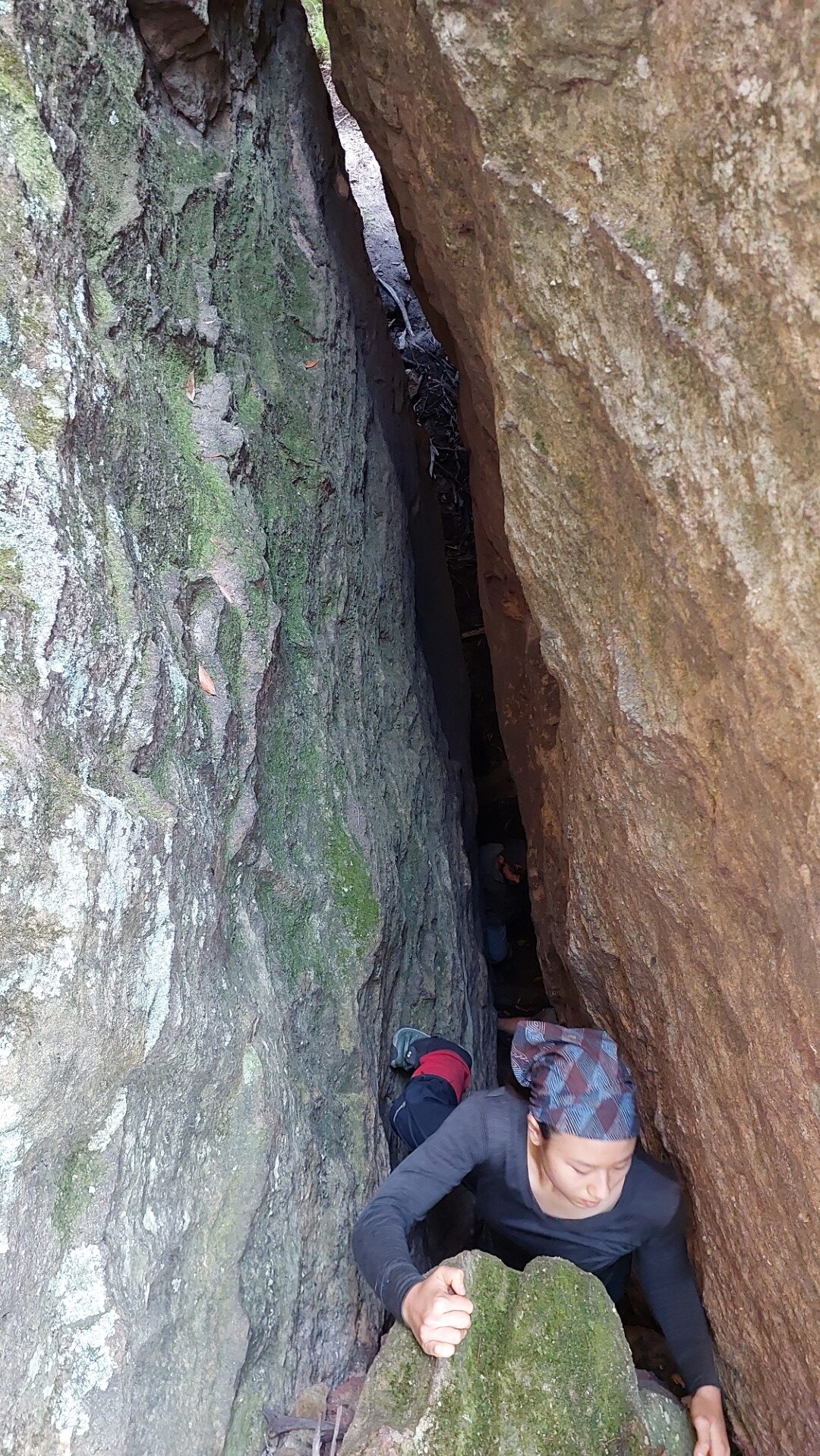
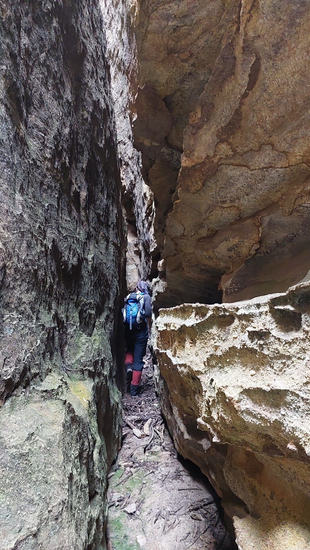
Back up into the Treeway took us into Jenny Craig - my only other goal for the day! Jenny Craig is a long narrow slot passage, named after the weight loss company of the same name. The slot is called Jenny Craig because if you haven't been through a Jenny Craig program, you won't be able to pass through it 😛
Bags come off as we shimmy our way through. Halfway down the slot, we find a passage going off to the side, even narrower. This slot is not marked on the map and highly confuses us! We initially think we are within the “Too Tight” chamber, however by walking around through to the outside, we can verify it was indeed Jenny Craig.

“Too Tight” is the slot just south of JC, and we are able to make our way about halfway through it, when above me I hear Lachlan’s voice. Turns out the unmarked passage earlier leads to a cleft in the walls of the slot, some 10m above!
After some fun and hard-earned snacks, the time is approaching 3:30pm. Our aim is to be back at camp before dark, so we start making our way towards the exit.
Not before a selfie with a view, and another Little Slot!
Right: Little Slot
We make our way back through the Grand Entrance, on a rough descent down the rocky slope of the mountain, before bashing through the trees back to our cars.
All in all, a great day out exploring. We all had fun - and might need to come back again to finish exploring the other side of the mountain!
Below is a GPS trace of our route with some points of interest marked, and a drawing of our route over Geoff Fox's sketch map. We Got Our Ass To Donkey Mountain!
Some bonus pictures by Piero: