Often in our club, with so many exciting things to do in the outdoors, good old bushwalking is neglected. I confess I've seen it as something to do with beginners, on rainy days, or when you're recovering from an injury. The poor cousin of activities like technical canyoning, rock climbing, and backcountry skiing. Eventually, you've had "nice" days trudging along all the usual tracks near Sydney - stuff like National Pass, Mt Solitary, the Royal National Park Coast Track, the Great North Walk, the Blue Gum Forest, Mt Banks, the Glow Worm Tunnel, the Six Foot Track, and so on.
Not to dismiss anything on that list, but the grand old pasttime really gets rewarding when you go weird and get in over your head on a hard off-track or multi-day walk. (I firmly believe everyone living in Australia who enjoys the outdoors should do a long trip in South-West Tasmania at least once in their life).
Anyway. On this Boree Log, I tried to counter complaints that there were no easy beginner canyons or climbing crags in the Wolgan, with the suggestion that there was plenty of great bushwalking. We had groups visit Donkey Mountain both days, and we've all come back raving.
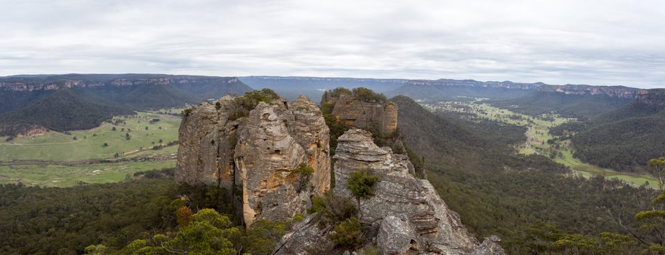
It's seems like it's starting to get a bit of hype these days ("Magic!" "Bushwalker heaven!") especially with access nicely settled now it's part of Gardens Of Stone National Park. Well, I'm not quite sure about bushwalker heaven, but it's got to be one of the more accessible "hard" bushwalking areas around, where you can learn about the dark arts of walking off-track, searching for passes, scrambling exposed pagodas, and finding water in desperate places, all without having to disappear into the Wollemi for days and in fact within sight of the car most of the time.
So what's the beta? Well, you park at the sign, climb over the stile, climb up the mountain and then go exploring for as long as you want. Well, I'll be a bit more specific and tell you a good way to climb the mountain. These days, my philosophy is to provide good access descriptions, but try to leave people free to have their own adventure once they get there. You can traverse the whole mountain in a day, with enough time for a side trip or two, but of course longer trips will give you more time to explore.
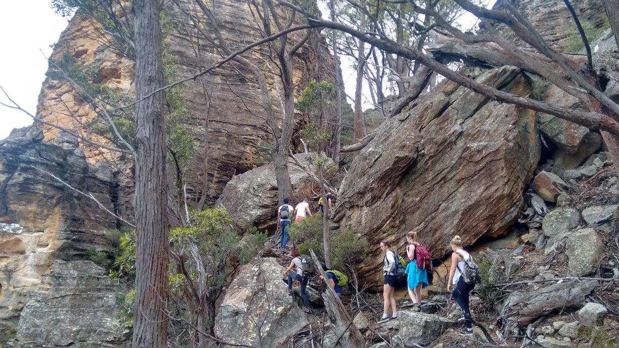
Some people have followed the direct route up, along old fence in a straight line up the ridge from the stile. This gets very steep and loose and a bit alpine, and will give you a risky moment or two. Walking around to the SW spur of the mountain might be a preferable option if you're going for a traverse. But the easier routes are up the northern slopes of the mountain.
(Coordinates are given in full UTM format for GPS waypoints, then in 6 digit paper map format in brackets)
Turn left from the stile, and follow the vehicle track alonside the road NE through the paddocks for about 1 km. You're aiming to start climbing the gentler NNE spur of the mountain from near 56 H 237715 6319519 (MGA 377195). Follow the spur up to a flat area with a few big prominent boulders at 56 H 237932 6319231 (MGA 379192). From here start contouring up and left - you're aiming for a pass through the first rocky band at 56 H 238151 6319148 (MGA 381191). After scrambling through that rocky band, head up to the "Grand Entrace" at 56 H 238164 6319034 (MGA 381190).
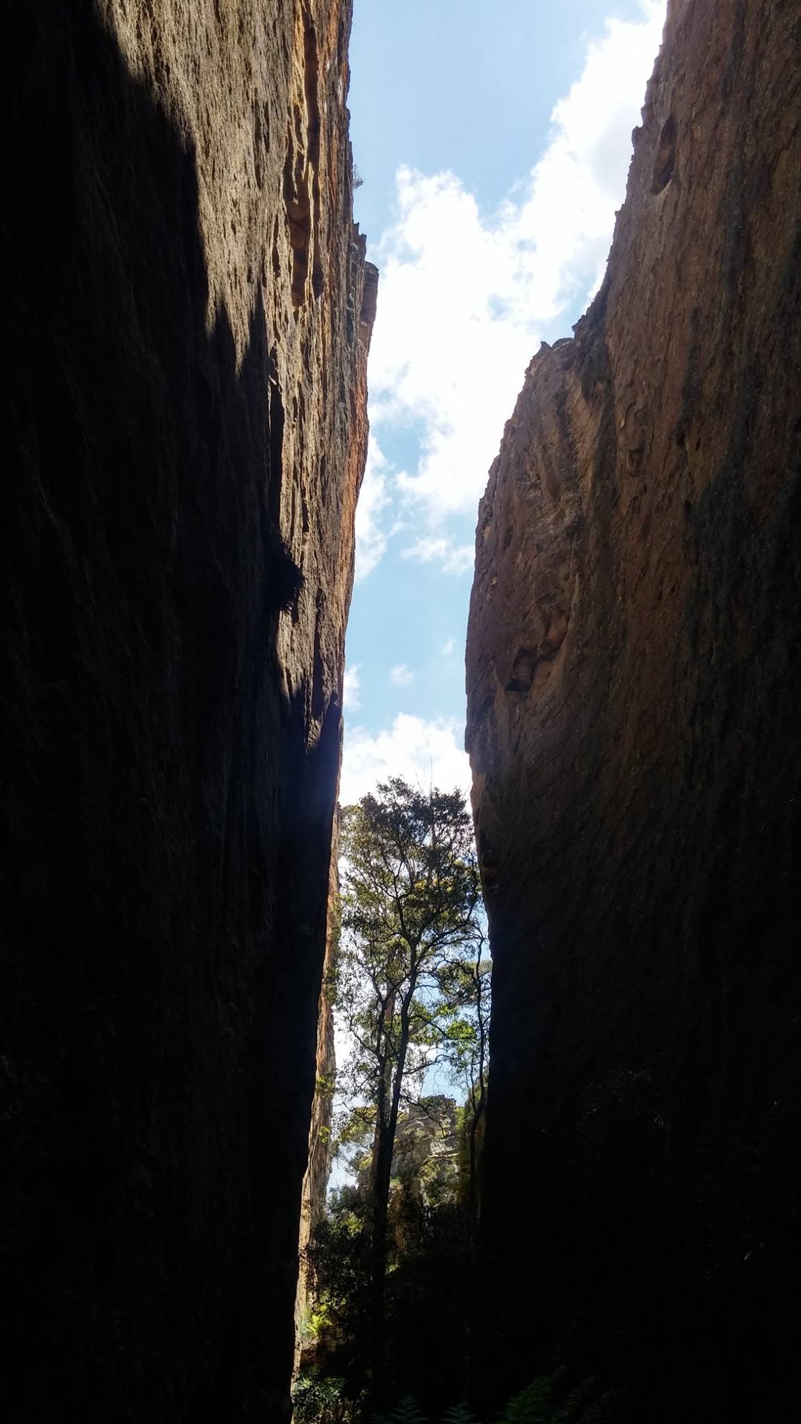
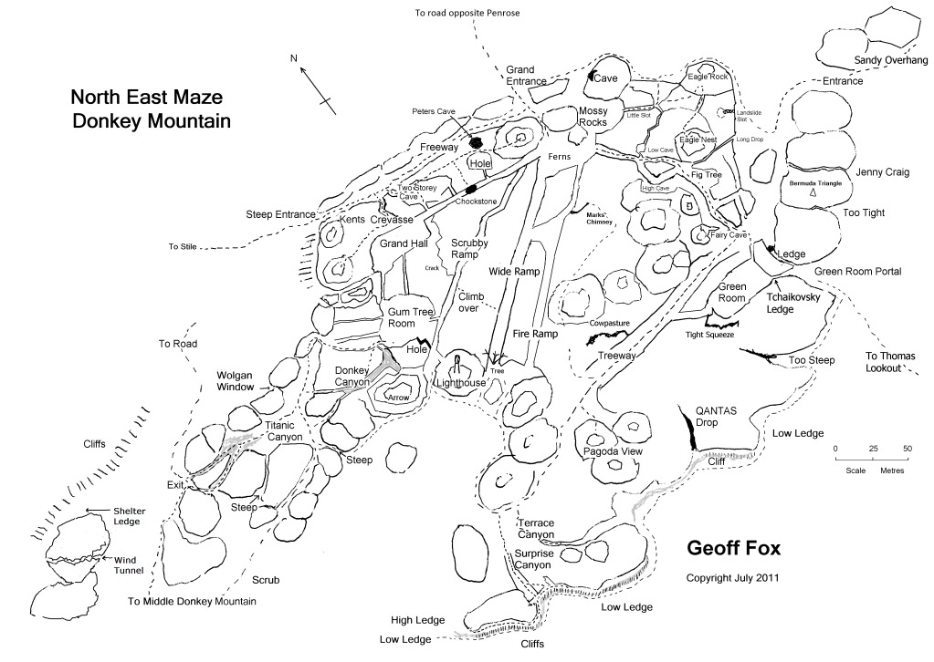
Here's part of a fantastic sketch map of the mountain by Geoff Fox. You can see where the "Grand Entrance" is. You'll find a logbook and a newer version of the complete sketch map in the "Grand Hall", which should give you some more ideas. Have fun!