*We spoke to a guy at a Hobart outdoors shop and he said this was harder than the Arthurs (highly subjective) – which is widely regarded as one of the hardest - so we'll take it.
This trip was supported by the UNSWOC Beanie Grant. The Beanie Grant provides trip leaders financial support to help run amazing adventures for the club.
Click on any photo to enlarge it.
The Southern Ranges Traverse traverses a mountain range in the Southwest Tasmania National Park, culminating in the ascent of Precipitous Bluff. The track is notorious for several kilometres of unforgiving, unmaintained, untracked scrub, with strong navigation, scrambling, and hiking skills required.
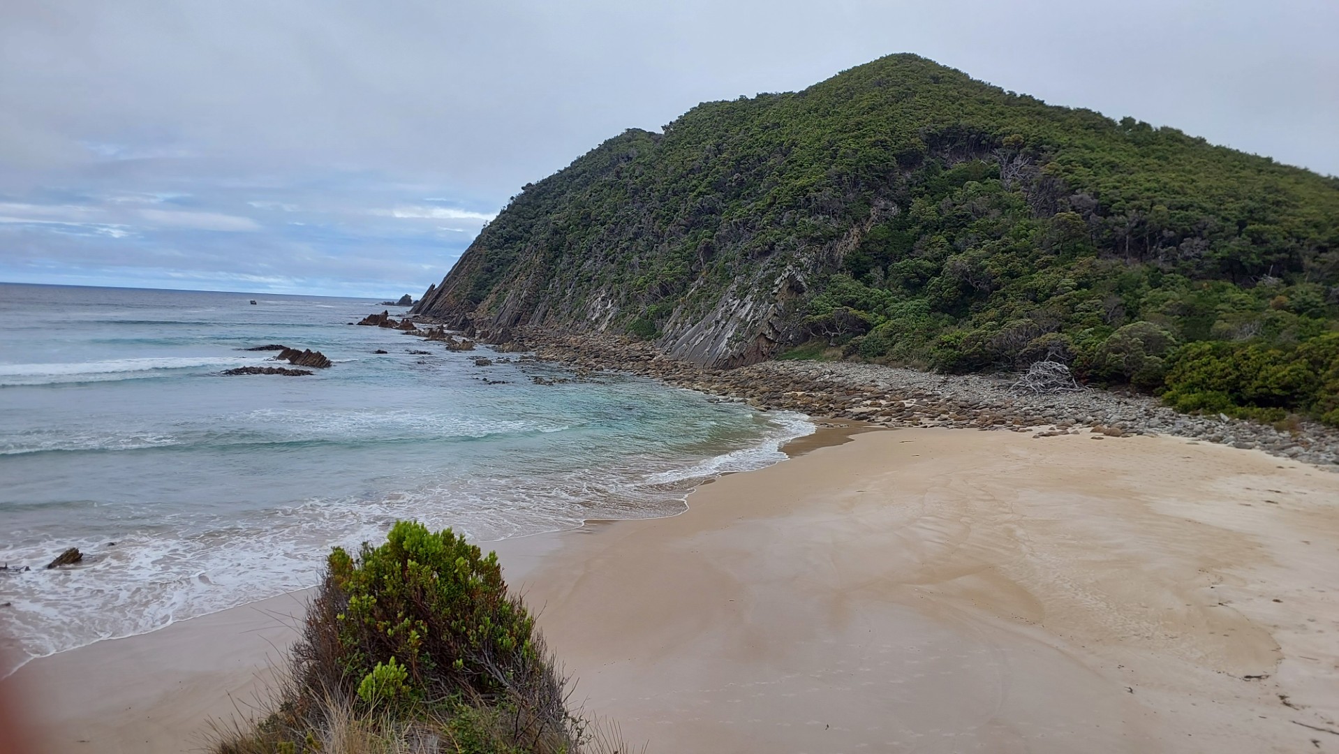
It takes 3-5 days to reach Precipitous Bluff - after which you can return the same way, or wade 8km across a lagoon to connect with the latter half of the famous South Coast Track.
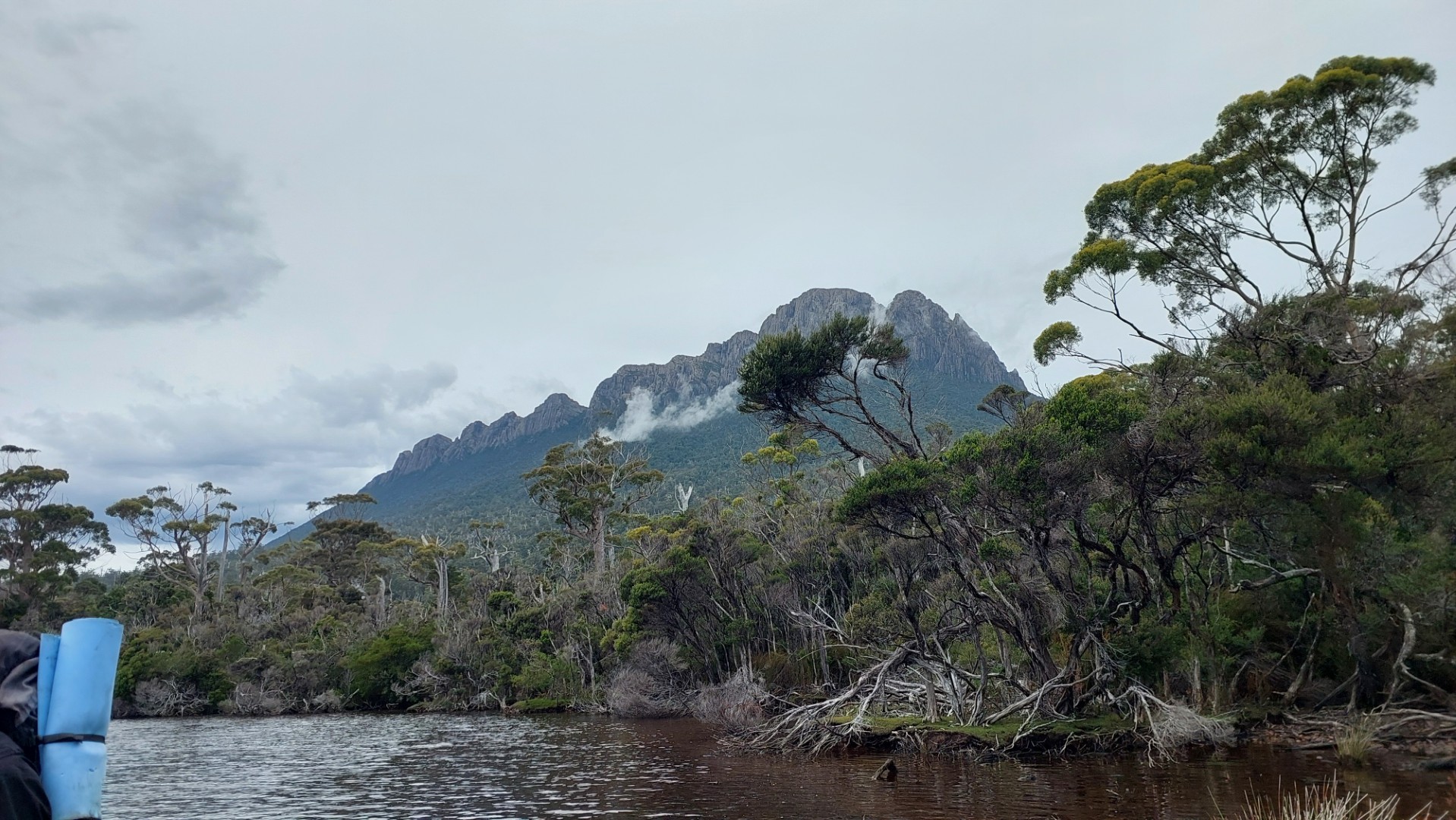
This sounds awful, but the name "Precipitous Bluff" ("PB" in the local lingo) is morbidly inviting, and one look at it from afar immediately explains why hikers want to climb it.
The Prelude
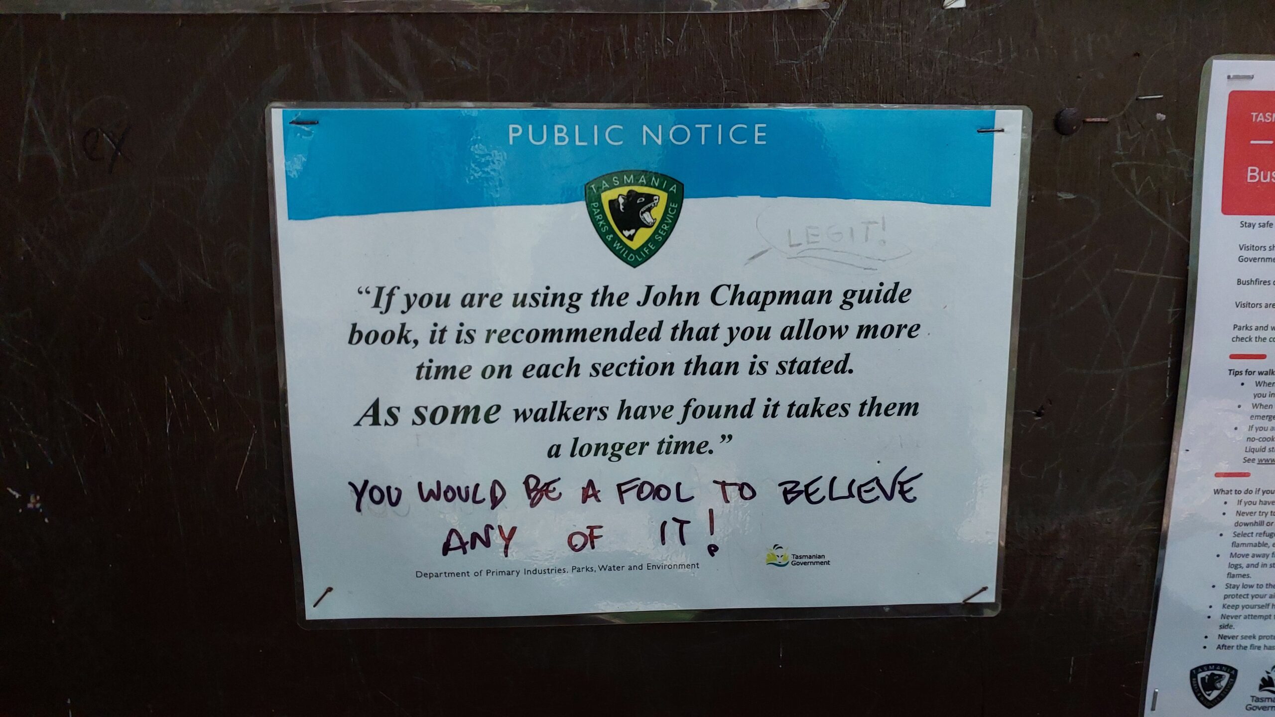
In December 2025, Callum and Rory floated this idea to me, and about 4 minutes later I was sold. My planning commenced shortly and I was faced with the gaping hole of information surrounding this walk. National Parks makes no mention of the trail and besides a small handful of blogs/vlogs, the only reliable source of information was John Chapman's guidebook from 2014 (found at the local library!).
> "What could possibly go wrong" - Callum, 2026
One more trip leader later, the 10-day trip was posted on the club website and 7 keen beans signed up to brave the challenge. I ran two medium-hard "training hikes" incorporating some bush bashing and steep hills, with the intention to get to know the participants and their skill levels.
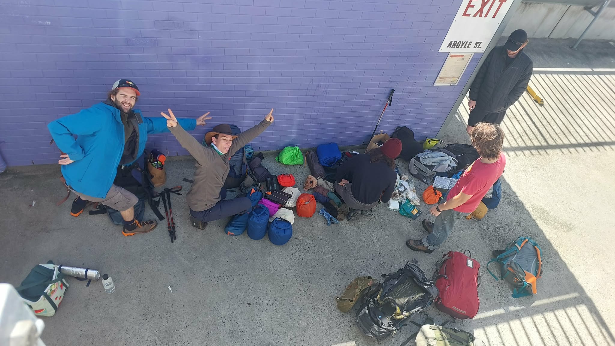
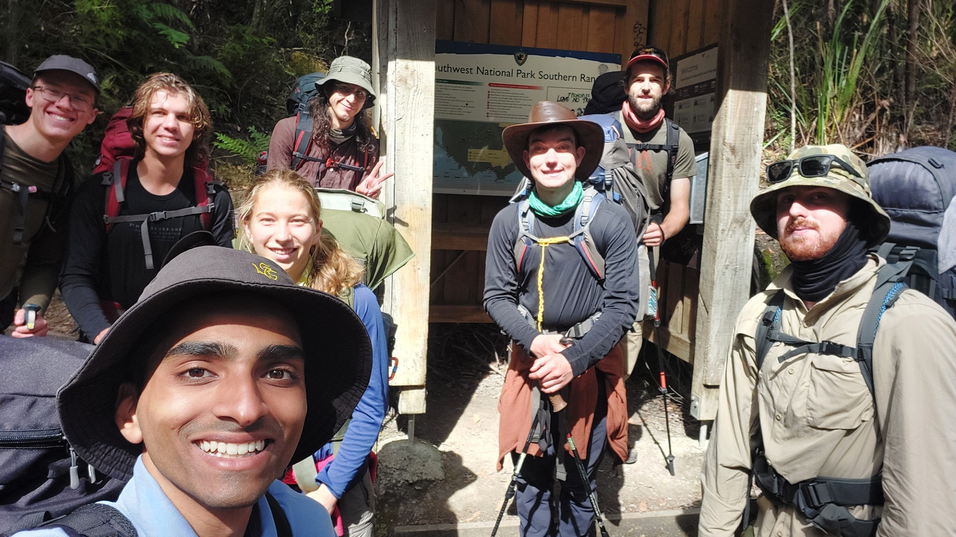
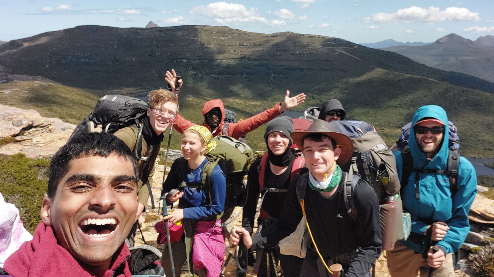
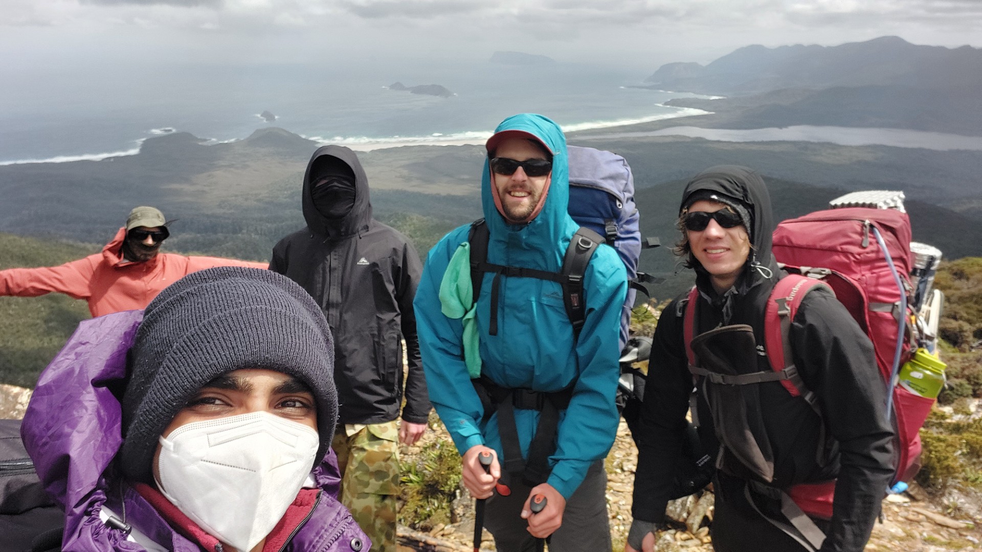
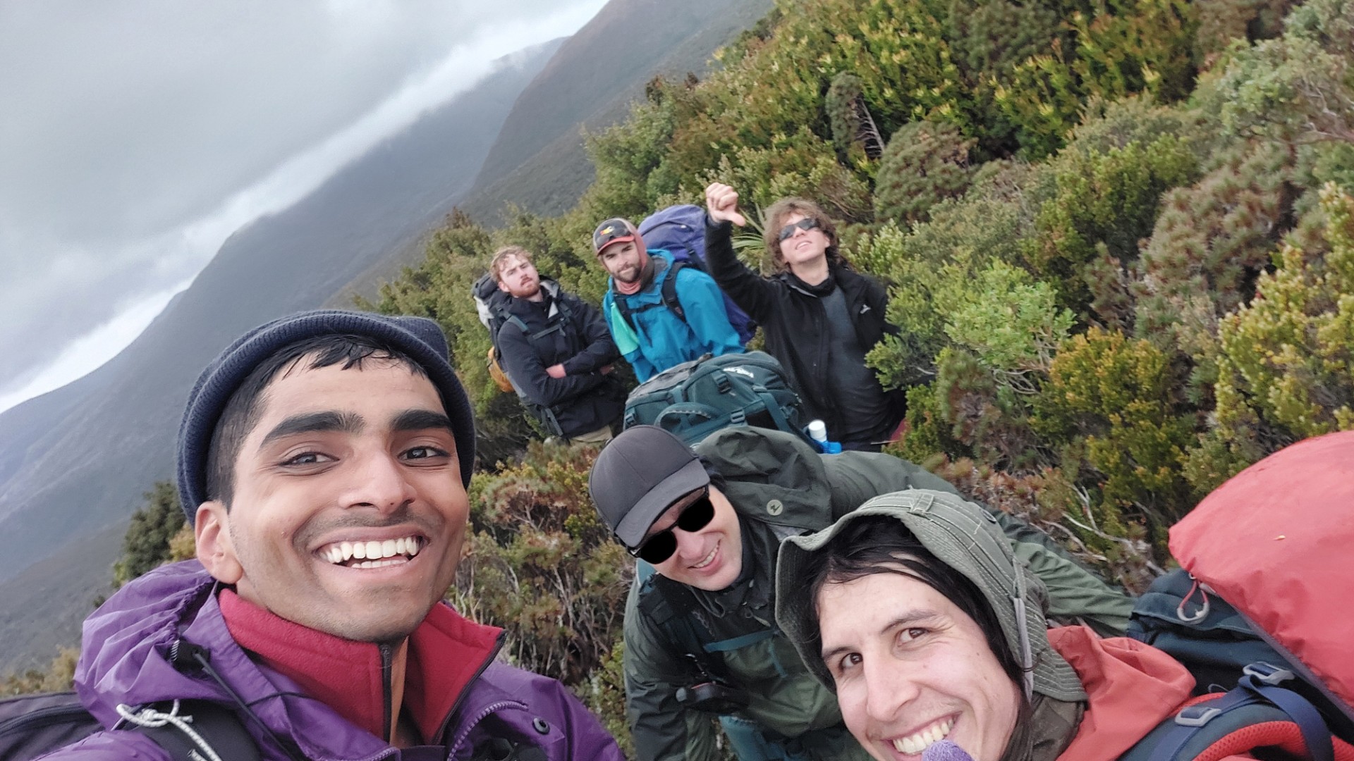
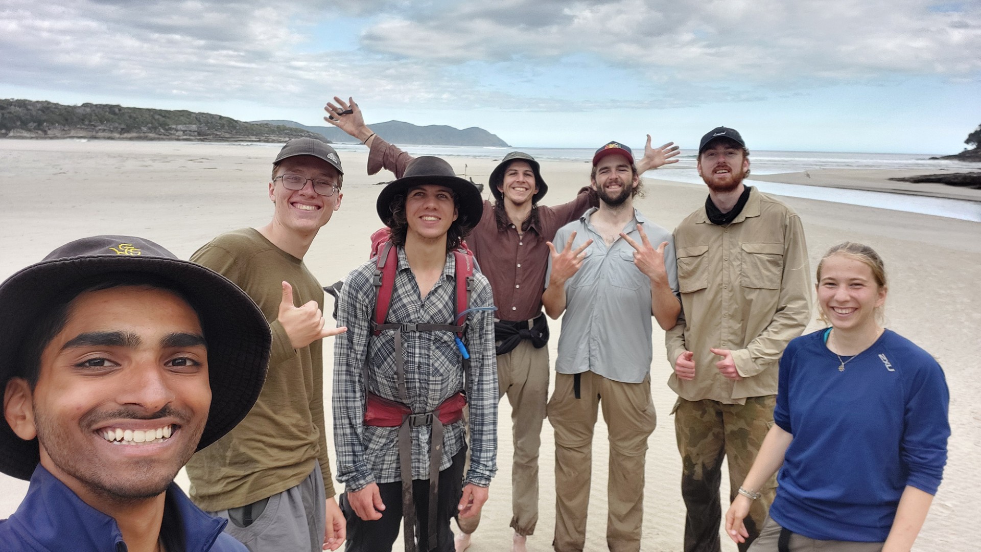
On the 2nd of February, 4 brave participants and 4 valiant trip leaders arrived in Hobart to meet up, before tackling the Southern Ranges Traverse. A gear check, shopping trip, lunch1, bus ride2, and car shuttle later, the group arrived in Ida Bay
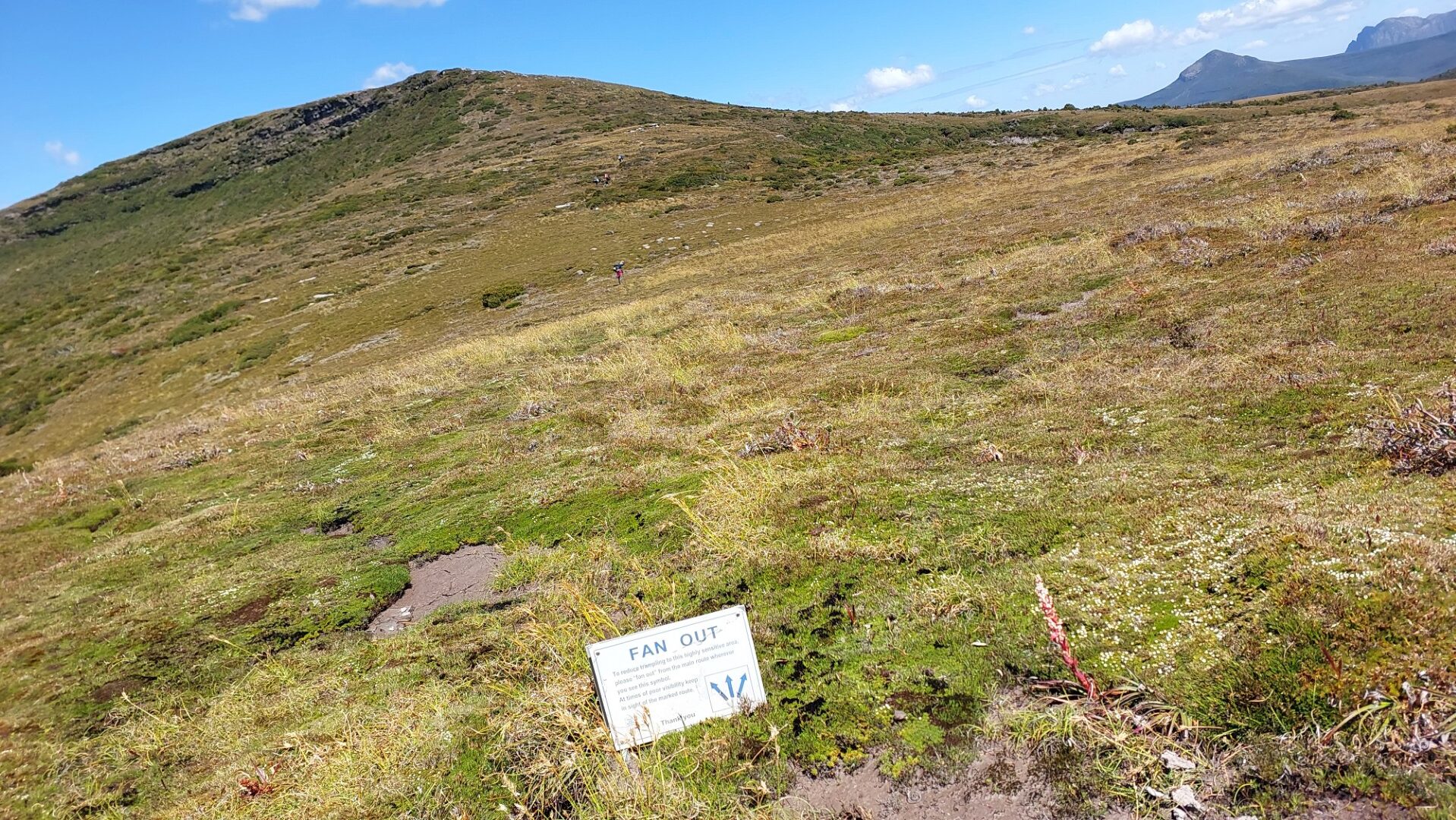
We were excited to see a surprisingly large hut and carpark at the trailhead, and the logbook indicated that the track was potentially more travelled than initial expectations3. A total of 15 people(!) had attempted the Southern Ranges Traverse in the previous month, but we were the largest single group by far. The map at the hut showed the walking track route as far as Pindars Peak, after which it was just denoted by a big black arrow pointing vaguely northwest.
Day 1
"Wake up at 7:30am, out by 9!", we said the previous night. At 10:45 we departed.
Day 1 starts off with 800m of steep elevation gain to get to the foothills of the Southern Ranges. We are immediately faced with the "quality" of this track, clambering over fallen trees a few minutes into the incline. The compass is brandished less than an hour into the day as we briefly lose the defined trail, before rejoining it on our way up to Moonlight Ridge.
Chapman's guidebook suggests a total of 3.5 to 5 hours for our Day 1 route, and we reach the campsite at 17:15, marking a 6.5 hour day. I had been told earlier that Chapman is "superhuman" in his time estimates, but the reality of these overzealous estimates only just start to settle in with the group. Day 2's upper estimate is 6.5 Chapman hours (our new unit of measurement!), meaning that our group would likely take at least 8.
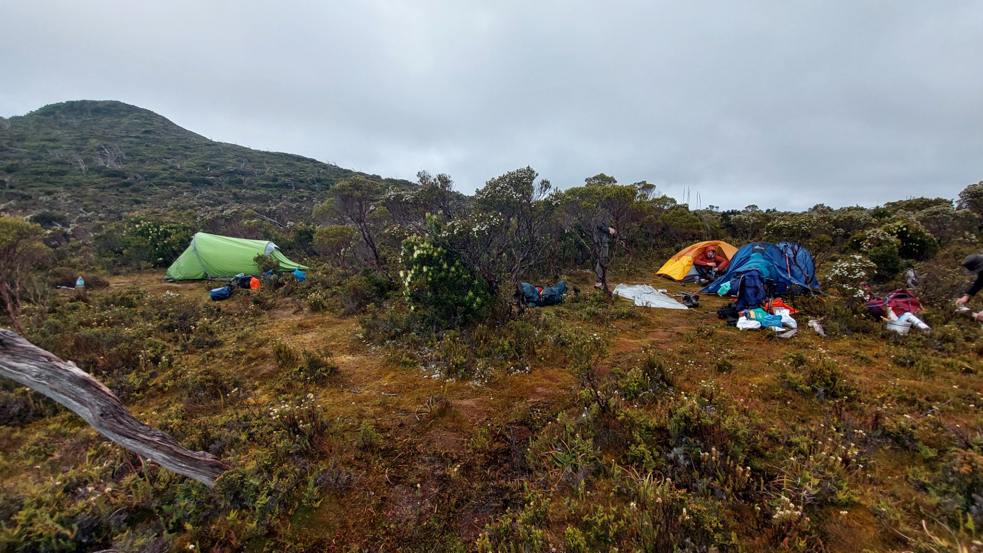
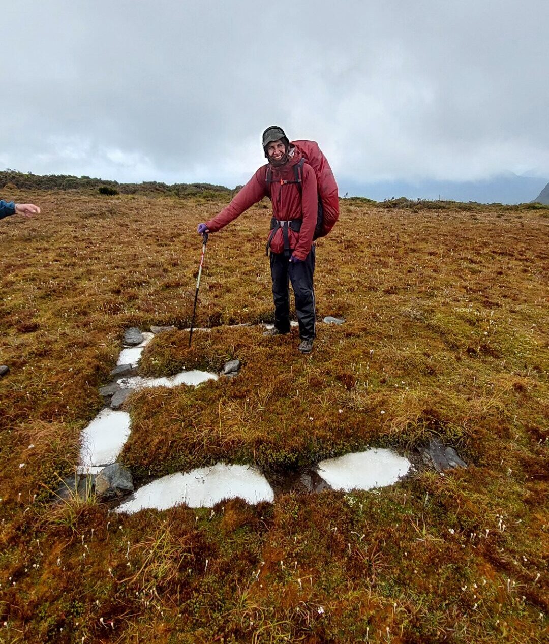
Our accommodation for the night is described as a "small, muddy campsite", and he is not wrong. Our bags sit on mudpatches and tent doors lead into swamp, however we get a nice flowing creek for water. Now is a good time to mention that when we chatted around (and I called a park ranger), we were told that the weather in Tasmania had been "Weirdly dry" over the past few weeks.
We become intimately familiar with this weather prophecy over the coming week.
Day 2
We start the day by finishing of the last 200m elevation to get onto the top of Moonlight Ridge. A fairly well defined trail continues to take us all the way to the final 10m cliffline. We lost the "real" track here, however following the base around to the North leads us to a nice break in the cliffline with a little bit of fun scrambling.
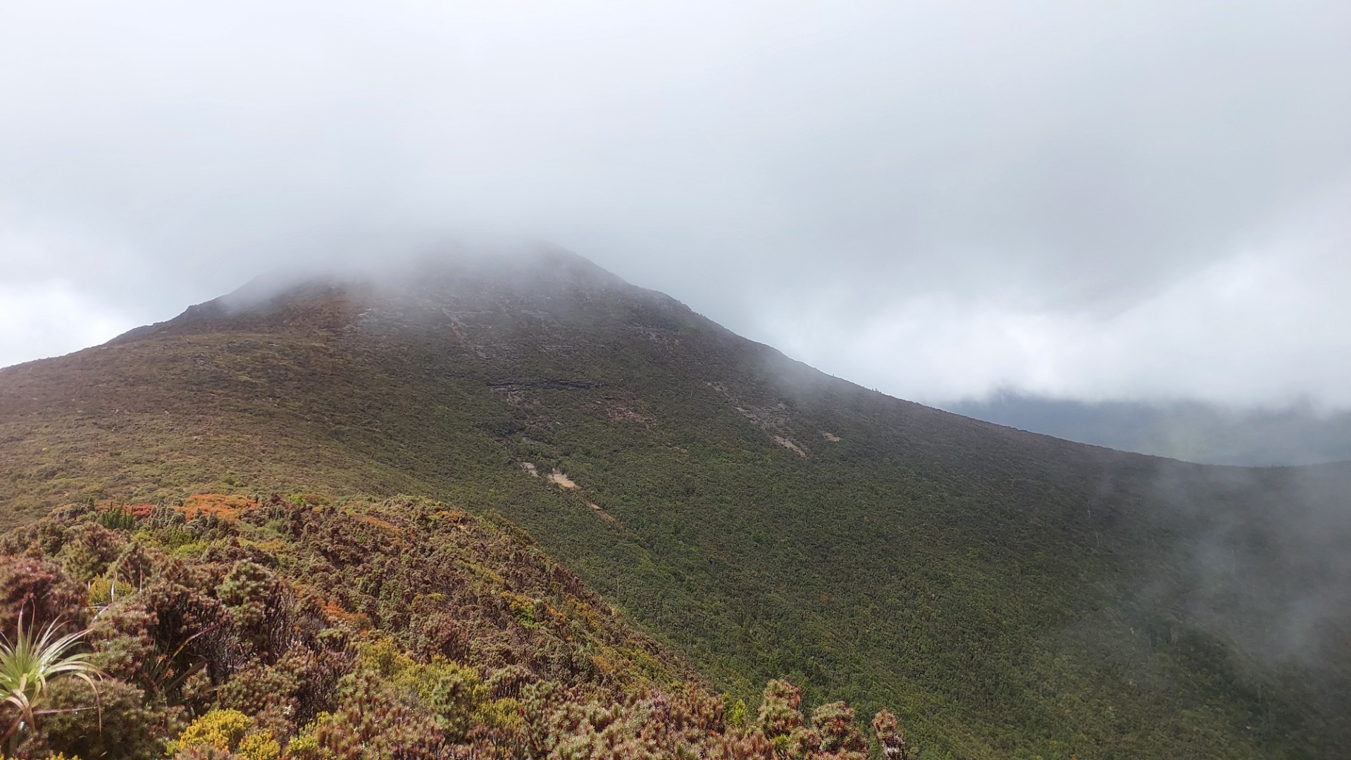
The views at the top are stunning, however this mountain is given the very boring moniker "Hill One". We jest that the past day of uphill walking has all culminated in a feature so unremarkable to Chapman and the likes, to warrant such a boring name.
The tops of Moonlight Ridge gave us the first taste of the winds we were about to face. The Garmin InReach forecast was about 25kph, however this was very notably not the case. Either the forecast was outright wrong, or was for sea level elevations.
We proceed over the ridge to our lunch spot, Pigsty Ponds. This is yet another false moniker – it is one of the nicest mountain lakes I've ever seen and did absolutely nothing to warrant such a rude name. Sights of Mt La Perouse are admired with food in hand, coupled with thoughts of "Yeah nah can't be bothered going there" despite our initial enthusiasm of this sidetrip in the morning.
Our campsite for the night is called Ooze Lake, and I suspect that Big Bushwalkers might have just had a very bad day when they first did this walk -- giving features the worst names they could stomach. We don't blame them - the walk from Maxwell Ridge to Ooze Lake gives us the first taste of the scrub bashing we are about to encounter, albeit at a much easier scale. More an overgrown ex-trail, than raw scrub bashing.
Chapman describes our campsite as "a rough campsite with fair shelter".
Night falls, we experience buffeting winds, and I am kept awake by the constant thwapping of the tent walls and a strong worry of the tent collapsing…
Day 3
Today’s walking time is 5 Chapman hours, with our first real section of this walk’s (ill-)famed Scrub Bashing!
Unfortunately one of the participants had to return back home, and Callum and Lena escort them on the two-day journey back. 5 remain, and we set off at 11am.
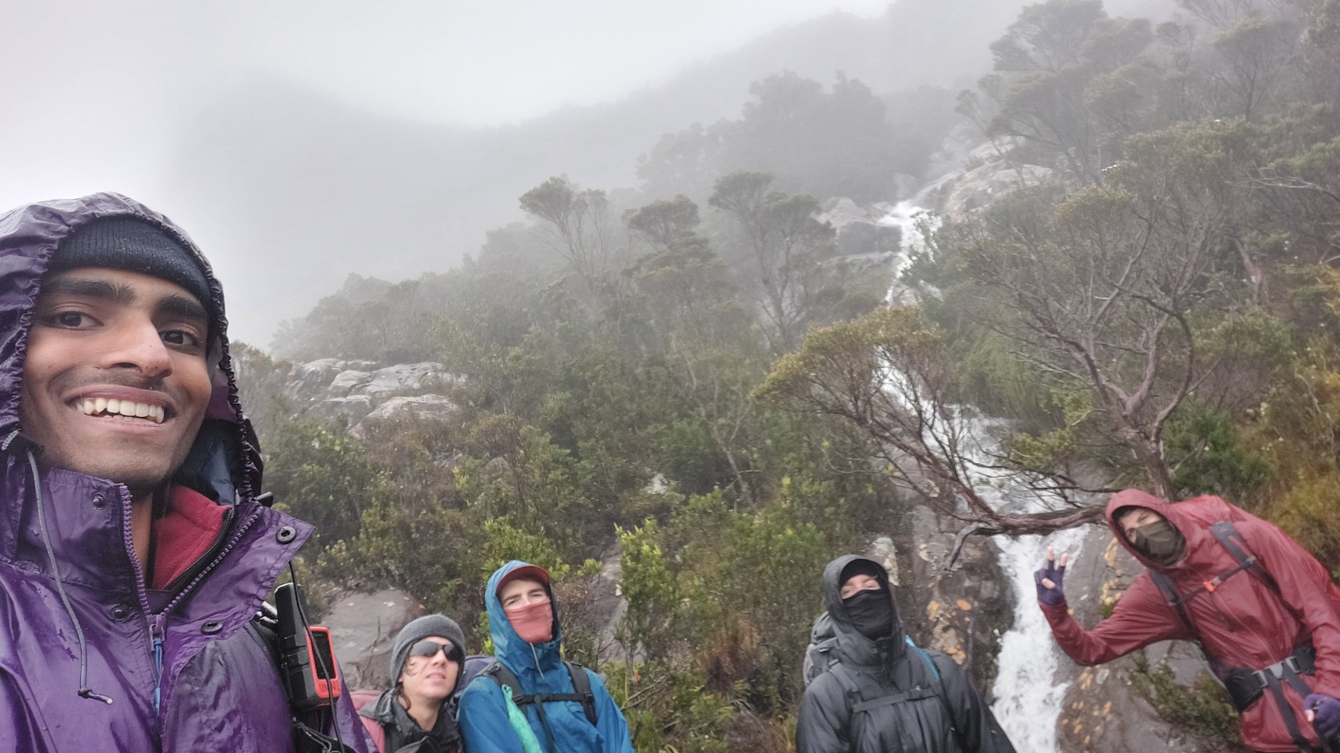
Despite winds until now, the weather has been relatively favourable, with clear skies and visibility. Steep walking up the mountain beside Ooze Lake (aptly named Lake Mountain) presents us even stronger winds, warranting the covering of as much skin as possible - out come the sunglasses and buffs. This is the strongest winds I'd ever experienced by a fair margin, and I did not have this mythical face covering, nor a handkerchief. Thankfully I happened upon an N95 mask in my bag (don't question why) which achieved the same thing and we set off.
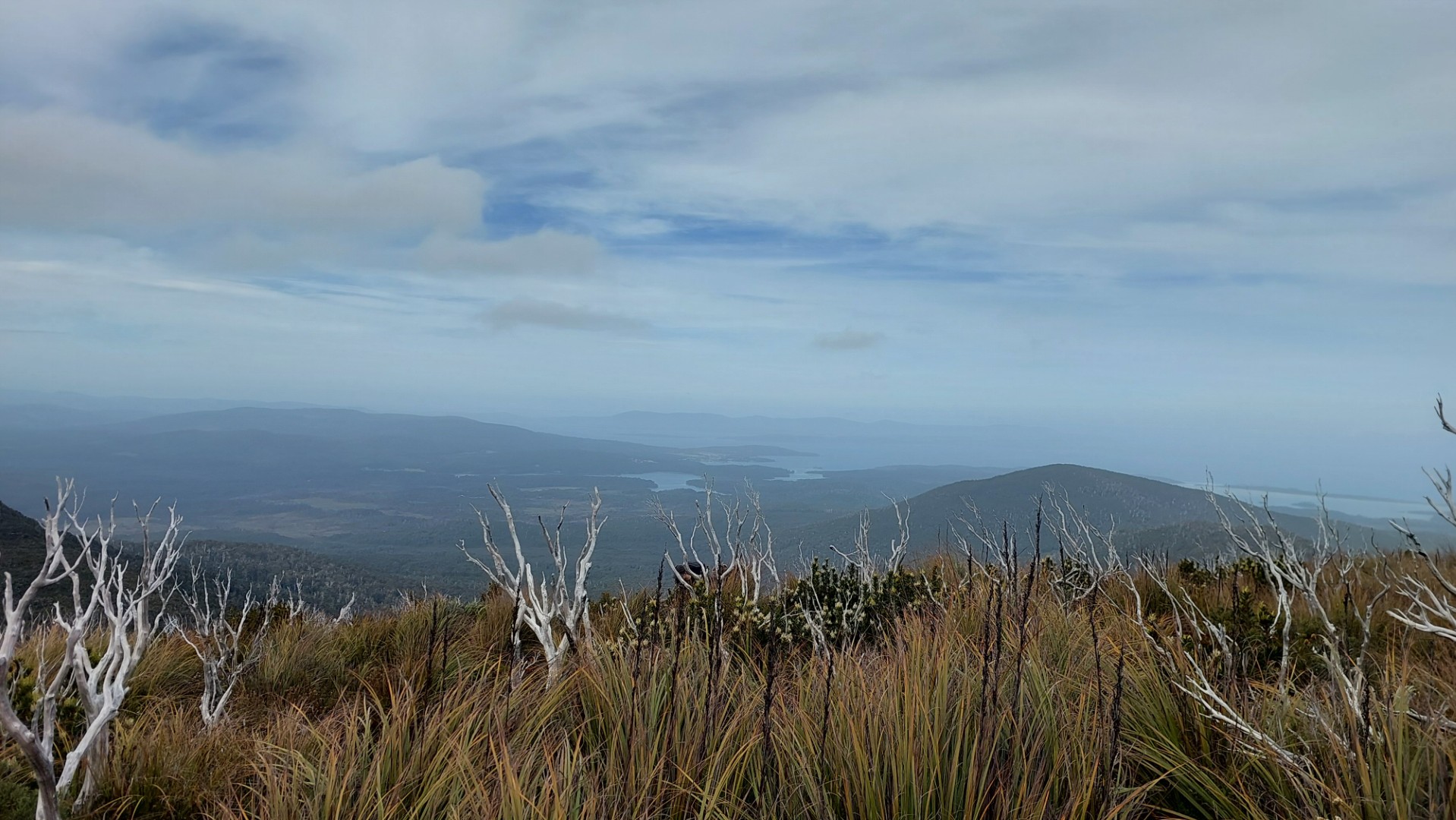
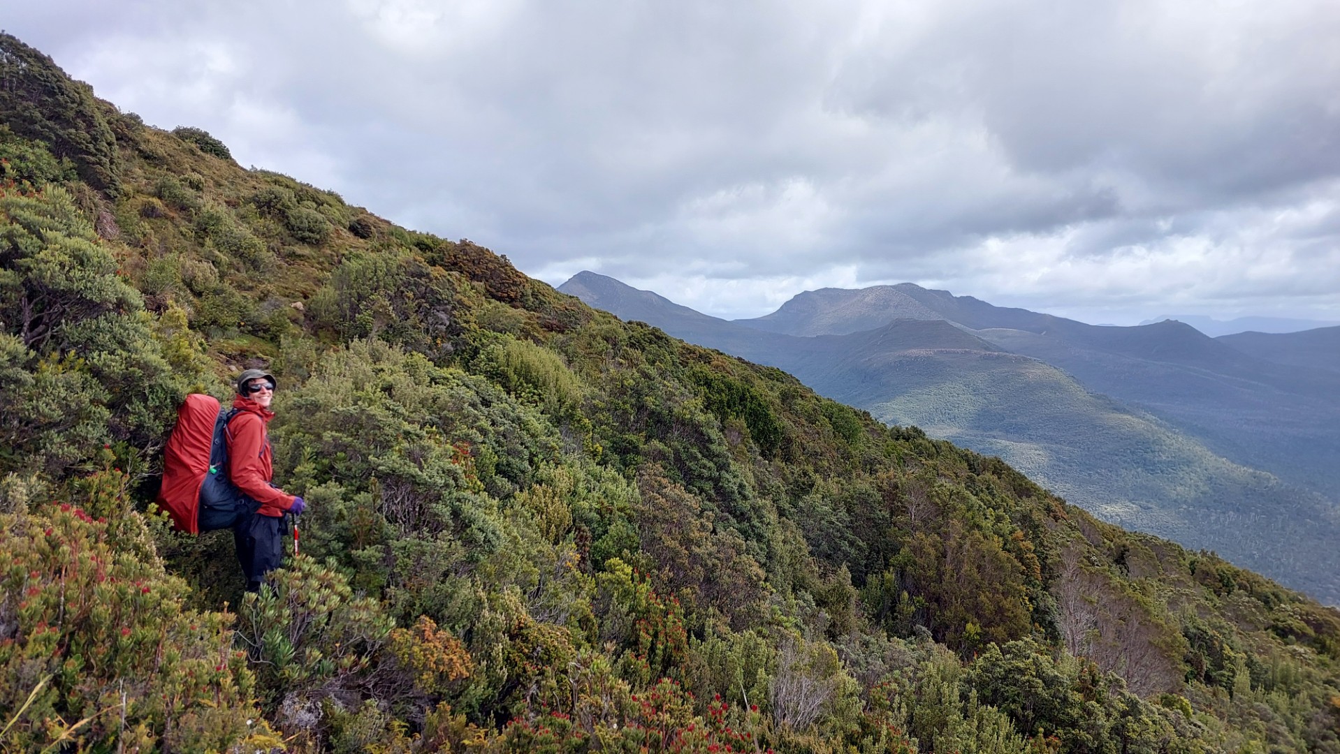
The steep climb gives way to a rocky escarpment traverse with some borderline rock scrambling while also affording us absolutely stunning views over the coastline, our destination (South East Cape), the Ironbound ranges, and New River Lagoon (day 6).
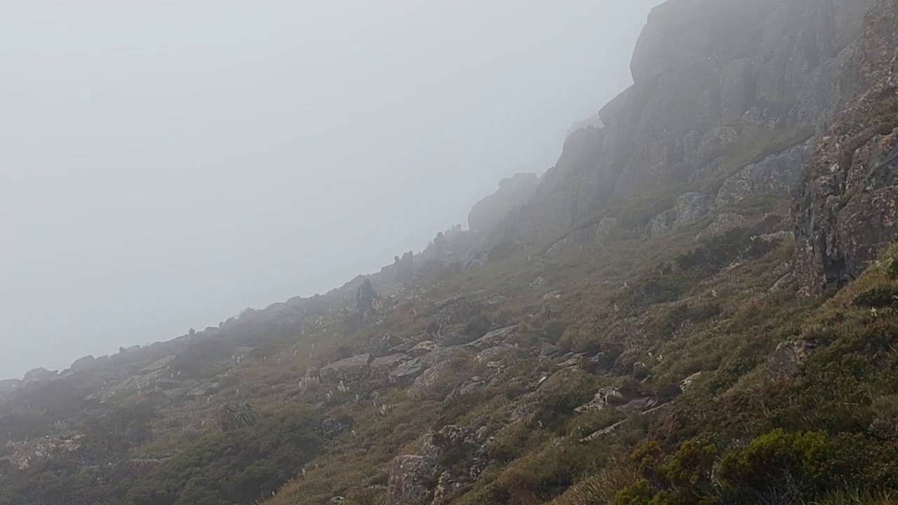
Unfortunately as if a present from the gods for approaching the top of Pindars Peak, the weather turns to crap, with rain and thick fog covering everything around us. I check the InReach forecast - so much for "sunny and low winds". Chapman mentions a sidetrip to the true summit of Pindars Peak, with the caveat "In fine weather the views of the coast and the Southern Ranges are excellent". Paired with our late start, the non-fine weather suggests us to give the peak a miss.
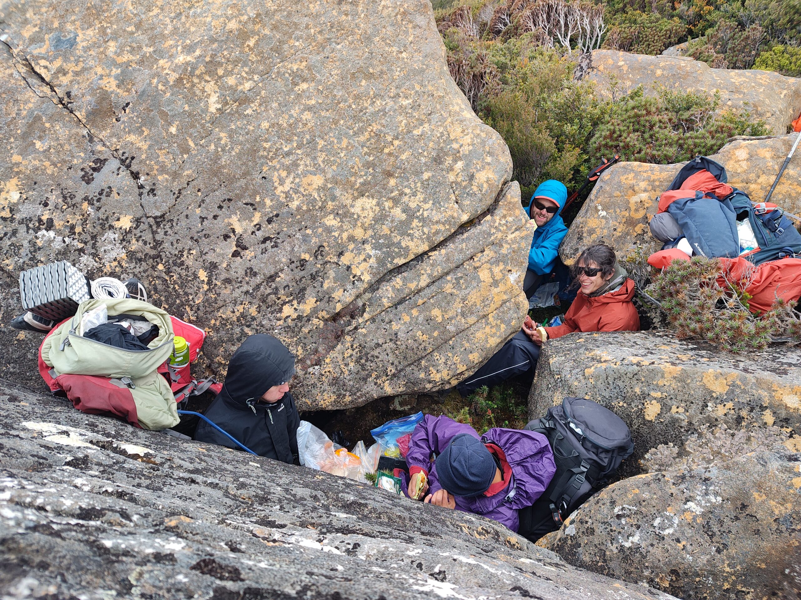
We have lunch at the base of Pindars, cowering beneath some boulders for wind protection. A solo German hiker also passed us - he had started the day after us, and camped at Pigsty Ponds the previous night. His aim was to camp near Mt Wylly, about 2.5 Chapman hours beyond our planned campsite of Leaning Tea Tree Saddle. I will call him Rowan for the purposes of this report.
Nice meeting you, we jested. Hope you enjoy the walk, we mused. 🤡
The ensuing walk was not to be enjoyed.
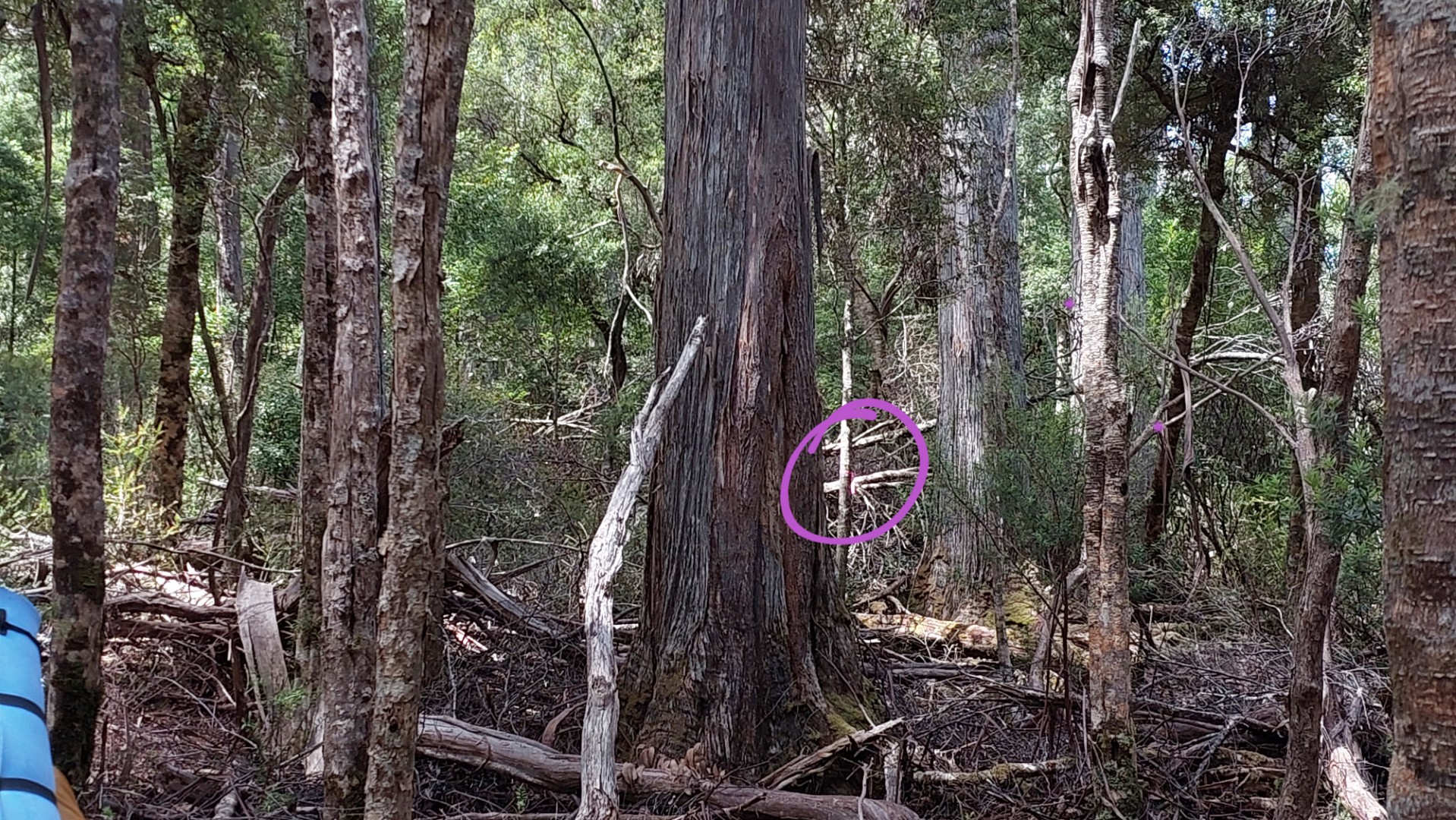
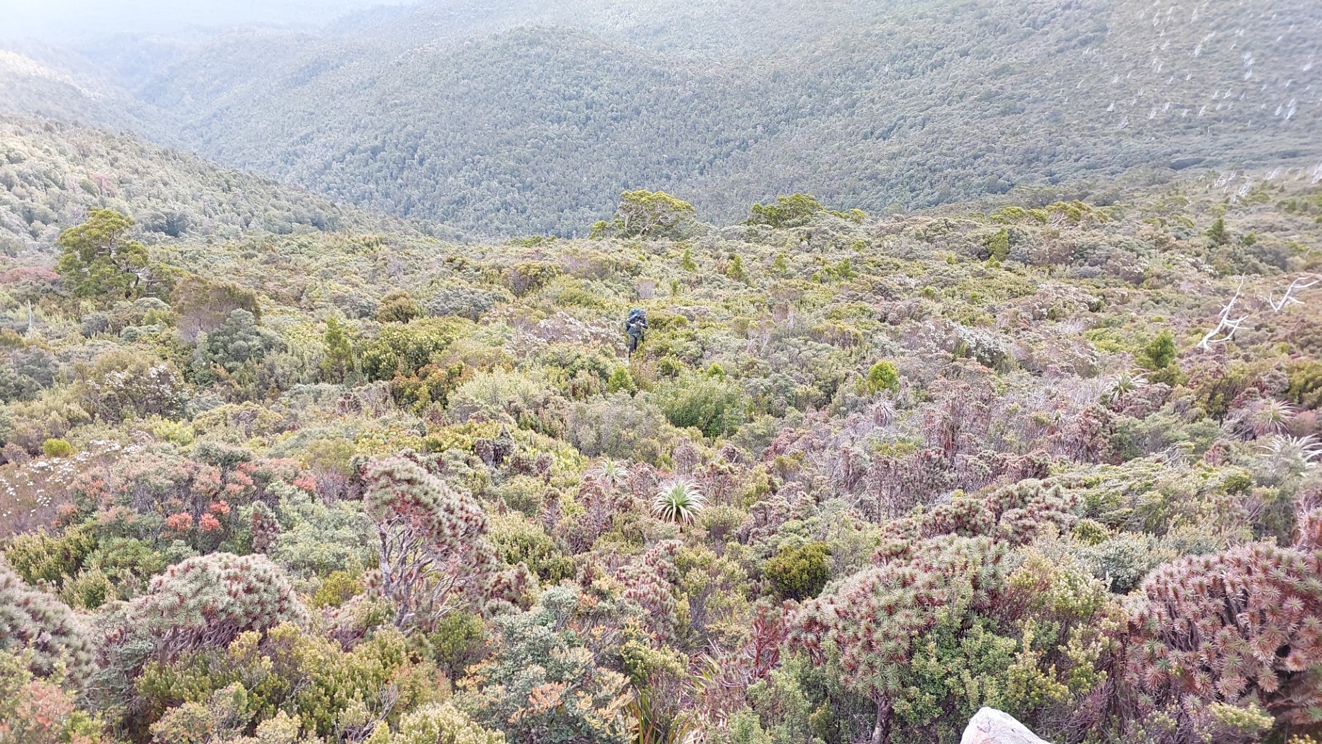
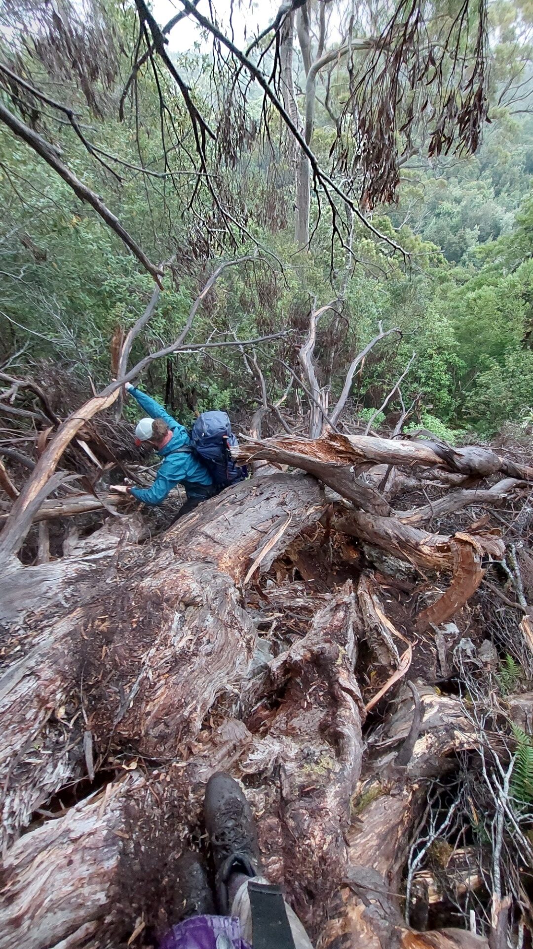
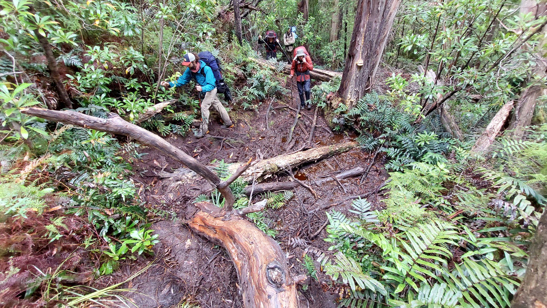
We set off through some of the thickest scrub I have ever encountered. This scrub is very different to anything found in the Blue Mountains regions, with very strong resistance and no opportunity for breaking tree branches to clear a path.
Scoparia and Tea Tree are the prevailing species in the first section, forming something akin to a shoulder-high ball pit filled with thorns. The benefit of this was whenever we wanted a break, we merely had to stop and lean slightly sideways. The scrub would catch us and provide genuinely one of the most comfortable standing rest positions, with added free acupuncture.
We were following vague paths through here, and Chapman remarks "The main route is not marked and there are numerous false leads". Oh, we slowly start to understand this man's highly literal language.
Understandably this book is 12 years old, and the information could be another few years older, but any mention of "Light Scrub" is at least medium scrub in reality, and "Thick Scrub" means Very Very Slow Dense Thick Scrub.
At 4:30pm, I see a figure walking towards us. “Wow, this track must really be more popular than I thought”. A closer look revealed that it was old mate Rowan again.
“Oh wow, when did you overtake me?” he asks – except we hadn’t overtaken him…
The thick scrub contained numerous false leads and is quite disorienting. Rowan had in fact walked in a big circle when we met him again.
And at no fault of his own. The track all but disappeared at this point, and the next 45 minutes were spent with me trying to push through different sections of scrub to get going in the bearing we needed. We finally found the main track up a little rock scramble, and continued on our merry way.
Rowan's name is changed and sunnies added for privacy.
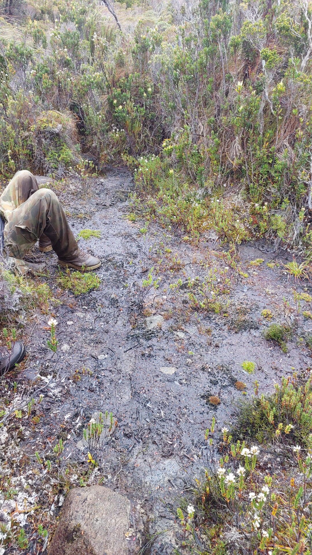
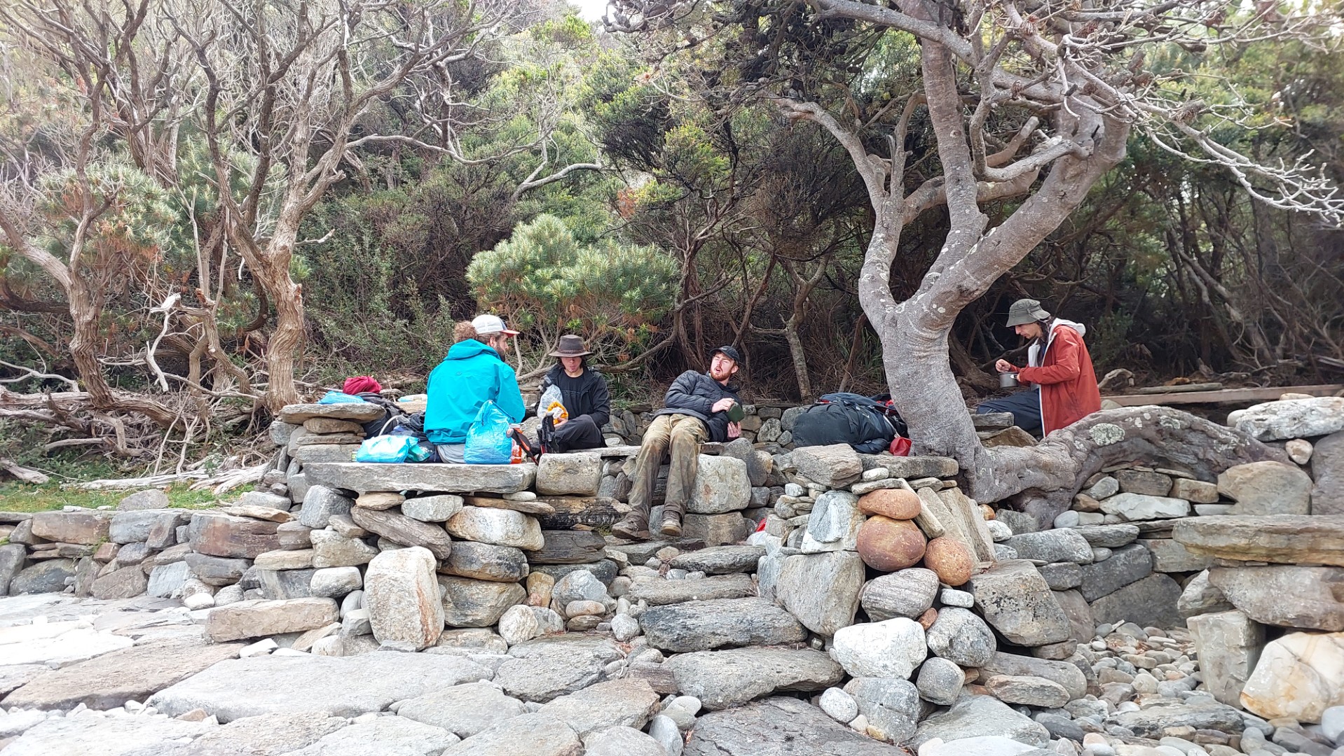
We eventually descended into the saddle, crossing through some weird tree/vine terrain filled with potholes of knee-deep mud, stumbling into our lovely campsite bog at 7pm. Our water source for the night was surprisingly gourmet, from pools about elbow deep and only mildly stagnant. (The weather is “Weirdly Dry” of course).
Alex made a spooky observation as we headed to bed: all the trees and tall bushes had grown almost sideways - the wind in the area must be so consistently formidable that straight growth was nearly impossible for the plants.
Day 4
More scrub bashing along the high ridges leads to Mt Wylly. The track is very thin, and the scrub seems designed to seize your movement at all costs.
The windspeed keeps increasing. Thomas tracks the clouds and estimates speed of at least 70kph.
It starts raining. Each member in the group always goes at a different pace, but the weather makes it nearly impossible to find a viable spot for regrouping – nowhere on this exposed ridge has enough shelter for people to wait (or take a break) without losing body heat fast. We take breaks by crouching beneath scrub.
We continue climbing higher, and the weather does not show any signs of improvement.
We are up on the Western face of Mt Wylly at 10:45am when I make the call that it is unsafe to continue. Crossing Mt Wylly any further is on unstable rocky slopes, on the prevailing side of the winds. We can barely stand up straight, nor can I see our destination through the rain haze.
The group pauses on a somewhat stable section while I ask Thomas to help me find a spot on the Eastern side, sheltered enough from the winds for us to cower beneath a tarp until the weather settles.
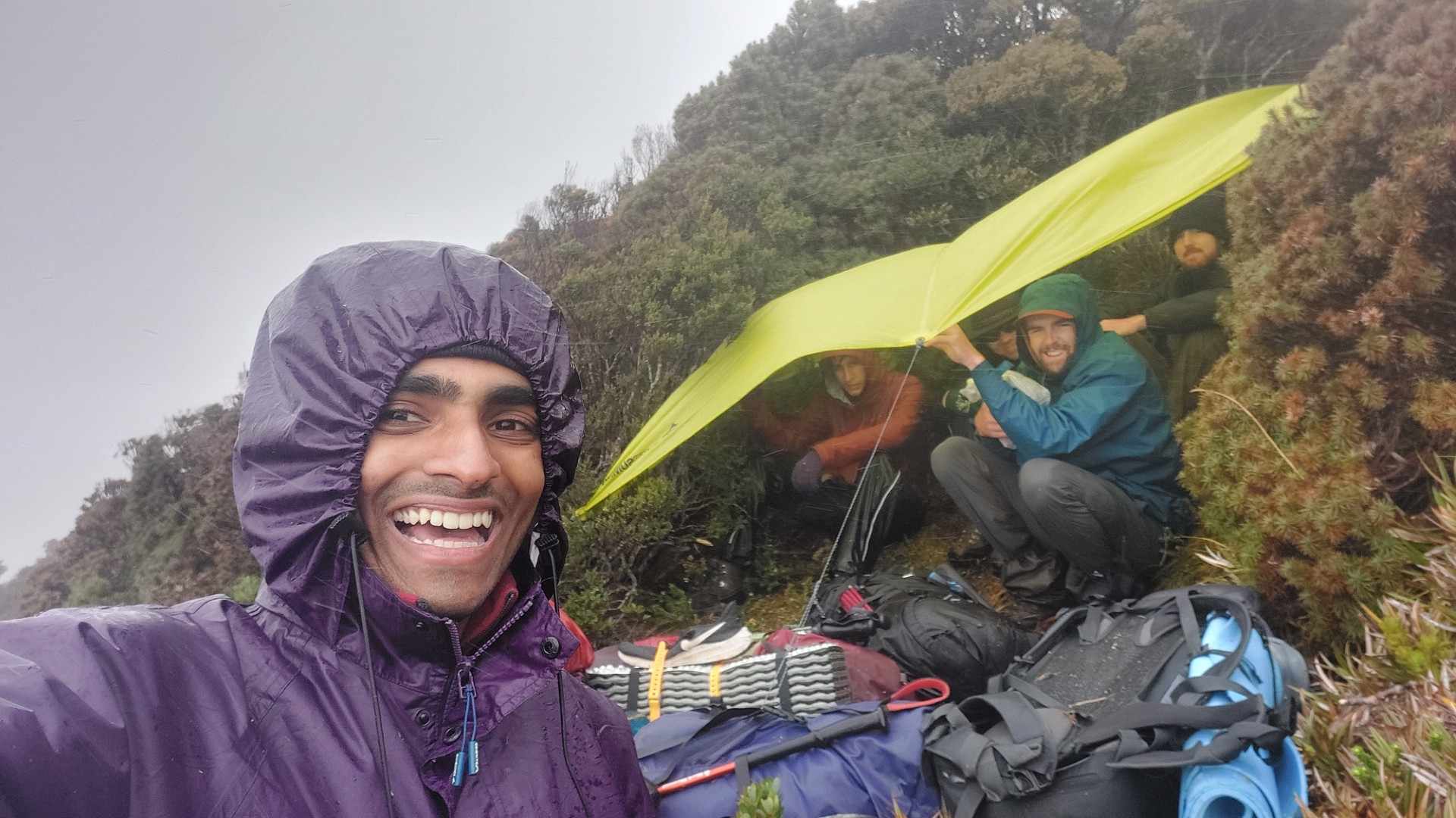
We wondered what situation Rowan was in – he left about 30 minutes before us in the morning and hopefully escaped the weather. By 12:30 the weather had calmed down enough to continue walking – but still not settled per se. We make it down Mt Wylly in record adrenaline-filled time, past a weird plastic “E” cut into the ground, and to yet another lunch nestled in the bushes.
The rest of the day is fairly unremarkable except for the scrub. Have I mentioned the scrub yet?
Today’s plan was 8.5 Chapman hours, but due to our brief altercation with the weather we were forced to take camp earlier. The book describes it as “A rough, sheltered campsite with no water nearby”.
Calling it a “Campsite” is a bold accusation for a bog. The main camping spot can house just about a large 2 person tent, and the rest of us are forced to find other clearings in muddier areas.
We briefly consider pushing on to our planned destination, but with a Chapman estimate of 2 hours to get there and only 2 hours of daylight left, the math did not work out in our favour.
We roll into bed fairly early as the rain picks up again. Tomorrow is to be a longer day than planned, picking up the 2 hours of slack from today, along with the previously planned 7.5 Chapman hours of walking.
Day 5 - Canyoning, Climbing, and Hiking in a day
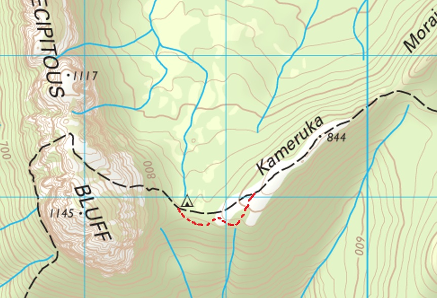
We wake up early and skip breakfast as we ration our water supplies from the previous day. We follow the very rocky ridgetop of Kameruka Moraine, hopping over and under boulders for a good 45 minutes before opening up into a more open area.
To everyone’s utmost unsurprise, it starts raining again…
While walking through the rain sucks, the only benefit of walking through 3 days of it is that all your gear is already wet! This may sound like Stockholm Syndrome, but once everything is soaked through, you no longer need to worry about stepping in puddles 😁😁😁😁 A knee-deep puddle can’t make you any wetter than you already are 😭
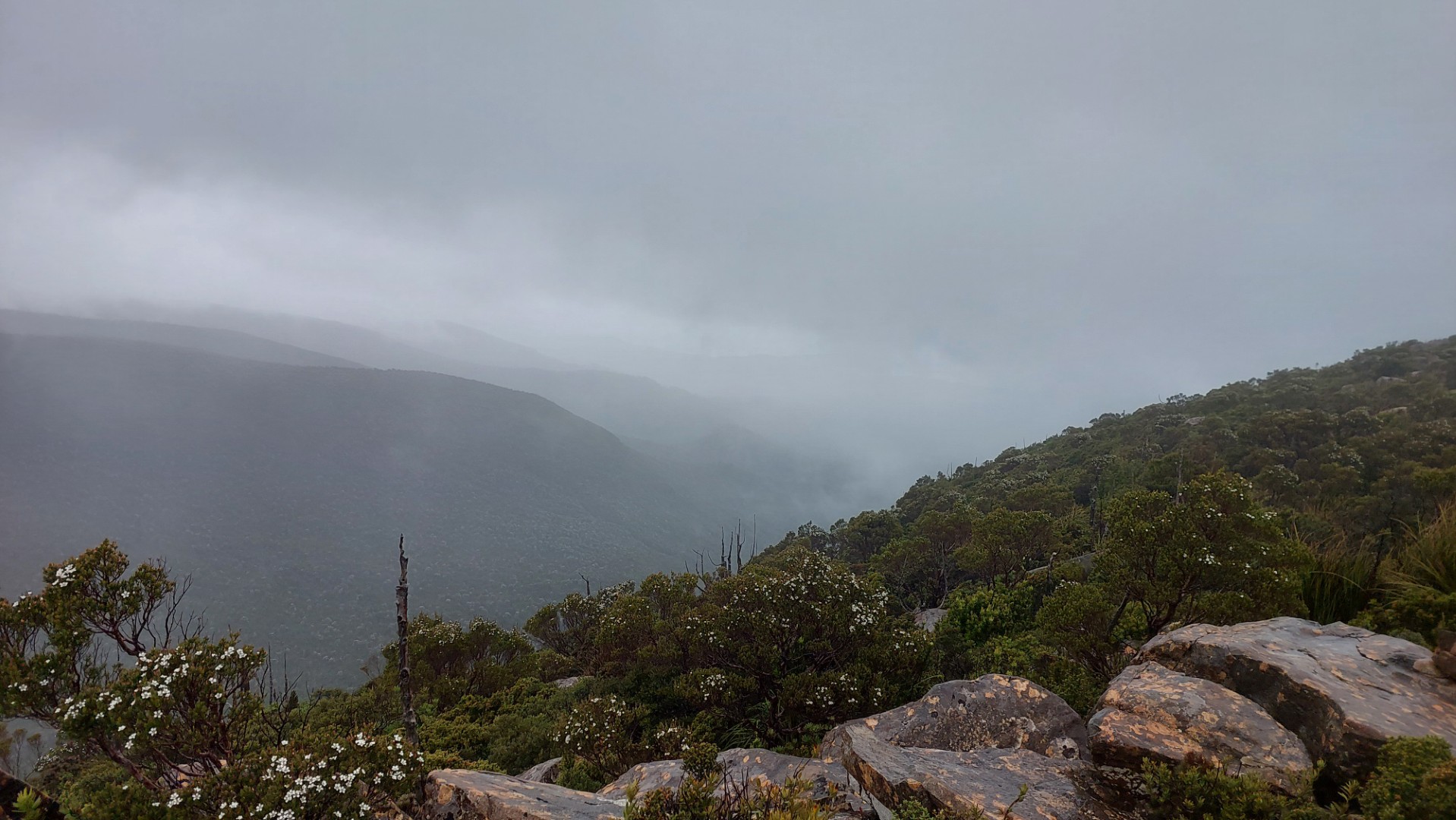
It’s basically a canyoning trip at this point, where our path has become a river which we are following downhill. Visibility becomes worse as the rain and fog becomes stronger, and despite being the closest to PB we have in the entire trip, we get the least views of it.
Fog also makes navigation much harder, as we can’t see our destination. Rain and the saturation of the ground (the weather was “Weirdly Dry” right?) meant that I’d find myself gaining increasing speed down a gully.
“Wow, this path is so fast to follow” I’d remark, before realising we were halfway down a hill in the wrong direction.
We eventually chain together some sidetracks to make it to the base of PB, where we have Breakfast at the astonishingly early hour of 11am.
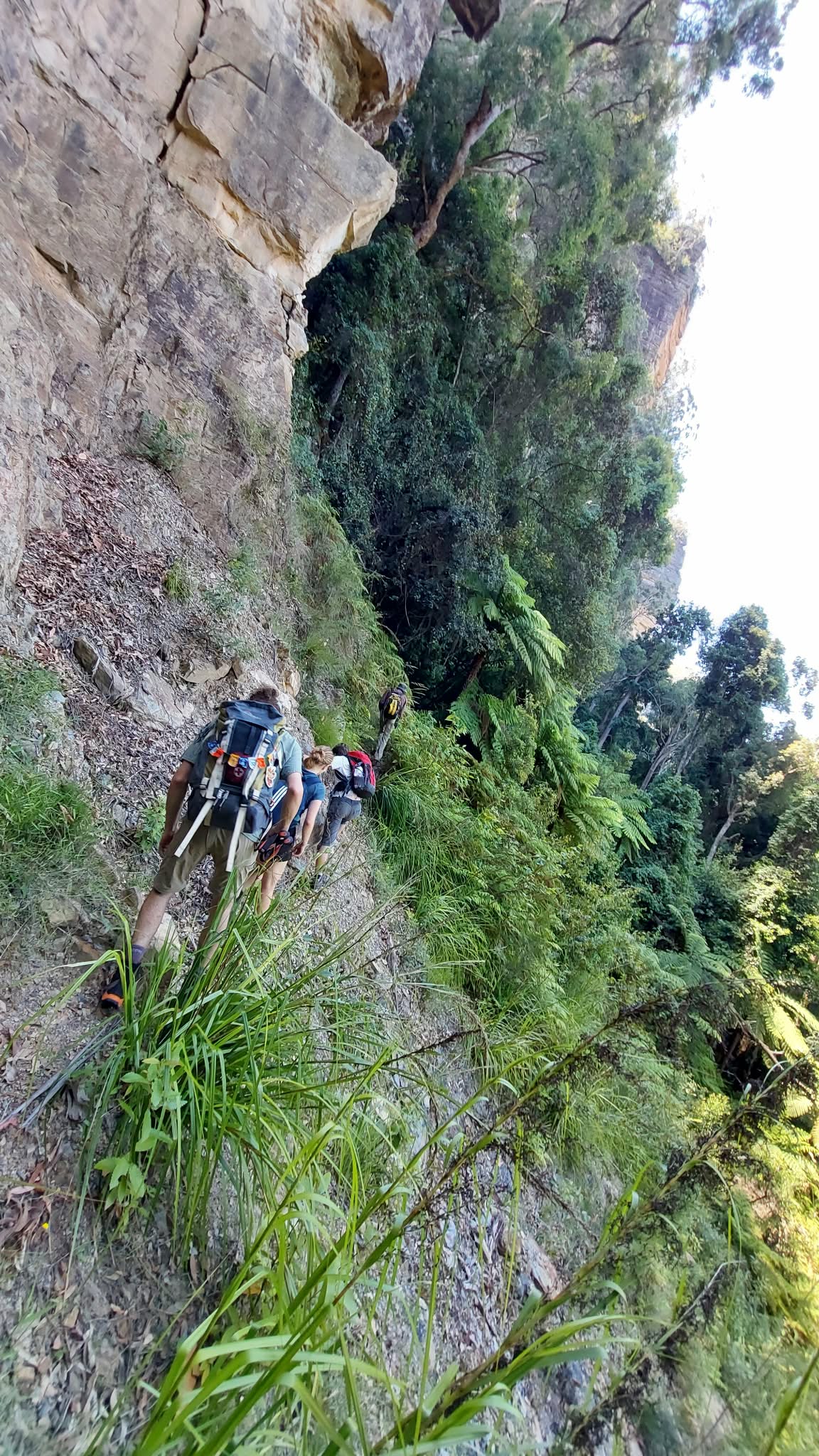
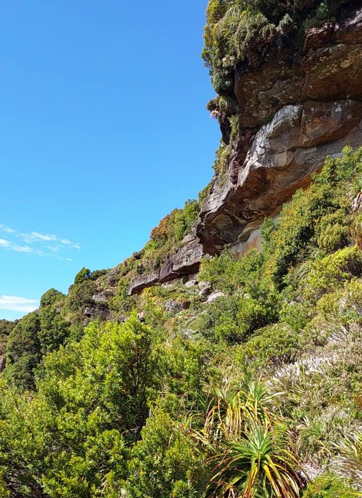
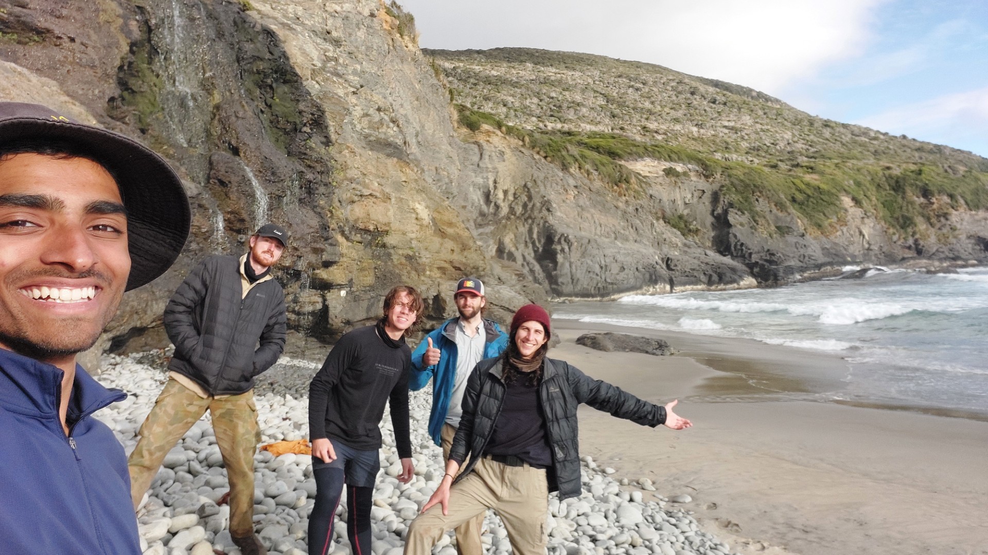
The ascent/descent of PB is probably my favourite section of the entire trip, scrambling up rocks next to a pumping waterfall. Chapman says that “From below the route looks improbable, and while steep it is not too difficult”. The Canyoning trip has metamorphosised into a Climbing trip!
He is bang on – from the bottom it is really unfathomable how we can even remotely think of getting to the top, but following the rocks really works wonders.
Thankfully the wind settles down while we’re on PB, and once we’re at the top we’re greeted with the stunning views of nothingness.
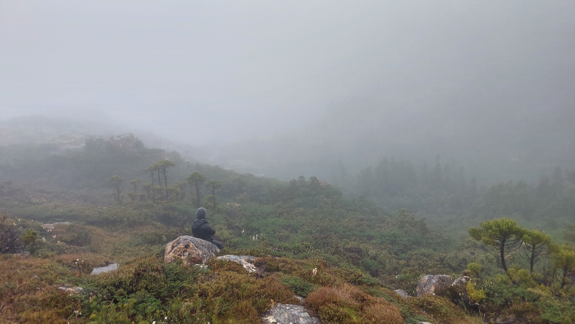
While it is unfortunate that we are not able to experience the famed views from here, being present in the thick fog and surrounded by the whispers of the wind was enjoyable in a unique way.
The way down is approximately as treacherous (or you could say precipitous???), and we continue making our way down the steep, slippery and mysterious rocky edge of Precipitous Bluff.
From the base of the bluff commences our descent of almost 900 vertical metres, to our sea-level campsite.
Until about the 500m level, the walk is open forest land, clambering over vines and through tree gaps to make a short and steep but quite easy going path.
The next 300m of elevation are more gradual and thus slower, as the steepness peters out through some denser bush. This whole time, no real navigation thinking has been required – a ribbon is present every 2 minutes along the walk, turning it into a very very long “find the next ribbon” game.
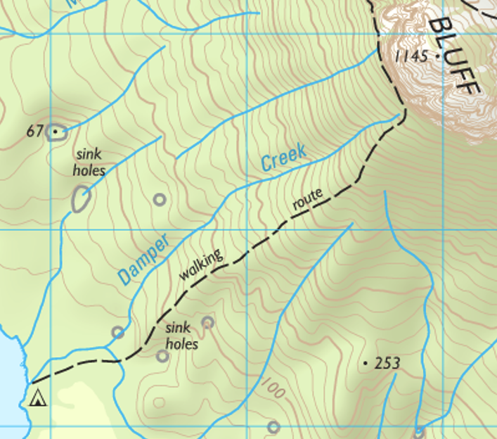
holes
At about the 100m level, we are faced with an area littered with countless limestone outcrops making walking harder, and numerous sinkholes marked on the map! To add to the pain, the area has been the site of numerous landslides, and at one point an absolutely massive tree blocks the path.
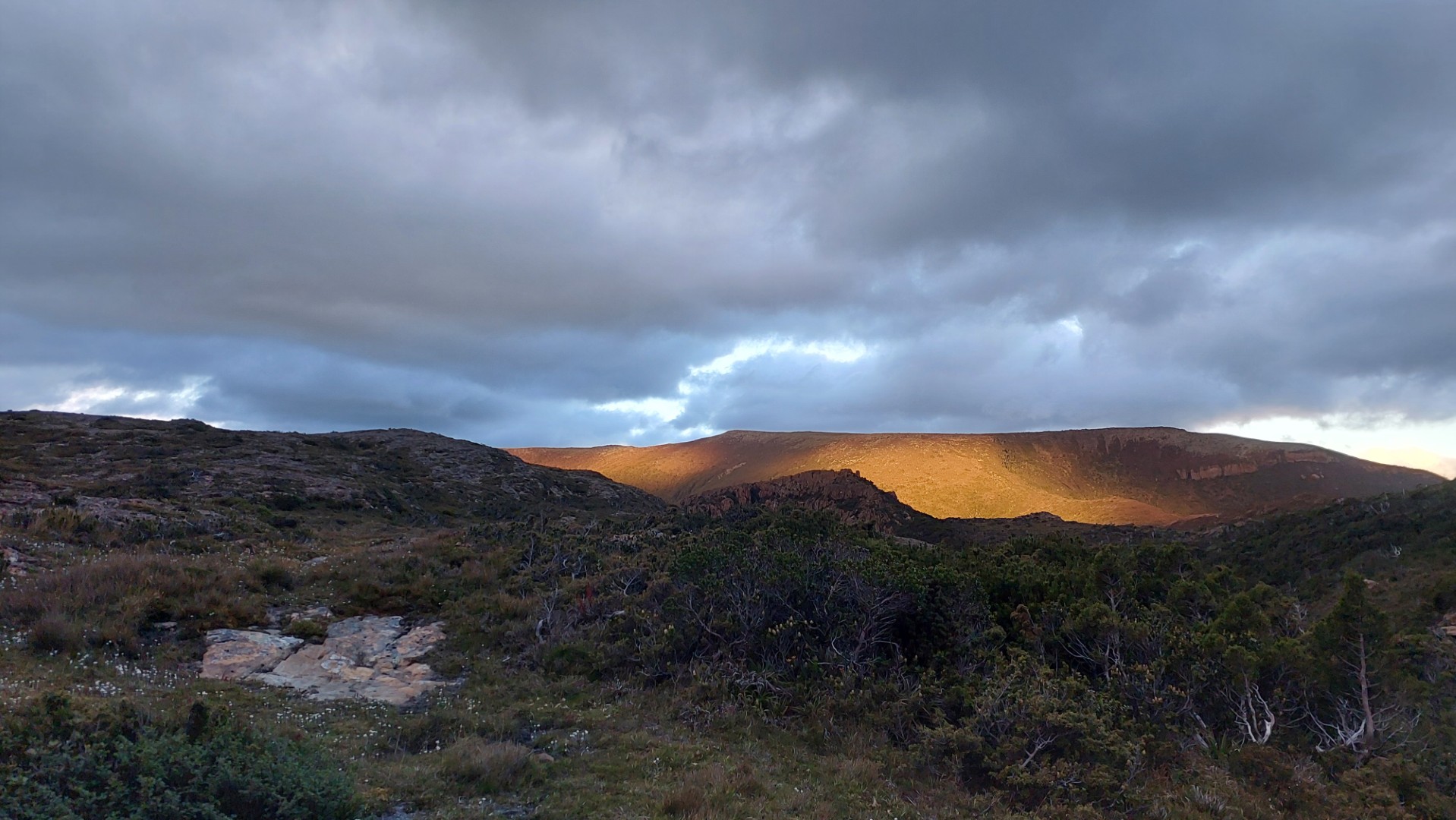
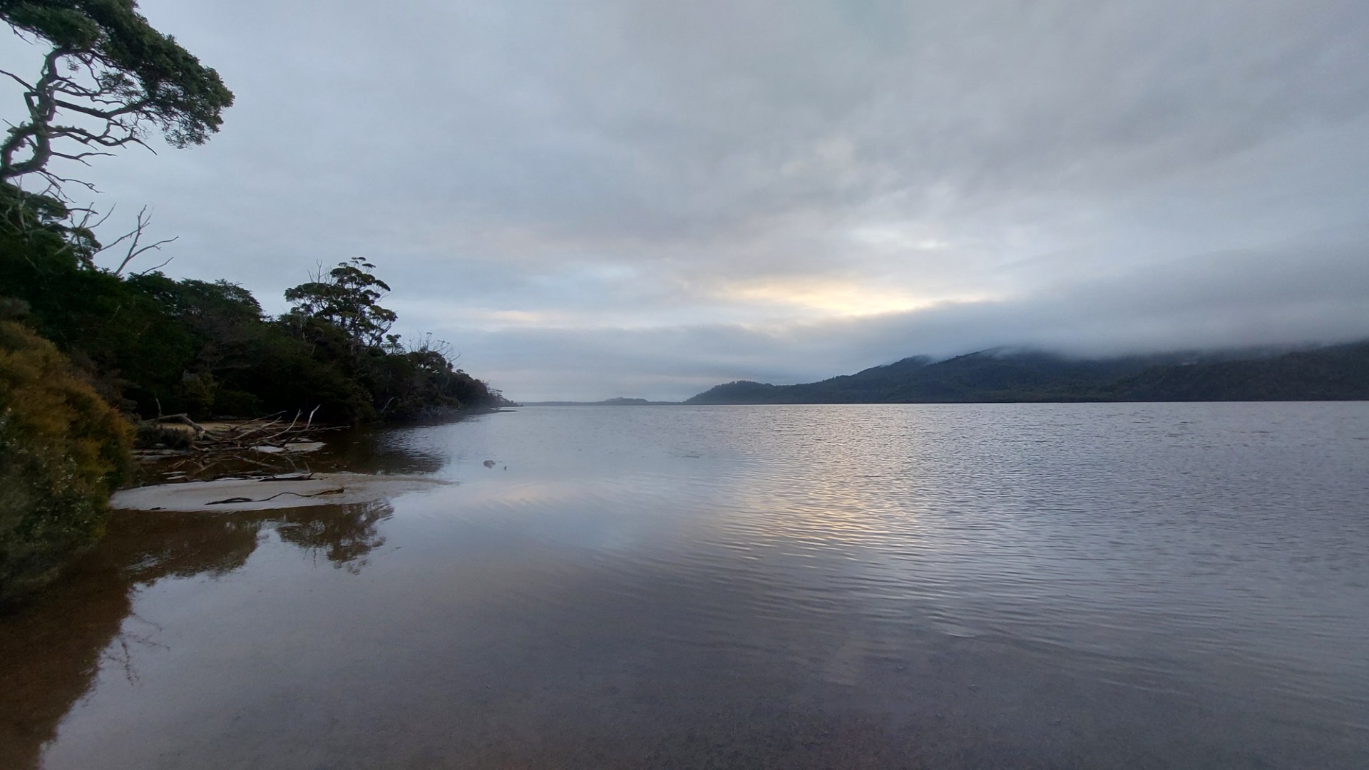
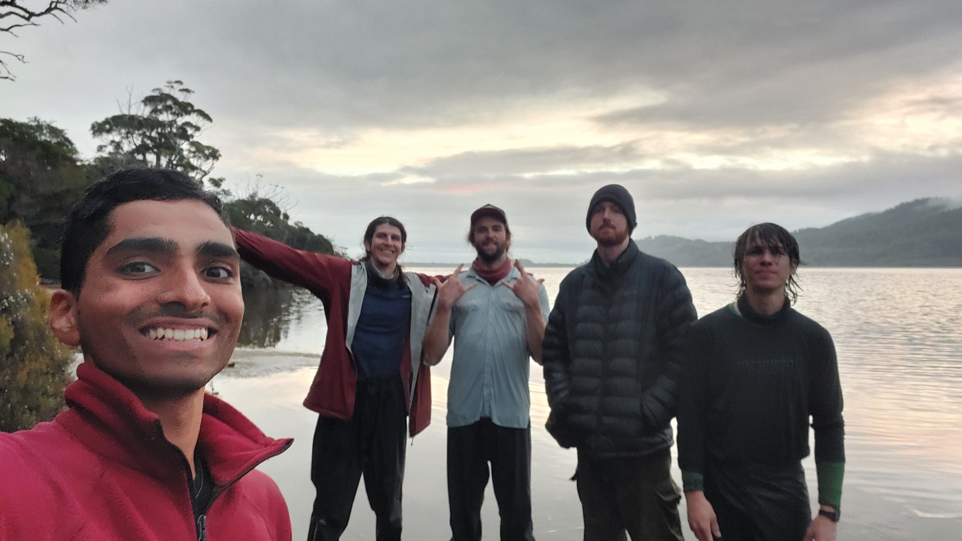
And finally at 8:15pm, after our longest day of walking yet, the lagoon appeared in front of us with a curtain of gold drawn across the sky.
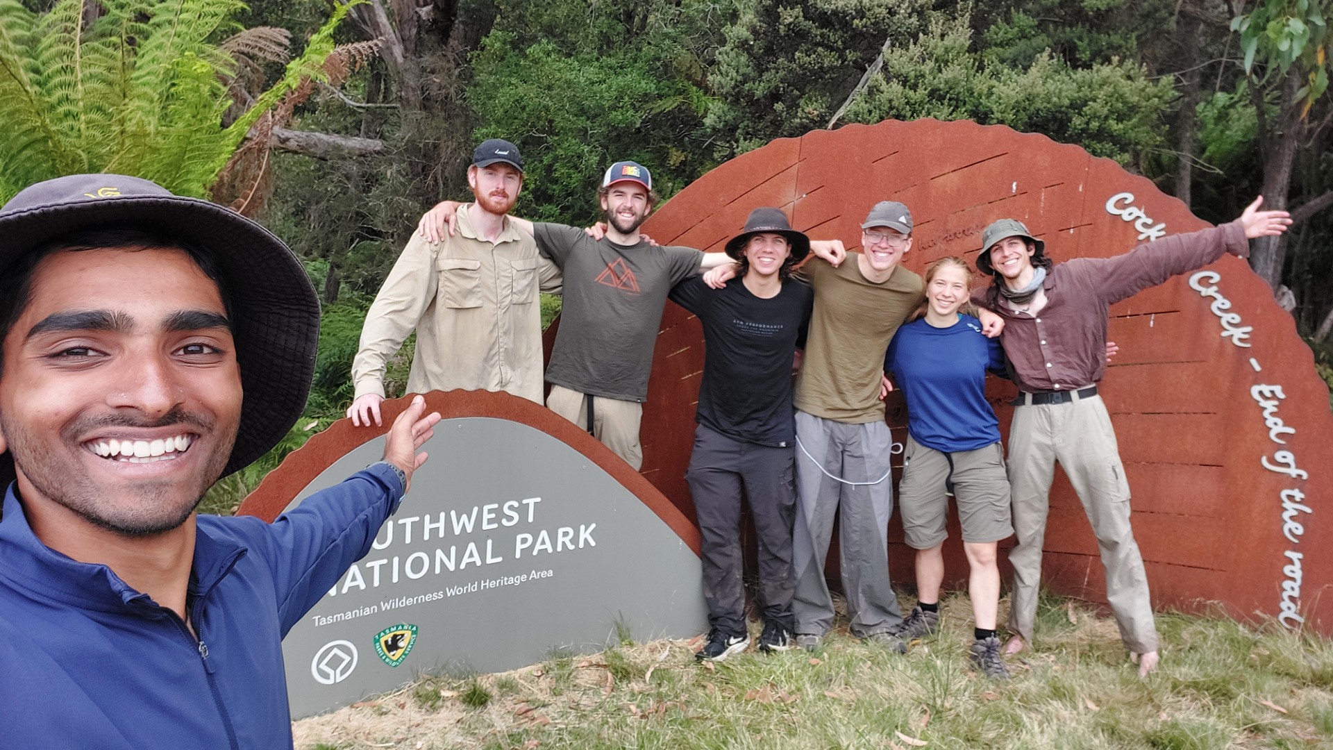
The Southern Ranges Traverse was complete!
As a bonus, we also found a very sleepy Rowan in his tent - he had made it just past the weather event yesterday, and had done the schedule we had intended to do.
But of course, you can’t have everything nice. This was the most insect-ridden campsite I’d ever been to. It was the day I discovered that some types of flies can bite – and that Tasmania has a blasphemous amount of them. We flopped into bed with an acknowledgement of a well-deserved late start the following day.
Day 6
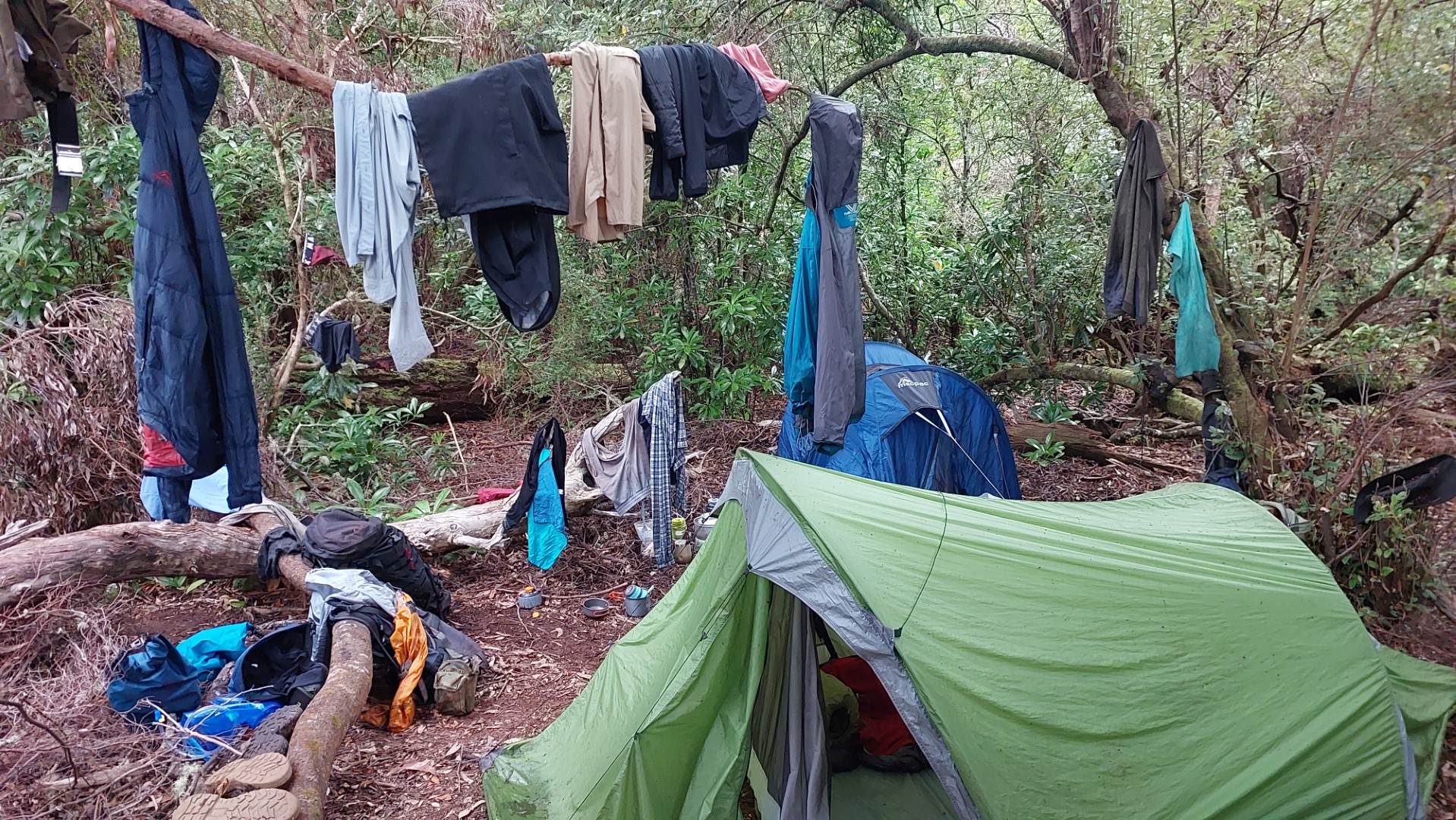
Futile efforts were made overnight to try and dry our clothes. No sir no, the weather gods were not in our favour.
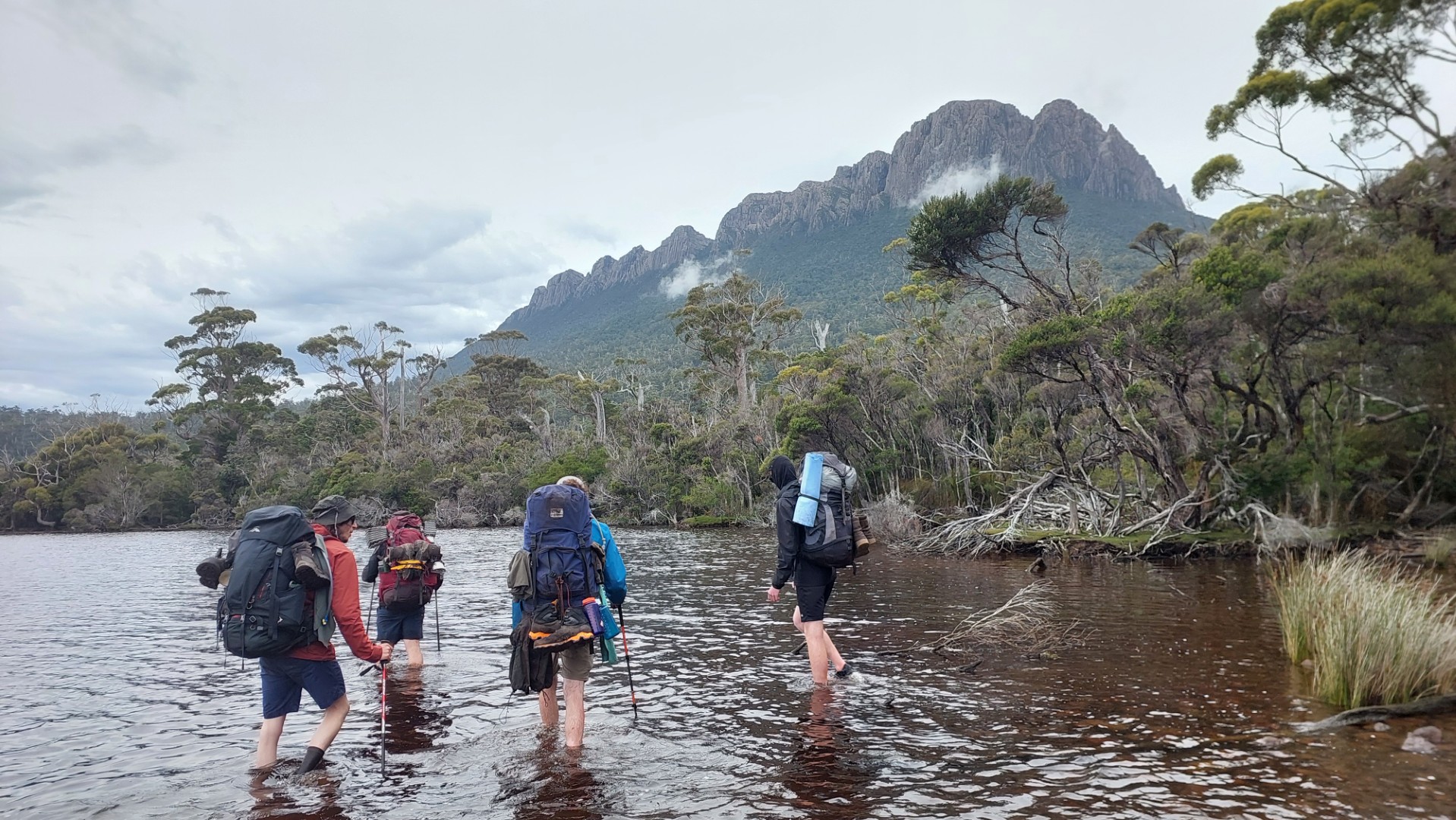
Despite our relief at making camp the previous night, we were only really halfway through the trip in terms of distance and time. We set off for the long-anticipated 8km wade, skirting the edge of the vast New River Lagoon. While planning, we decided to bring alternate shoes for walking in the lagoon, as not to make our boots wet.
On reflection, we probably should’ve worn our boots in the water anyway. The wade was on little submerged boulders with poor visibility, so most steps were not very enjoyable. I even went stomach-deep in the water at some point to attempt avoiding them, but to no avail.
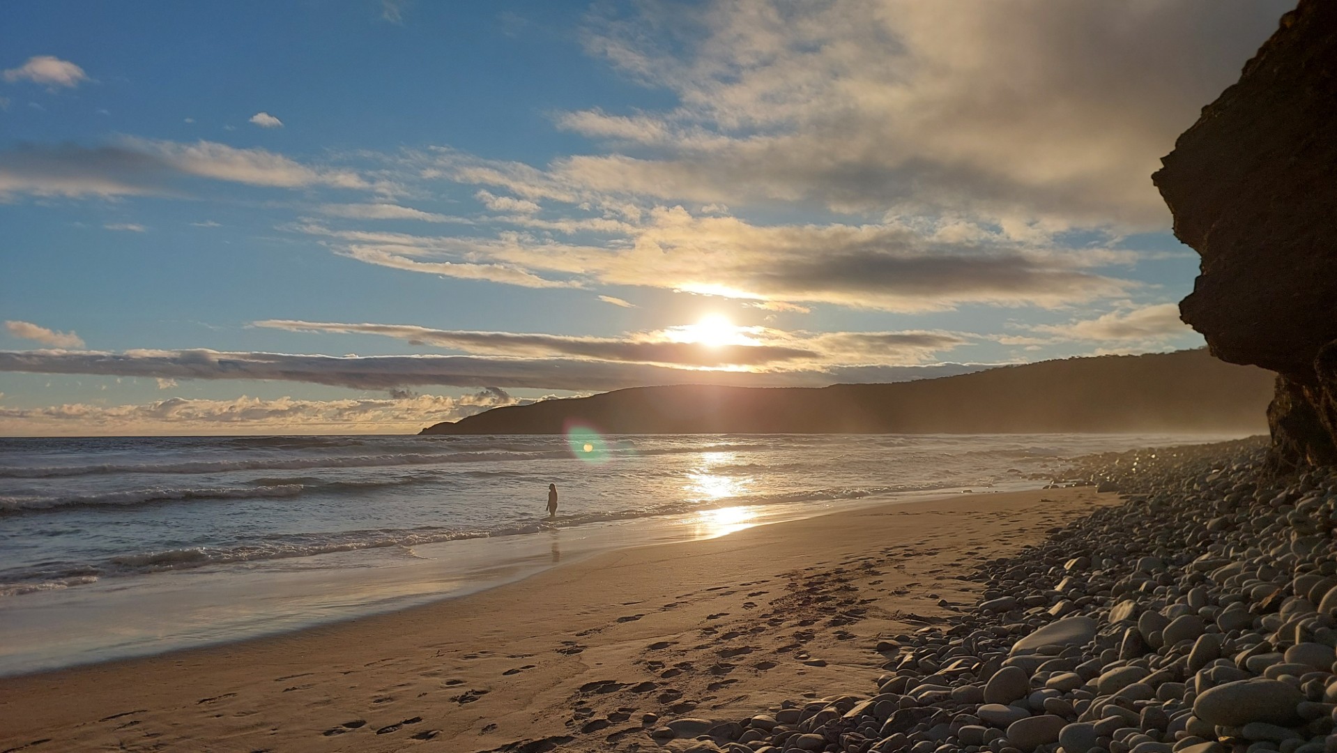
The wade only took about 3 hours, and besides me finishing my entire packet of Dried Mango (so good!!), was fairly uneventful. We did however see the sun for the first time in 5 days though!
> “The South Coast Track is a challenging 6-8 day walk along Tasmania’s wild southern coastline. Wander windswept beaches, climb mountain ranges and wade (or row!) across rivers on this 85 km adventure.” - Tasmania Parks Service
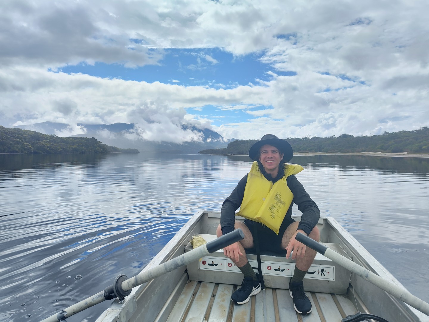
We were now joining the South Coast Track about halfway through - the above mentioned “row across the river” at the mouth of this Lagoon. Rory and I enjoyed lunch on the boat while the rest of the group (losers) enjoyed being on flat ground after so long.
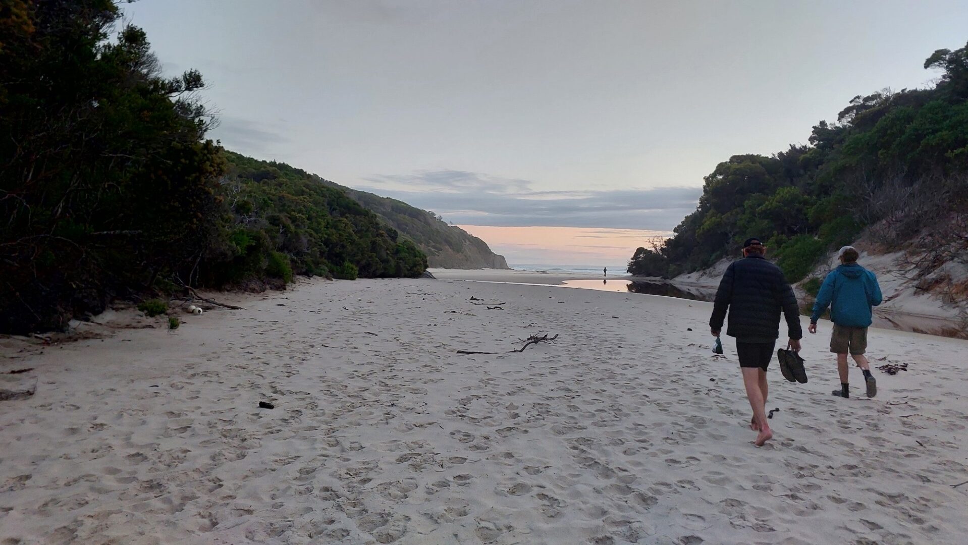
We made our way to Osmiridium beach for the night, enjoying a lovely sunset dinner against the majestic sounds of the Southern Ocean.
Day 7 and 8
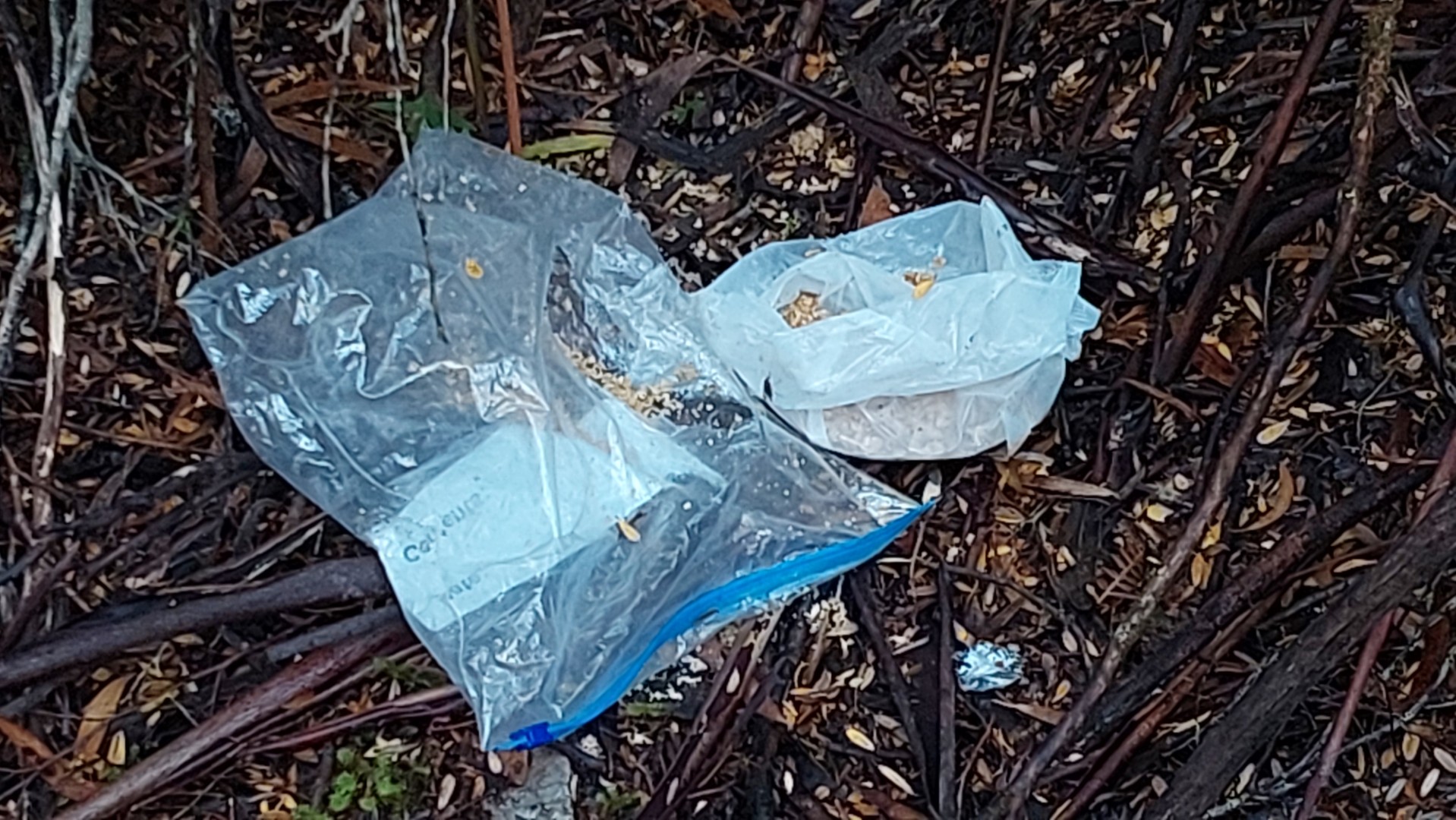
Tom woke up to find his snacks for the next few days missing. Turns out an animal had gotten into it, discarded the muesli after tasting it, and run away with the rest. We made a relaxed midday start, with only 10km to cover.
Despite the South Coast Track being one of Tasmania’s crown jewel walks, it is surprisingly neglected. Copious amounts of mud line the track, fallen trees and logs block the path, and even more mud lines the track. For most of us this wasn’t a major issue as we were already wet and muddy, but I’m surprised at the un-quality for walkers who are only doing the full South Coast Track. In saying that, the views are stunning and the walk is generally quite enjoyable.
We have lunch in a cosy little handcrafted beachside picnic area and reach camp at 5pm - spending the next few hours enjoying the stunning landscape around us.
Day 8 is rather uneventful, with reasonably nice walking, and some very unenjoyable steep sections. Oh, and the mud.
However at 5:30pm as we approach camp for the night, a stunning sight for sore eyes emerged from the ocean! Callum and Lena had made it to Hobart, and then hitchhiked back to the end of our track to start walking in the opposite direction to meet us. They even bought presents (drinks and chocolate) 🥳
We enjoy a group dinner by the beach before setting off for our very final day.
Day 9
We admire our final sights of the Southern Ocean and the coast, before making our way up towards the finish line.
The weather forecast prophesised of 2pm rain and we had 13km to cover, but spirits were high. Additionally, the promise of flat boardwalk for the last 5km was sufficient fuel to power us along the otherwise uninteresting final hours of the walk!
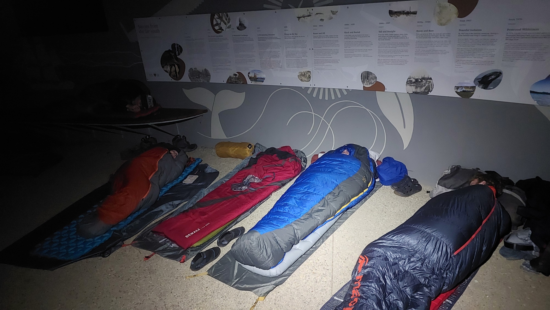
We reached the finish line just in time for the rain to hit (and continue well into the night), and relaxed in the visitor information shelter. Benches were enjoyed, and a literal massive weight was taken off our shoulders.
We (allegedly) just slept under the visitor information shelter to avoid the rain, and got picked up the following day at 9am.
We had initially planned to get picked up on the evening of Day 10, allowing it as a rest day if we needed during the hike. However nowhere along the Southern Ranges had nice enough weather to entice us for a rest day, and by the time we reached the South Coast Track we had our eyes on the prize.
For the curious, our transport was with Tas Adventure Co and they were very accommodating with our request to get picked up earlier than initially booked.
Thoughts
Overall, this was a great adventure. We definitely underestimated the difficulty of this track, made only worse by the weather. In saying that, most members of the group were adequately prepared and skilled to complete the walk, and we had no major mishaps.
If you are considering doing this walk, I would say to go for it. Ensure you have strong navigational skills, and can tolerate about 17 hours of scrub bashing. Be prepared for horrendous weather that can change at the flip of a coin. If using the Chapman guidebook, keep in mind that the information is at least 15 years old and the track has only degenerated since then.
Would I do this again? Maybe in a few years time, to actually enjoy the view from PB 🙂
Fun fact, there was a cancelled trip to the Southern Ranges approximately 26 years ago! Check out February and March 2000's newsletter.
Party
Trip Leaders:
- Sudarshan (me!)
- Callum
- Lena
- Rory
Participants:
- Alex
- Thomas
- Louis
- Stirling (Days 1-2)
Special Mentions:
- Rowan (Days 3-5)
- The lovely group of 3 from South Australia that we played leapfrog with on Days 8 and 9.
- Shoutout to Heartfood in Hobart for an absolutely amazing lunch ↩︎
- For the curious: We had a car with 5 seats. 4 of us drove down from Hobart to Ida Bay (2 hours). 4 others took Bus Route 718 to Dover. Rory drove back (30 minutes) to Dover to shuttle the others back. ↩︎
- 15 in the entire month is still absolutely tiny. The Western Arthurs has a limit of 12 people per day, and the Overland gets 60 hikers a day. ↩︎