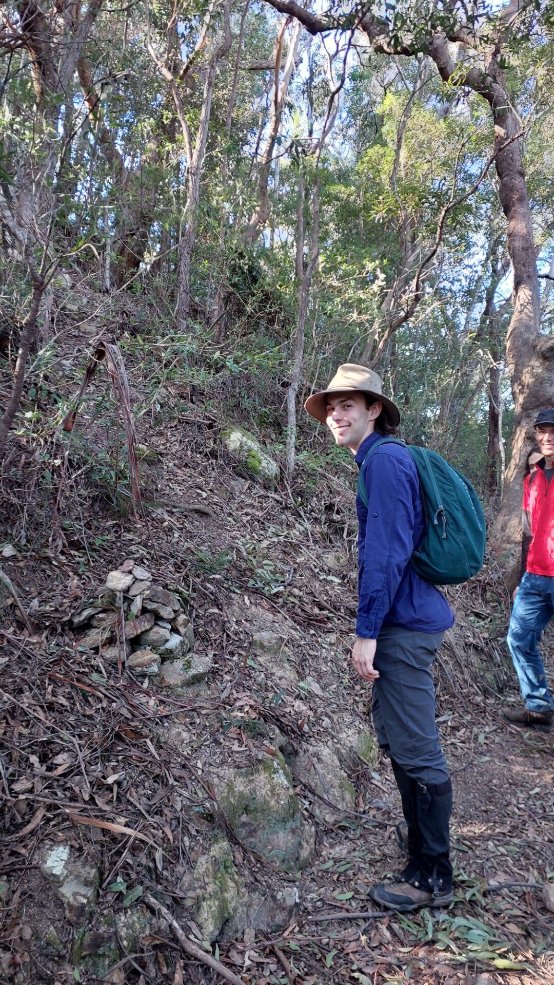
Party: Alex, Julian, Noah, Sudarshan.
Photos by Julian and Sudarshan.
Updated Jan 2026, see below.
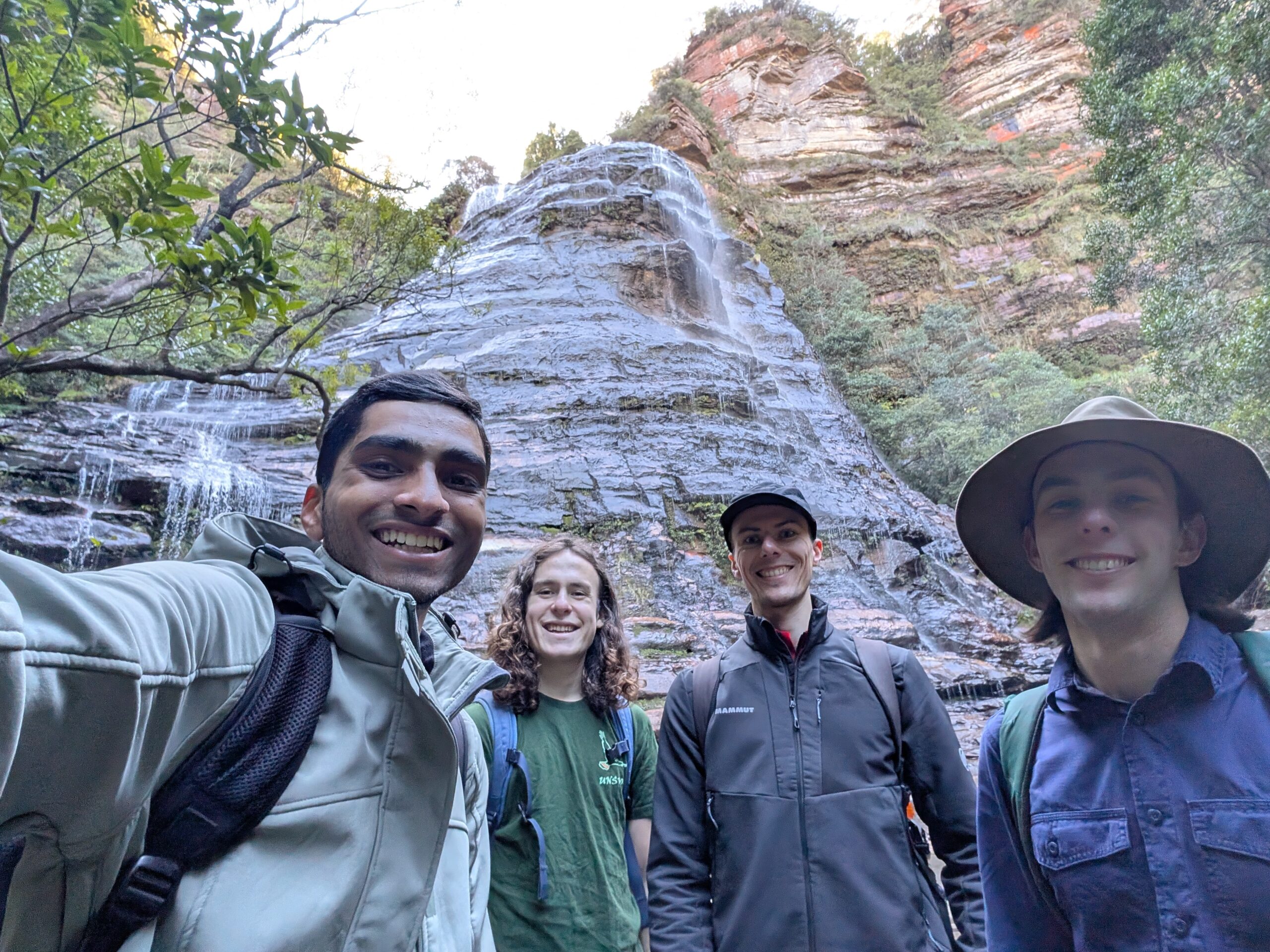
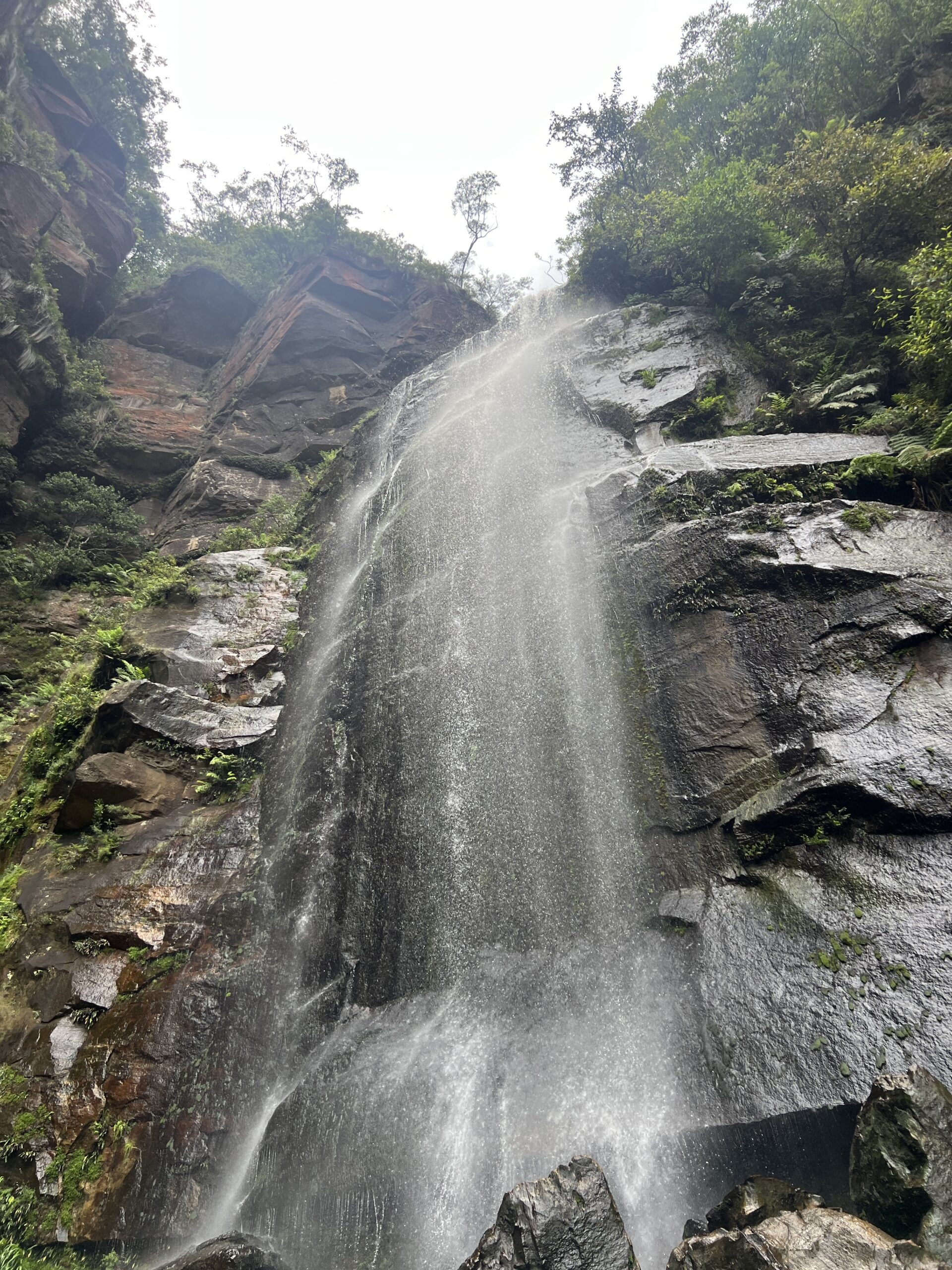
The base of Bridal Veil Falls in Leura is a very popular spot, following the Amphitheatre Track down from the parking lot up on the road. The falls themselves look.. malformed? It’s a very funny shaped rock when viewed from the bottom.
This Amphitheatre Track continues until the junction with Federal Pass, where a slightly less-travelled path then branches off to visit the base of Leura Falls.
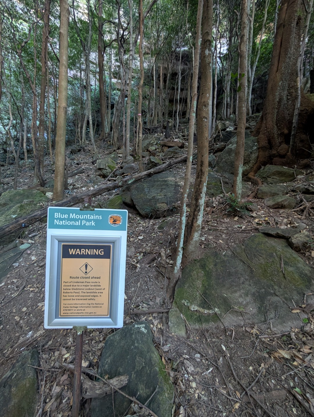
Last I was here, there was a lovely big warning sign noting the dangers of a “Lindeman Pass”. Apparently it was “Remote area, unmarked route, rough, hard to find”.
I took this as a challenge.
***
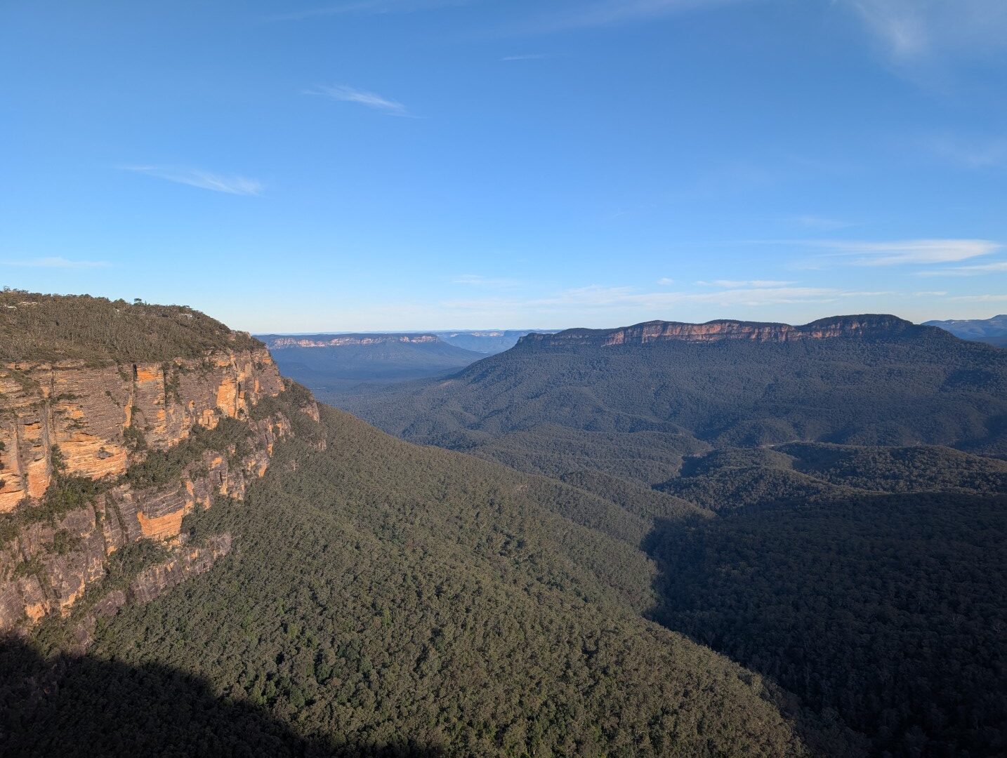
The Lindeman Pass “skirts the top of the talus slope through the Jamison valley, giving unobstructed, unique views of the valley”. Due to a landslide in mid-2022, a portion of this trail has been closed.
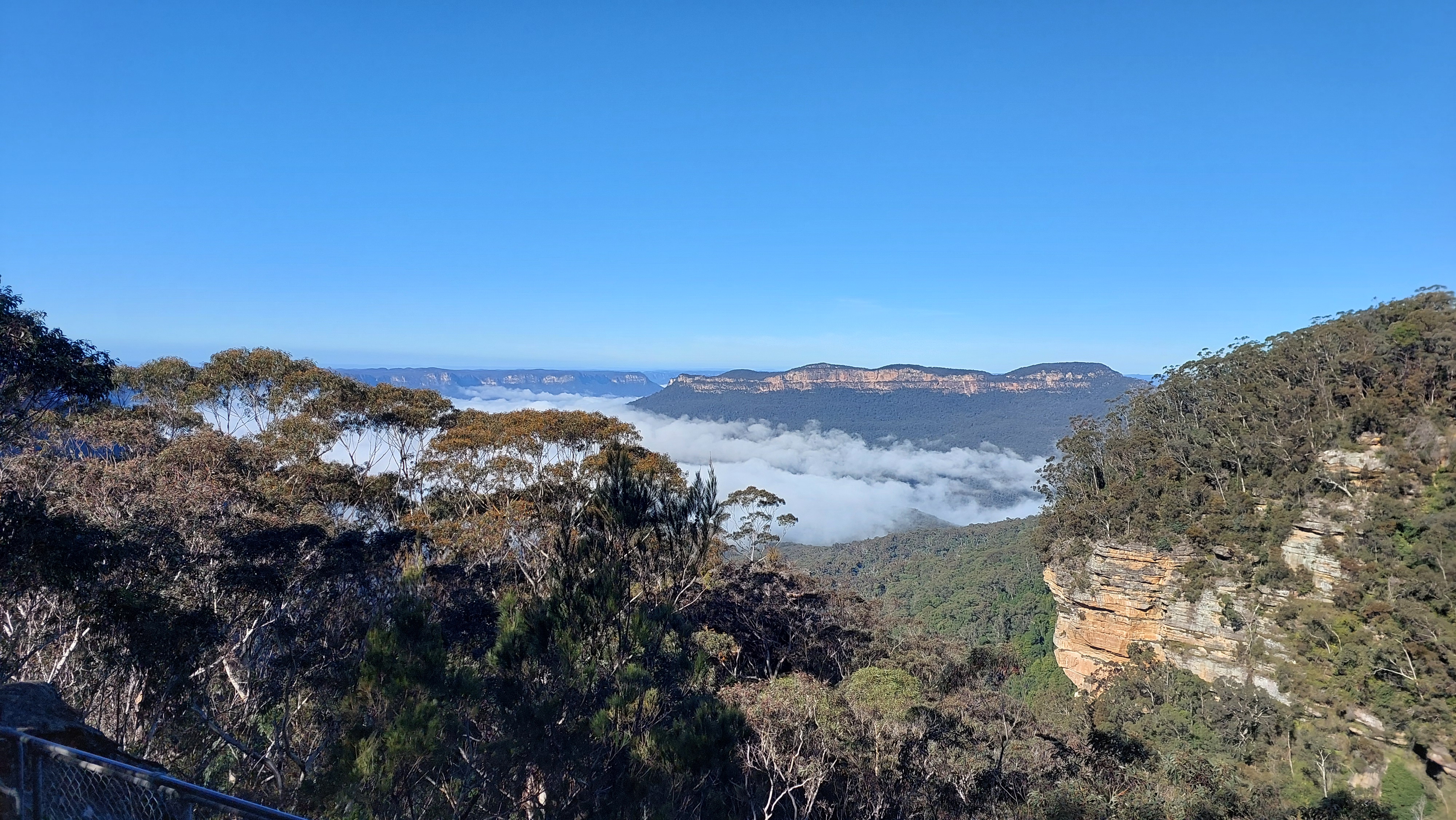
After posting a club trip and only getting 4 signups (one of which fell sick), the remaining 4 of us met up at Leura at 10am to tackle the other half of the Lindeman Pass. We immediately faced more detours with the closure of Leura Cascades, before arriving at our first lookout over the valley.
This part of the walk is mostly tourist track meandering along the little gullies and cliff edges, proceeding down to the base of Bridal Veil Falls. Following the water leads you to a recently Instagram-famous location called the Infinity Pools. In summer, this place is overflowing with people waiting to get that perfect picture. Thankfully we had it all to ourselves, being a July morning.
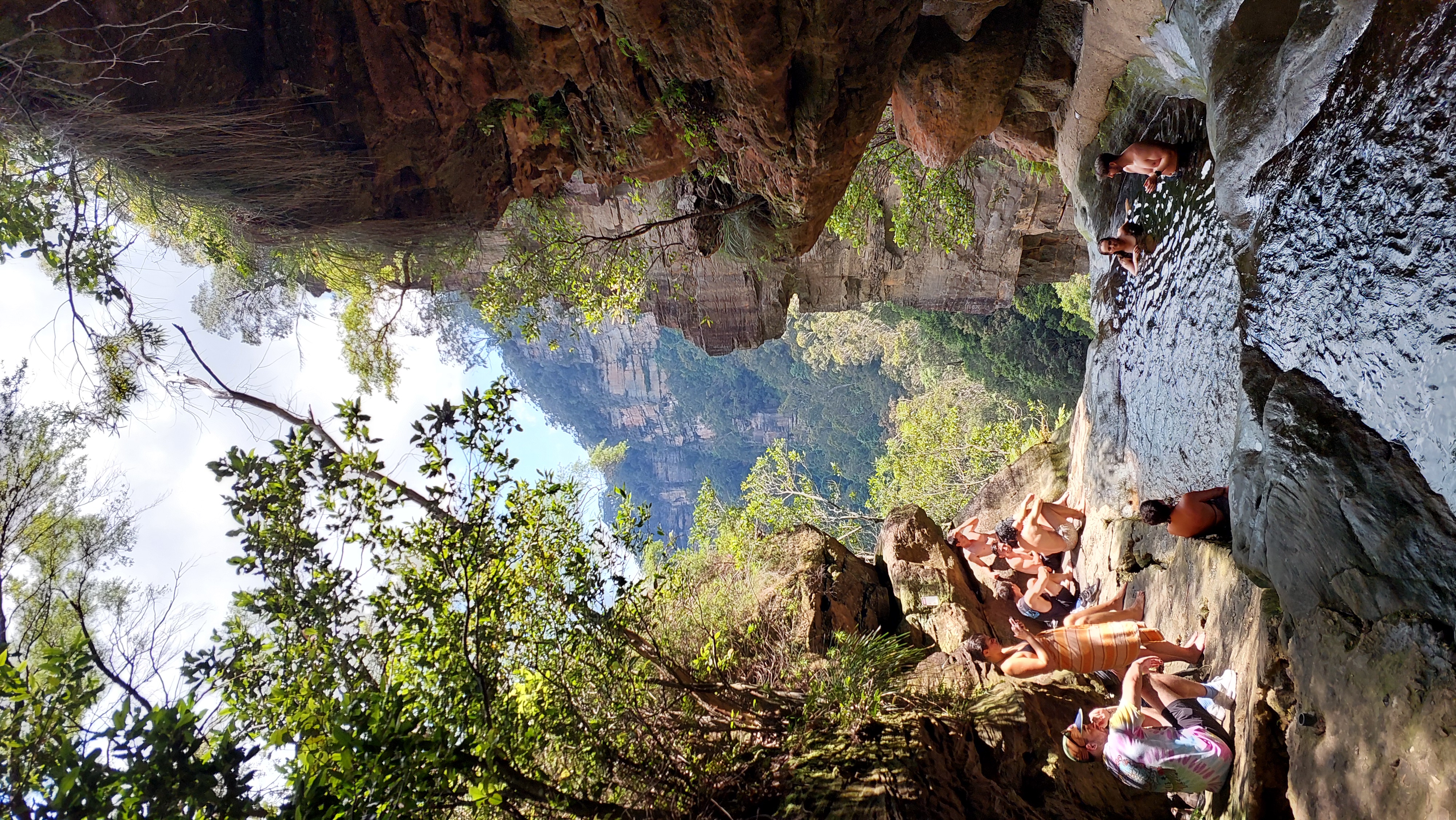
The most ironic thing about the popularity of this pool however, is its history. The edge of the pool is very peculiarly made of concrete, and there are little access hatches on the way there...
Constructed in 1934 and in use until the late 1990s, this was part of the Upper Blue Mountains sewage scheme whereby raw sewage from the area would be sent in a pipeline down all these waterfalls, to the South Katoomba Sewage Treatment Plant. The somewhat treated effluent would then be discharged into Coxs River, making its way through Warragamba Dam and into the Nepean River.
This was problematic for several reasons: it looked ugly, could not cope with population, hard to maintain, poor quality of treatment. What stands out to me most though is the “Warragamba Dam” bit. Whatever happened to the old adage “don’t poop where you eat”?
[Source: Water Board of NSW, 1990. Warragamba Dam is Sydney’s primary water supply.]
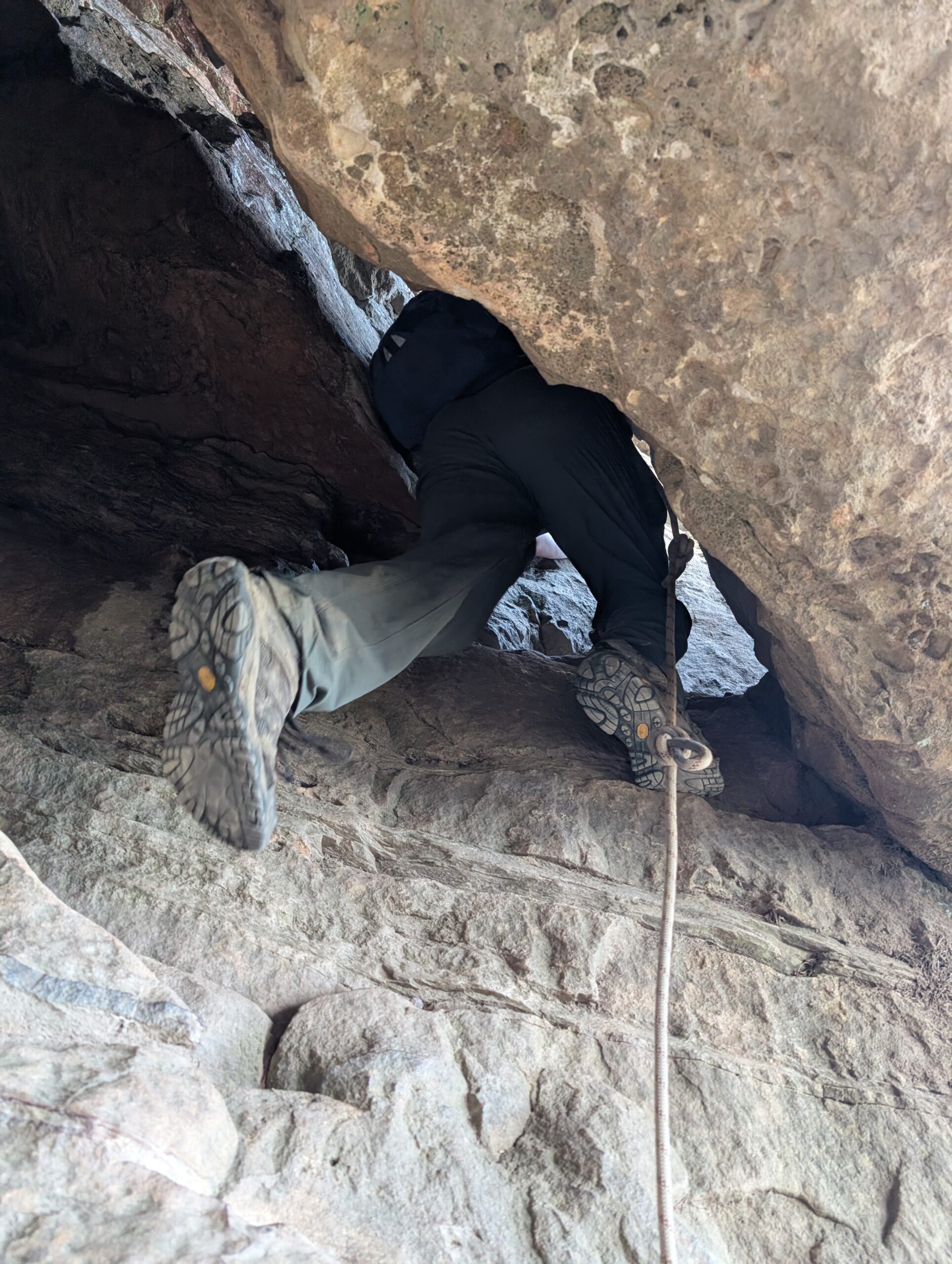
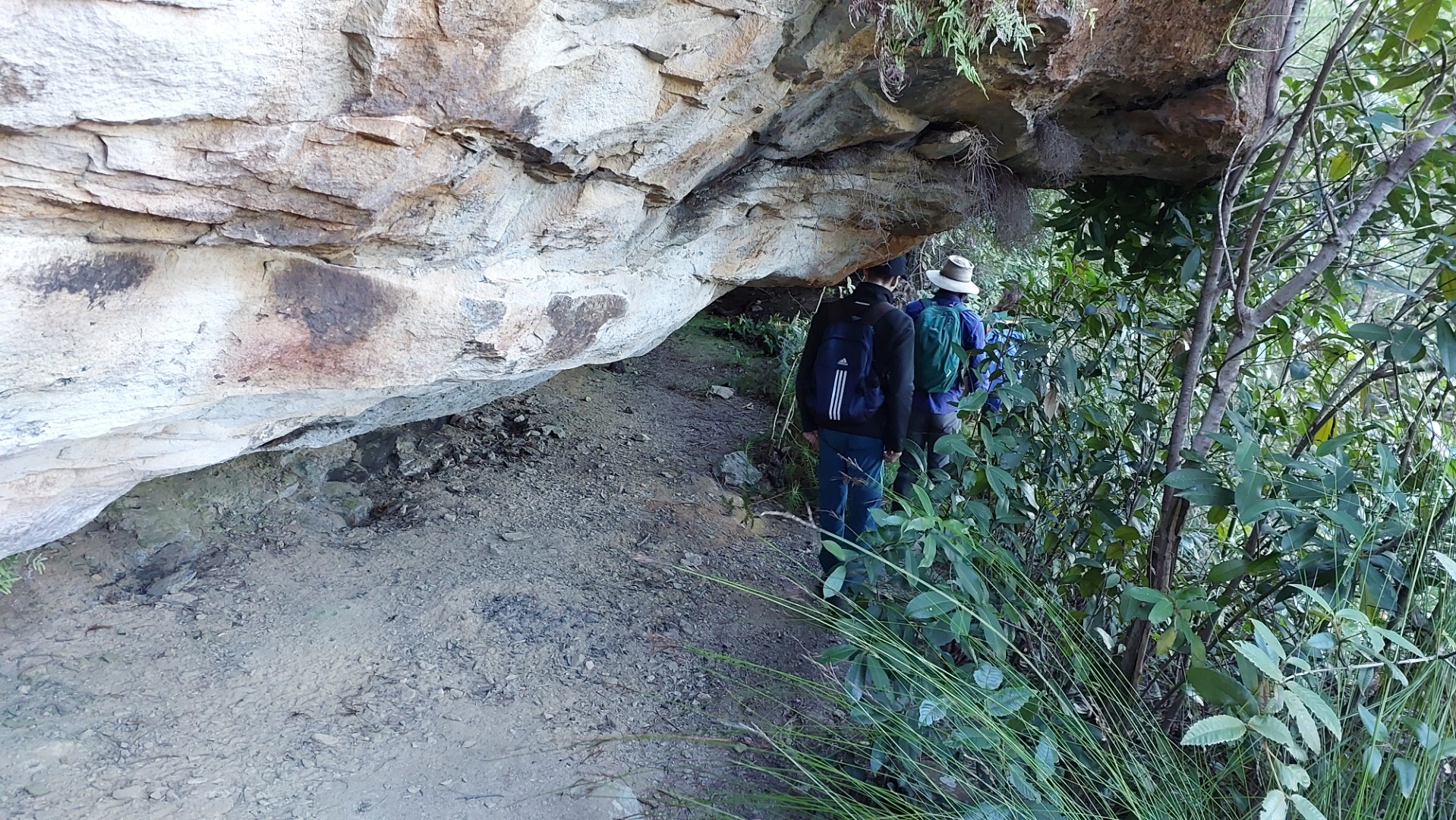
Anyways, we hopped back onto the Amphitheatre track and followed the steep staircases down to the start of Lindeman Pass. The track started off well defined and fairly easy until the base of our next waterfall. Crossing the creek here required lots of care, with some extremely slippery rocks to negotiate. The next ~100m of the route had no real track, with the aim being to just get across the creek, and back up to the base of the cliffs to find the rest of the path.
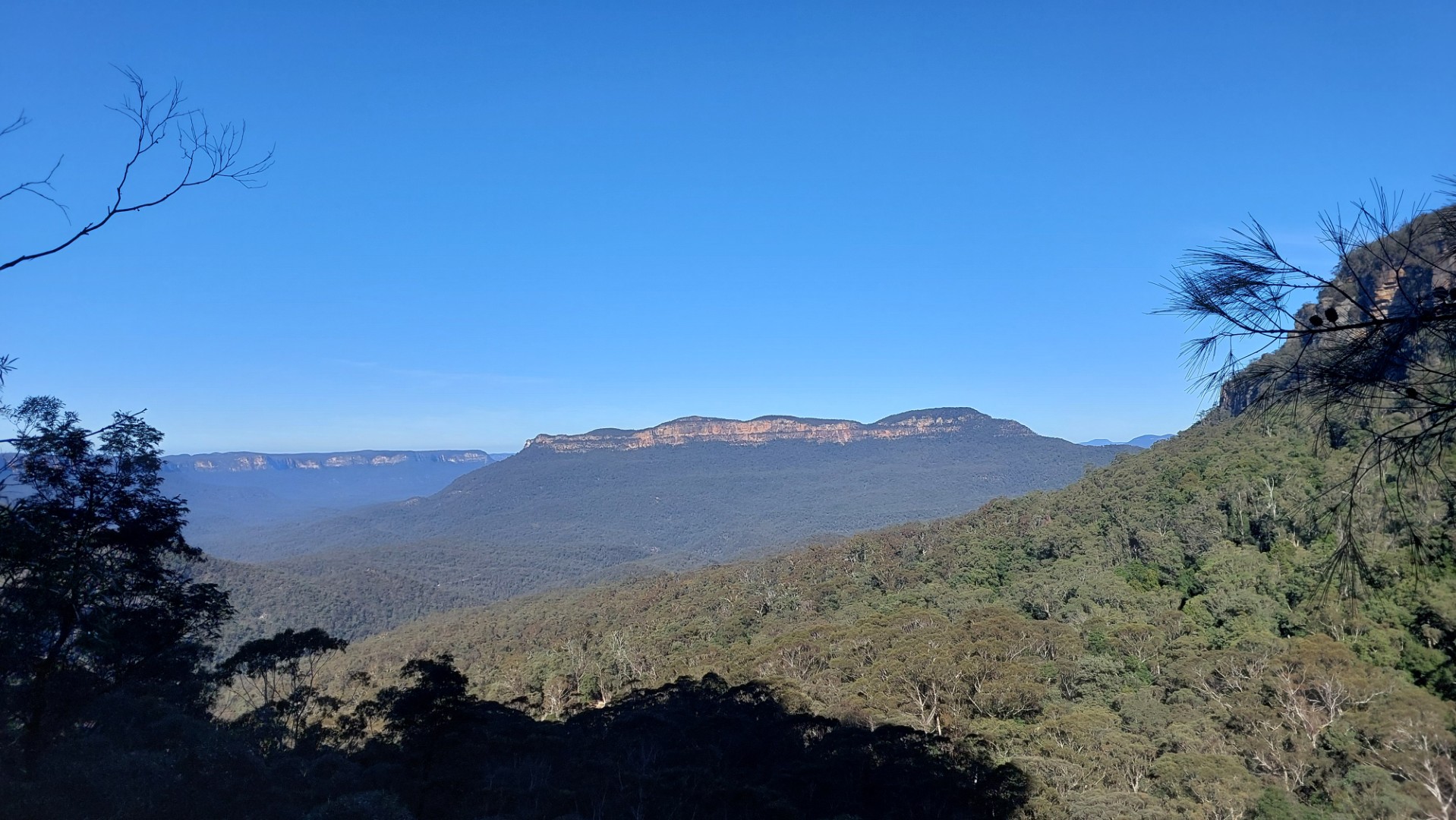
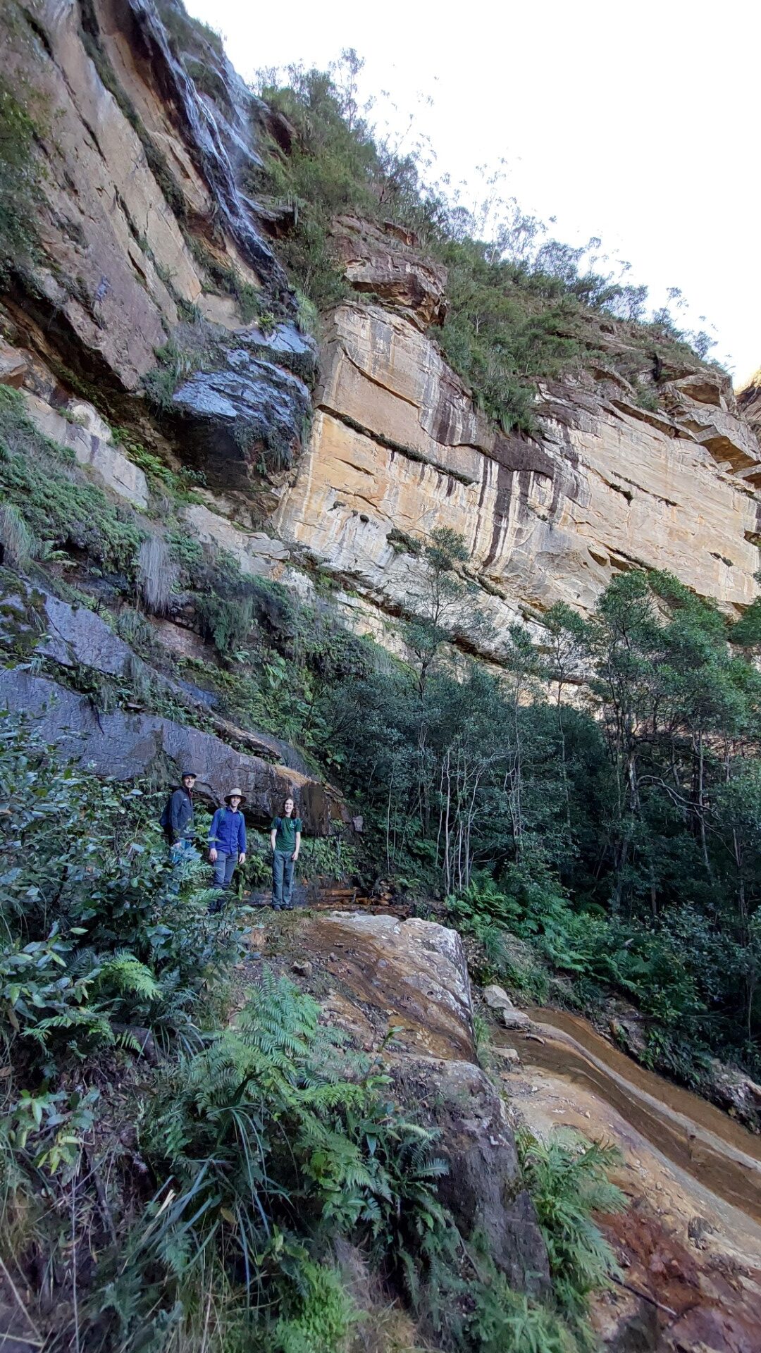
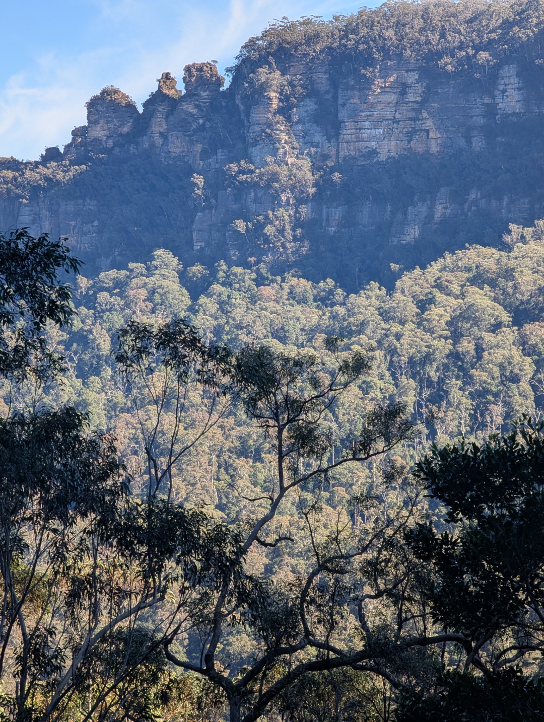
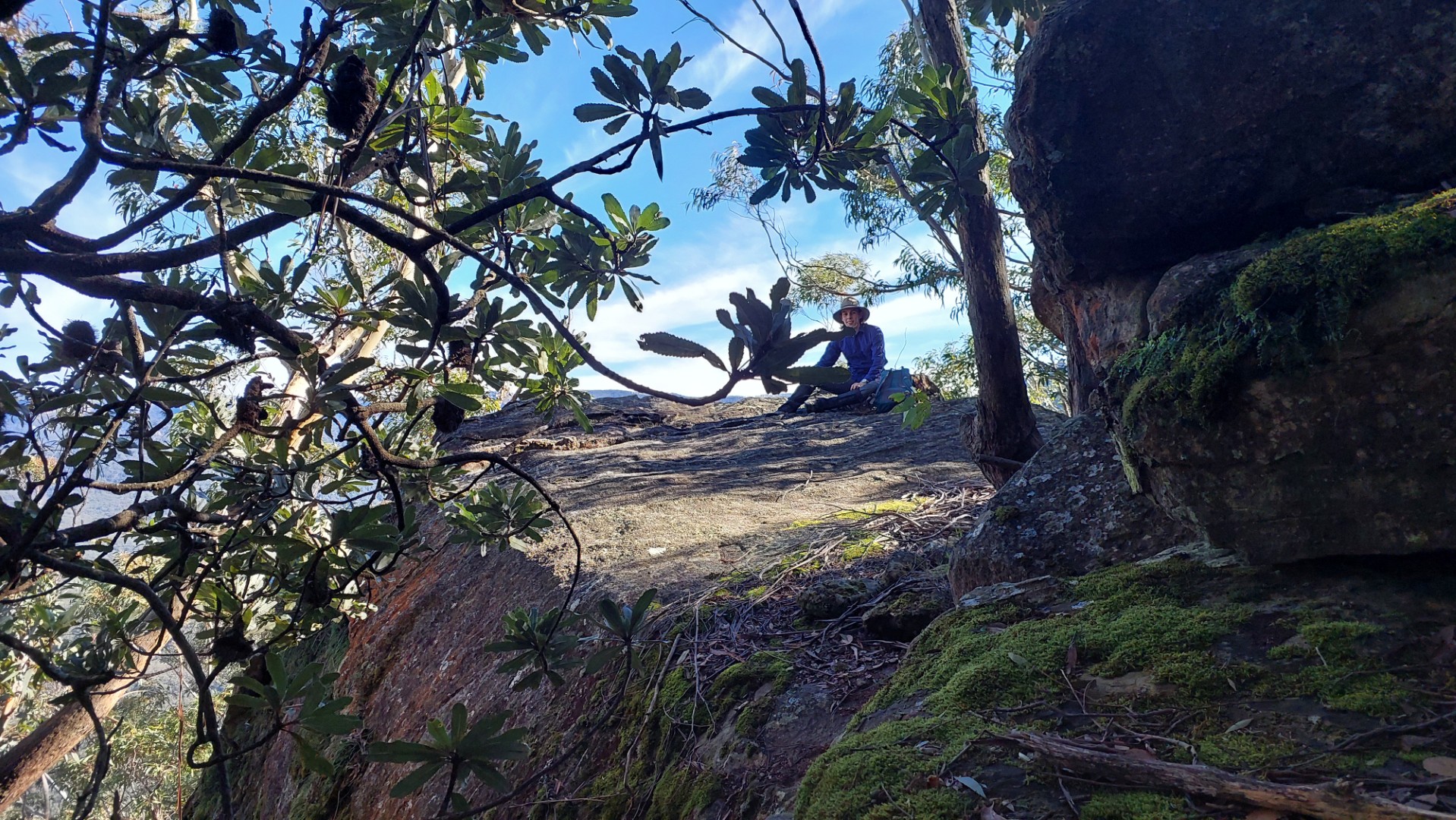
The best part about this track is that it skirts the base of the cliffs the entire time - meaning that if you ever lose the track, you just have to go up! Following that philosophy, we made it back onto the real Lindeman Pass. The route itself is very nice, giving a unique angle on all the classic Blue Mountains views.
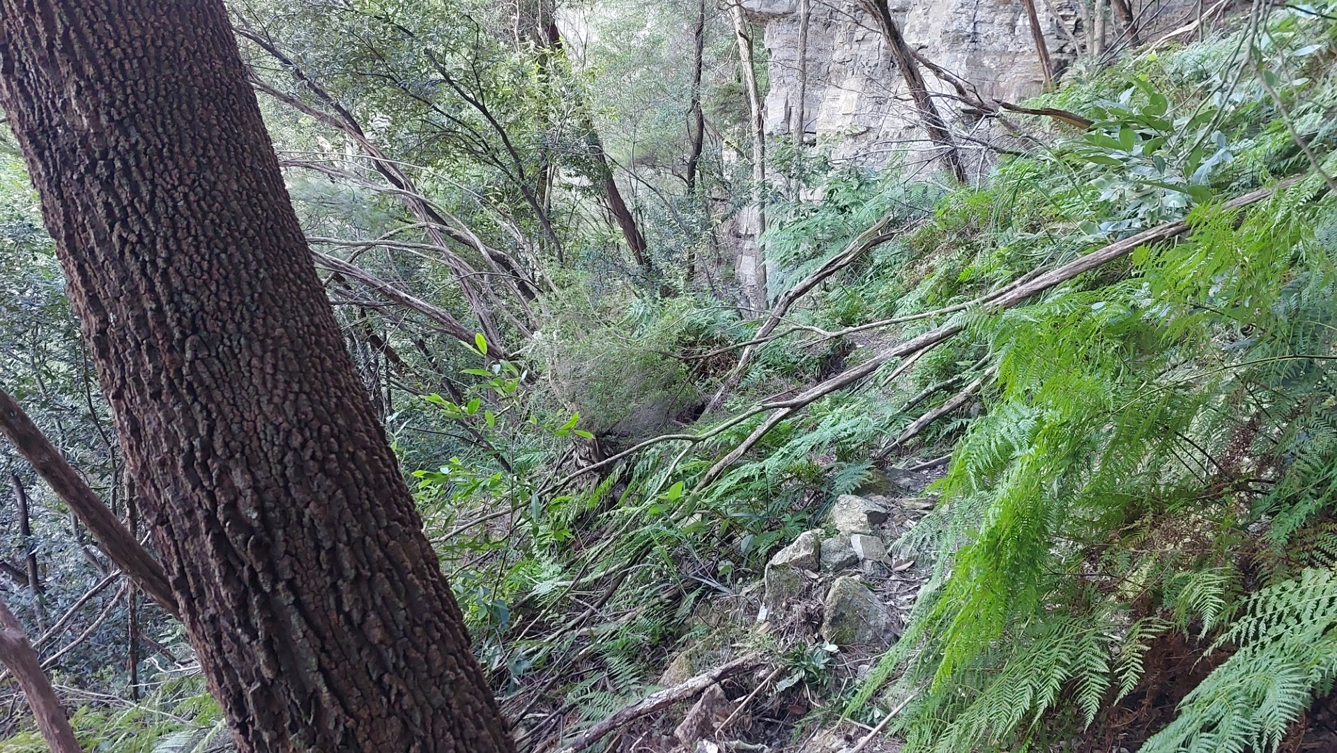
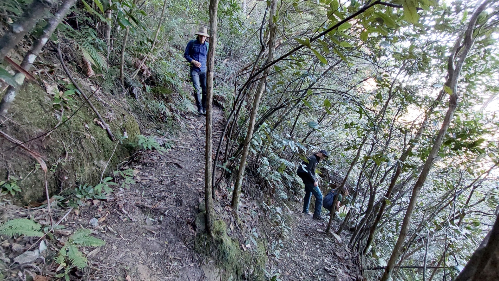
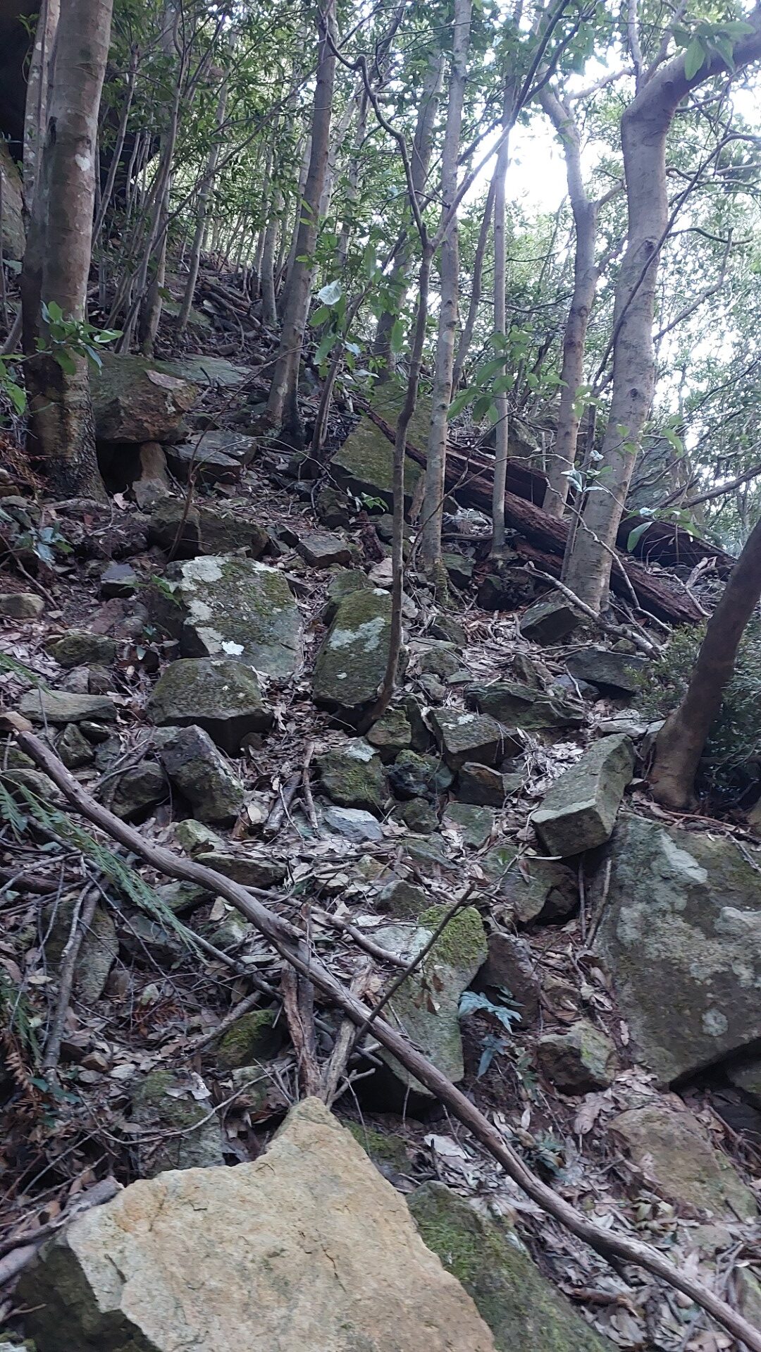
The “unmaintained-ness” of the track was definitely evident with several mini landslips, no track markers, lots of fallen trees and some narrow sections of washed away path. It is certainly not a path that gets daily visitors. That being said, the track was in significantly better condition than we had initially anticipated - a solid 90% of the route was very well trodden!
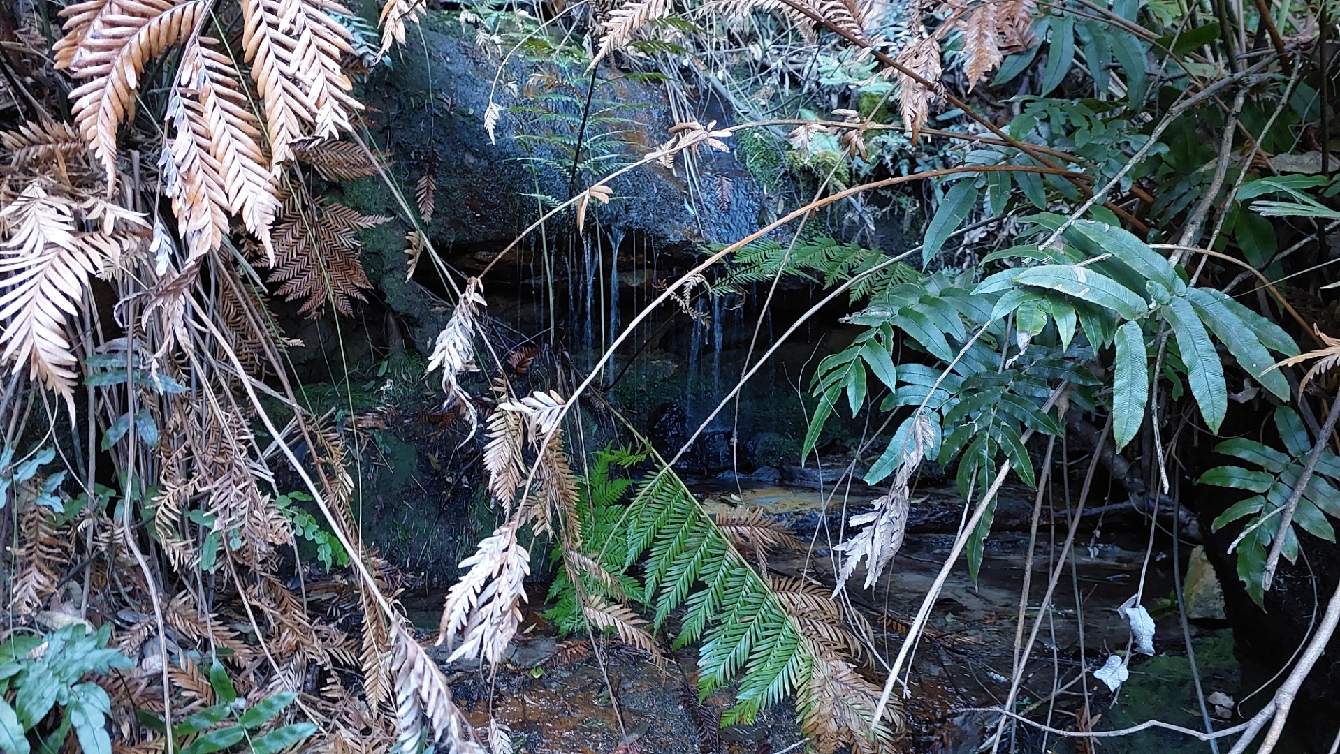
Being at the bottom of a cliff, the route also enjoyed several tiny waterfalls spilling over the track. There was the odd beer bottle washed down from above, and even a cute 1m tall ladder repurposed to climb over a little boulder at one point.
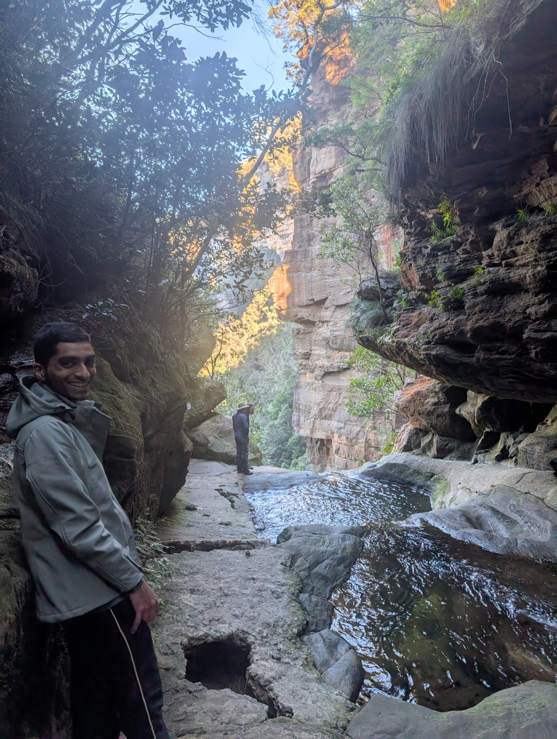
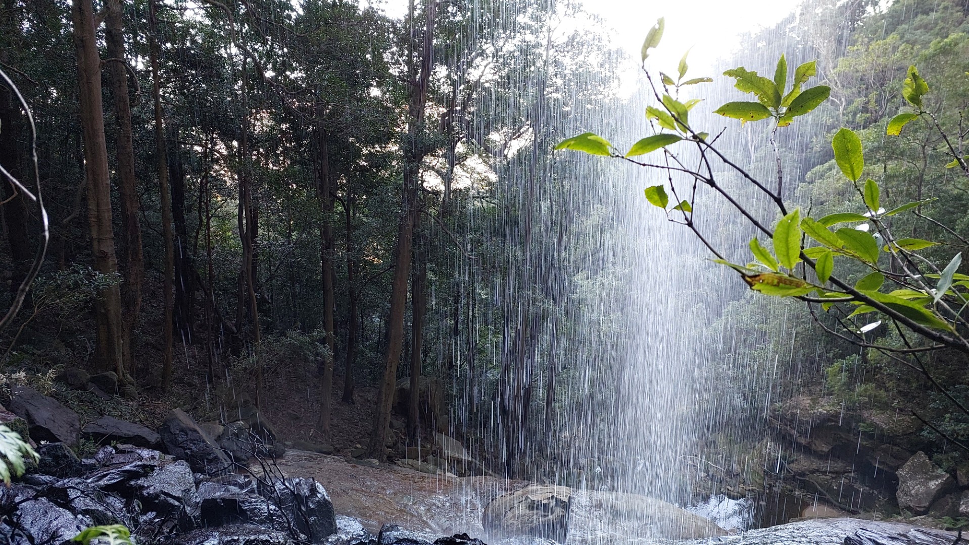
After about an hour of heading east beneath the Leura cliffs came Gordon falls. A great place to stop for a snack and views. As a bonus, the track went behind the waterfall!
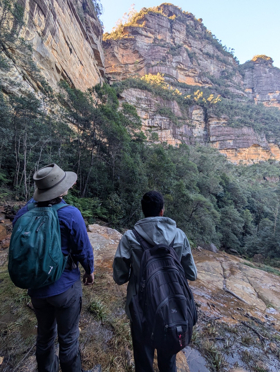
From Gordon Falls, the track turns sharply south heading beneath the cliffs of Sublime Point. The track conditions were much the same for this portion of the route, but with a slightly varied environment. Significantly more ferns, and lots of wattles blooming as the elevation and tree cover changed.
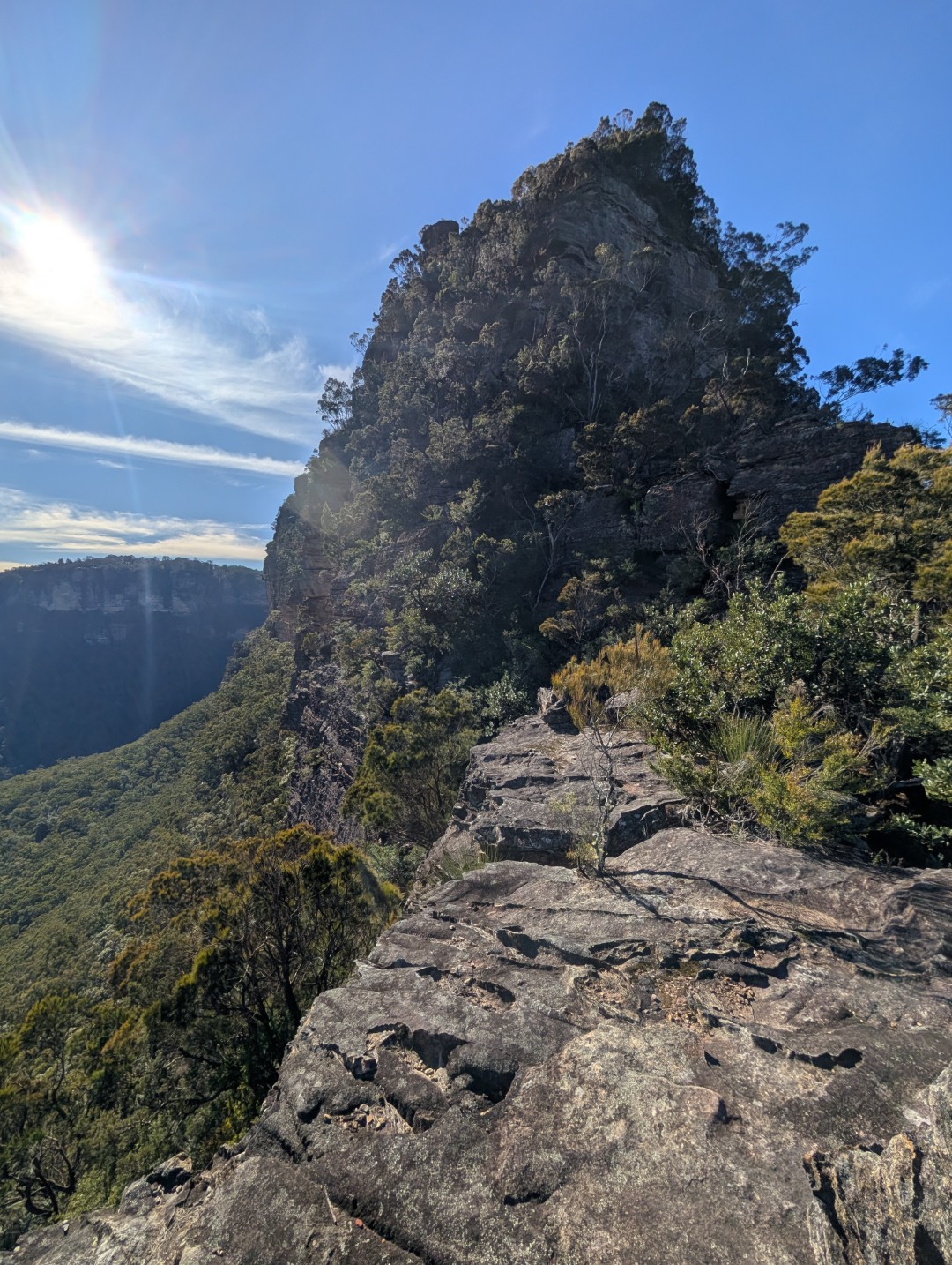
One of our group members was in Sydney on exchange, and this was his first experience of the Blue Mountains. His first view of the iconic Three Sisters was definitely not the usual though 😆.
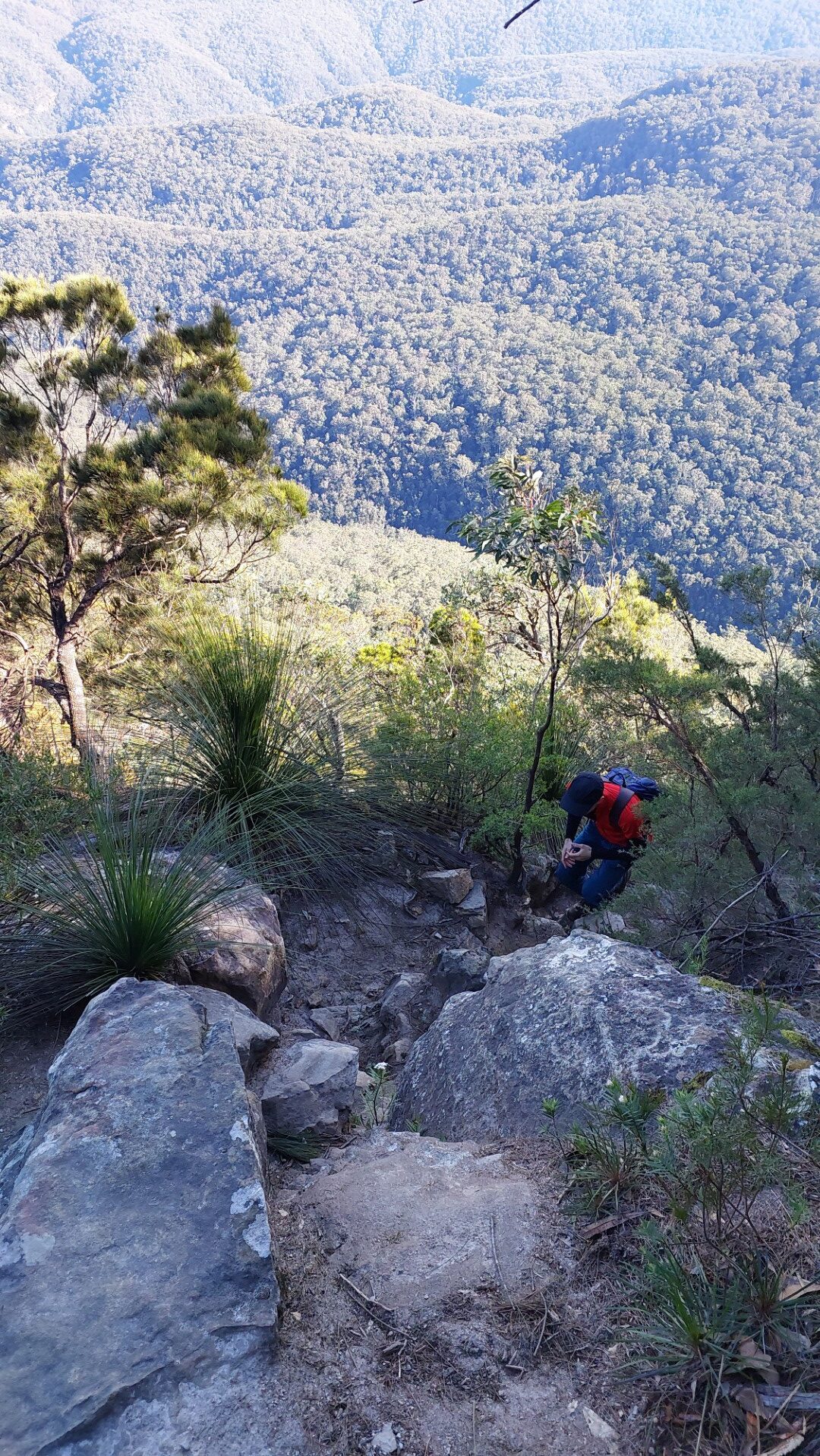
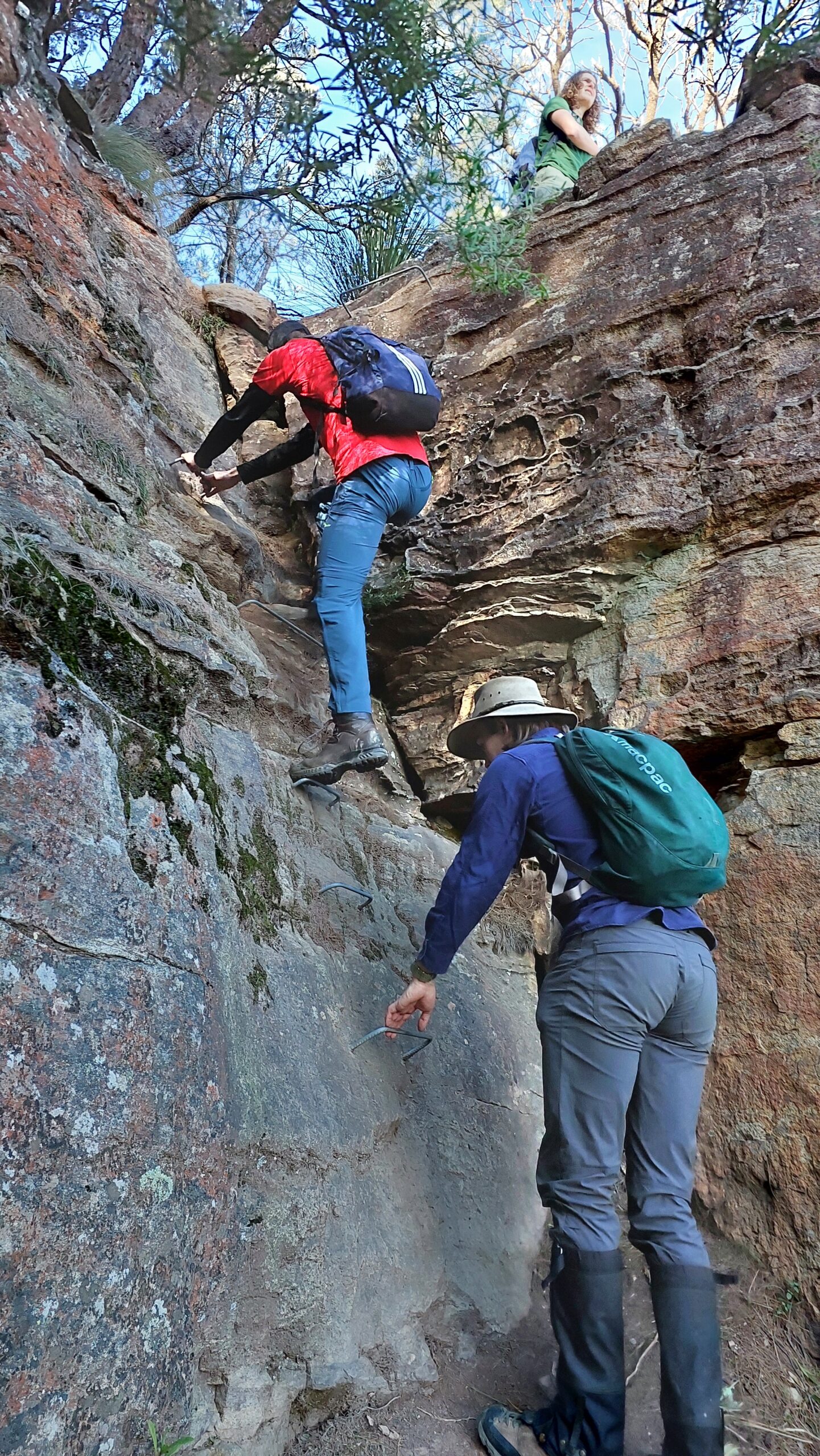
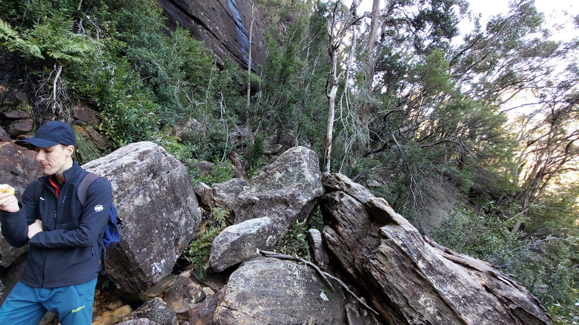
We stopped for lunch at 1pm at the bottom of Sublime Point to enjoy some truly sublime views before our next task - take Copeland Pass up Sublime Point, regaining 270m of elevation across the next 400m.
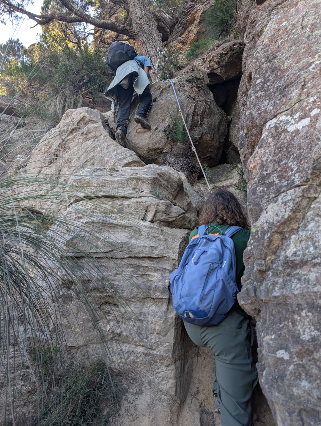
The way was quite faint in places, but our motto for this section of the trip was “just go up”. This worked well! There was significant rock scrambling involved, but thankfully there were a couple of fixed lines and ladders (staples?) to aid the worst bits.
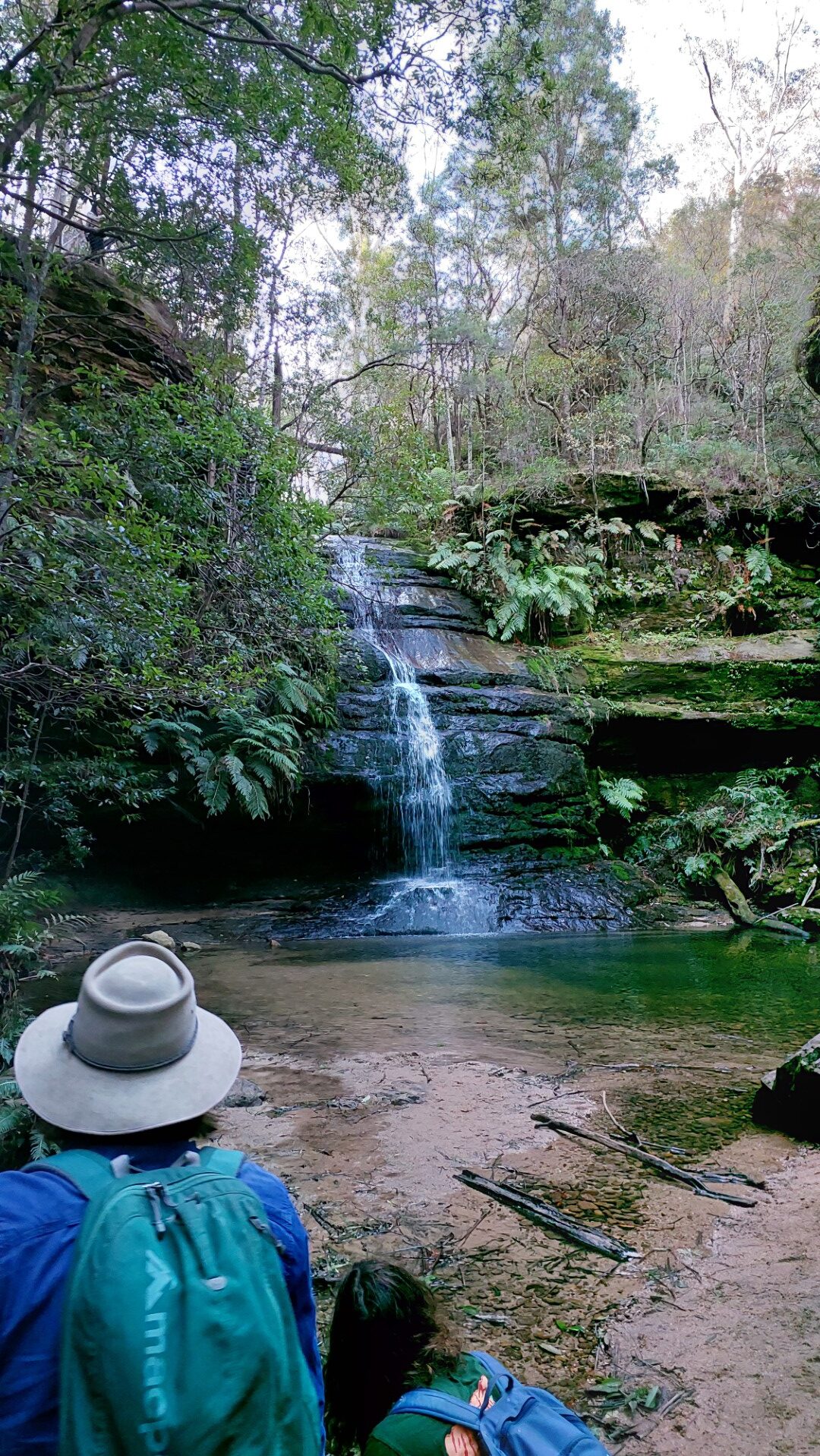
From the top, we followed the tourist tracks back to our starting point, stopping at the Pool of Siloam (not a bad pool) and Gordon Falls lookout. This portion of the track was extremely well maintained, being part of the new “Grand Clifftop Walk” program. We enjoyed true luxuries such as:
- Pavement
- Handrails
- Stairs
- Phone signal
- Signage
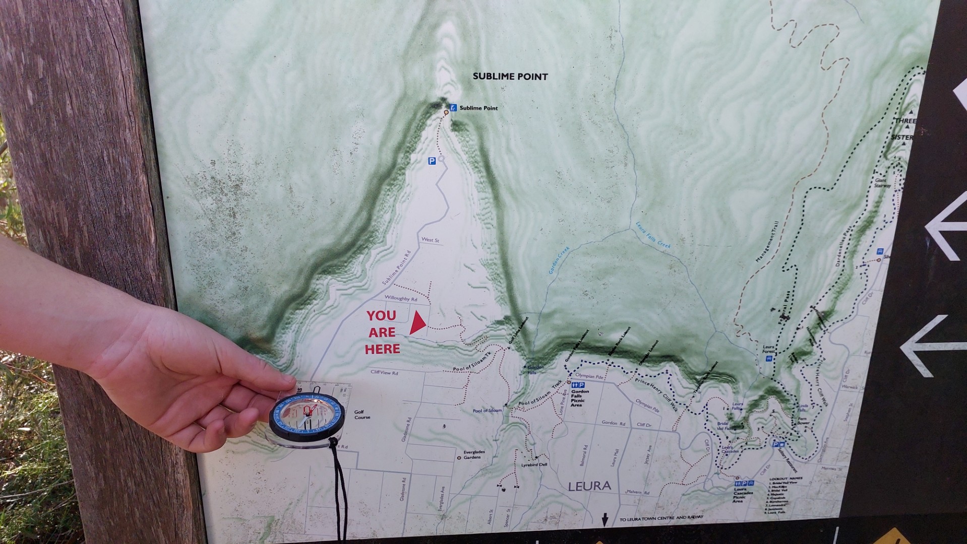
We did however encounter the below abomination of a map on the way. For one, it had north oriented downwards. This is an immediate map sin but can be excused if the map was instead oriented to the direction that the reader is facing. This was indeed not the case, as the reader was also facing North (compass included for proof). This meant that you had to travel in the opposite direction as what was suggested on the map.
And as if that wasn’t enough the contours were weirdly inverted? At first glance, it looks like Leura itself is within the valley.
After 5 minutes of collective map slander and disbelief, we ended our day at Gordon Falls lookout at 3:30pm, reflecting on the route we took, from above.
Overall: 10/10 would do again. This section of Lindeman Pass was fine. Copeland Pass was not easy. Good navigational sense is required - we only needed to use the GPS once for the turnoff to Copeland Pass.
Stats: 15km, around 800m elevation gained. This walk was done by train, starting and finishing at Leura Station.
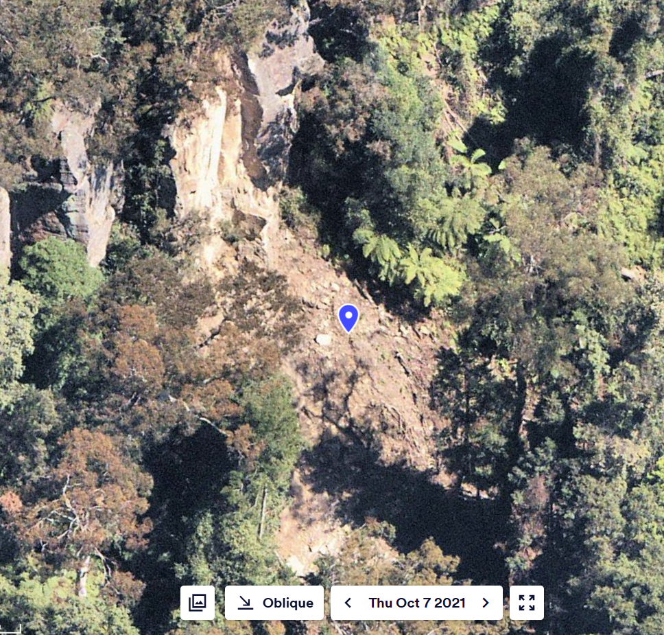
The landslide below Gladstone lookout means that another 2km of Lindeman Pass can actually be walked east of Sublime Point, exiting up Gladstone Pass. However as the track is beneath the eastern cliffs, it is in full shadow after 2pm in winter. Maybe worth an attempt another day??
Miscellaneous Photos:
Update Jan 2026:
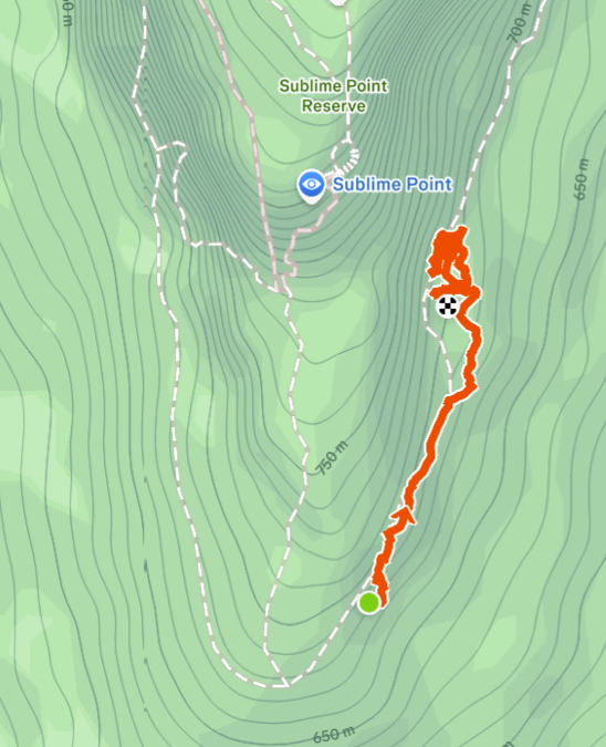
"Maybe worth an attempt another day" he said. I brought another group of 5 here on a 40°C day as some training for a harder multiday hike (weighted packs and all). The aim was to complete the final 2km section we didn't finish last time.
The Fern Bower track had just reopened, so we used that instead of the Amphitheatre Track to descend into the valley. Very nice. We followed the same route (and hilariously made the same 2 navigational errors as last time) to the base of Copeland Pass. After a lunch stop we continued along Lindeman Pass, hoping to finish at Gladstone Pass.
We were stopped by a landslide just 300m later. Very thick overgrowth, fallen trees, and all sorts of thorny vines blocked the track. We tried to fan out in 3 different ways and were able to push through, but could not reconnect with the track on the other side. The decision was made to return and exit via Copeland Pass.
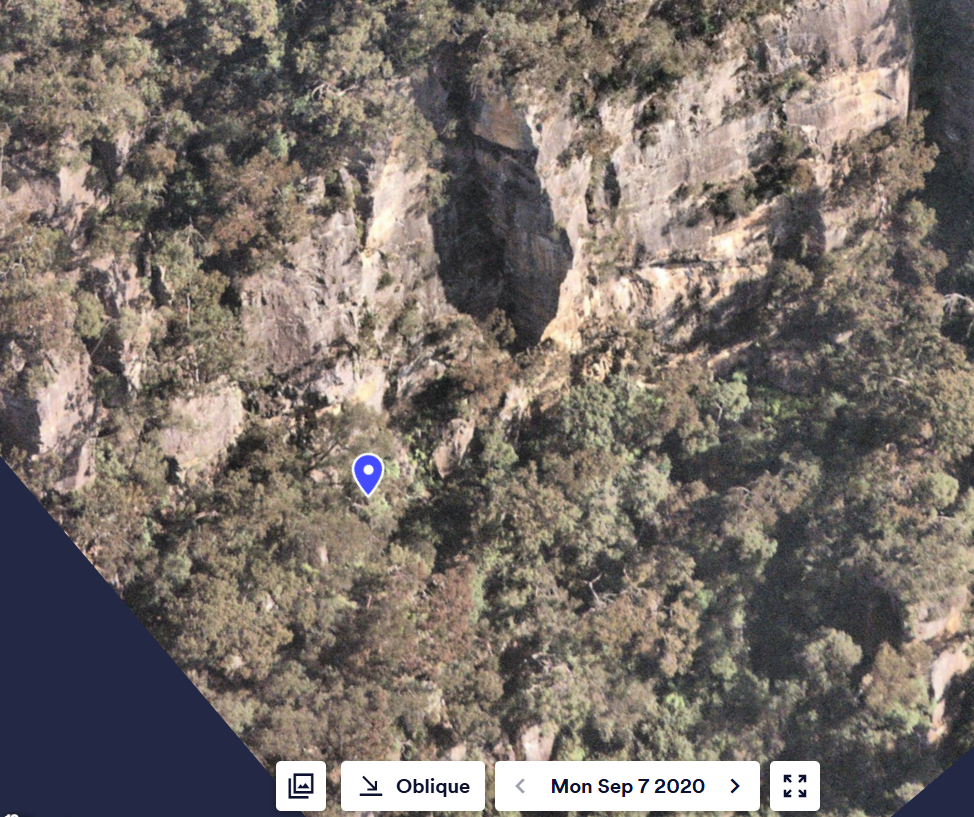
This section of wall is notorious for landslides and most reports of Lindeman Pass mention these, however they are usually "not too hard to pass". Satellite image research suggests that this particular landslide (GR 535 637 Katoomba) happened in early 2021. The most recent report of this particular section I could find was from March 2021 here. It is hard to say whether their report includes this particular landslip, but it does note heavy overgrowth along that section, which aligns with our experience.
In any case, I will be back yet again to hopefully try and meet up with this landslide from the other end. Stay tuned 🙂