The Western Arthur has been one of those hikes that you talk about but there are so many failed attempts that you don't ever really believe you will EVER do it.
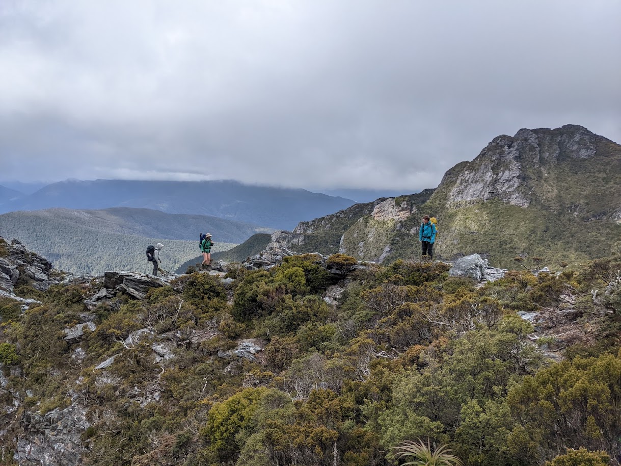
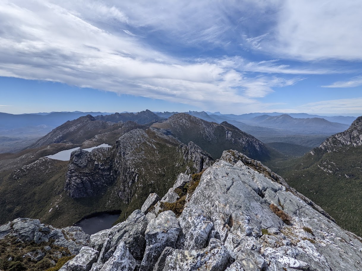 Looking out over the rest of the traverse.
THE BEGINNINGS: As the traverse has a section of quite serious scrambling, it’s important that you have good weather, which in that part of the world, is quite hard to come by. I’d hear of people spending days in tents due to bad weather, and three years ago the club organized a beanie grant to try and string the whole traverse together, and were also stumped by fires. Then last year we had tickets booked and covid got in the way. However even after all that Glenn Southern was determined. And his determination pulled in Meg, James and I and suddenly I was again dehydrating food, checking tent waterproofness and driving Alice (my car) across the Bass straight.
After leaving the horrendously wet NSW, the weather in Tasmania looked glorious but we initially had some hiccups straight off the bat. Glenn and Meg got super stitched up in that whole PCR testing taking Foreeeeeever and had to isolate in Tassy waiting for something to come through. I was concerned we would miss our weather window. But 2 days later we drove out to Huon creek campground at the trailhead and the following morning we set off.
THE TRAIL: The trail follows the dream lollipop shape where the stick is really short and the lolly pop is really big. The top rim of the lollipop is the mountainous traverse and the bottom is flat plane, joining the two sides together. The walking along the plane is muddy, and grueling as you are expected to quickly smash it out to maximize time on the mountain top. The mountainous section is breathtakingly beautiful but hard in its own way. Littered with lakes and massive rocky outcrops the path descends and ascends rapidly and continuously, often resulting in short (and not so short) rocky or muddy scrambles. Along the ridge, It was not uncommon to spend 6h covering 4km. Overall we spent 1.5 days on the flat and 4 days on the mountains. 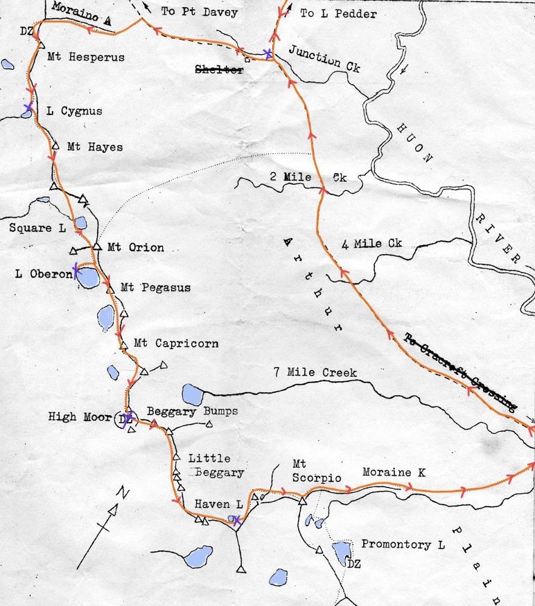 Old book with map that I have added our journey in orange and purple
The first day we pushed through the muddy section (and my exhaustion), past junction creek campsite, and were aiming from the small campsite at the bottom of Moraine “A”. As we approached the range a thin line of trail heading 800m up a steeeeeep grassy hill appeared tantalizingly in front of us and we decided to push on to the next camp at lake Cygnus. The hill was hard, 7 days of food is heavy, but the views quickly became rewarding. After reaching the top you start to get a taste of the terrain. Suddenly losing 300m elevation and gaining it again. Over and over. The day was long but oh boy was it worth it!
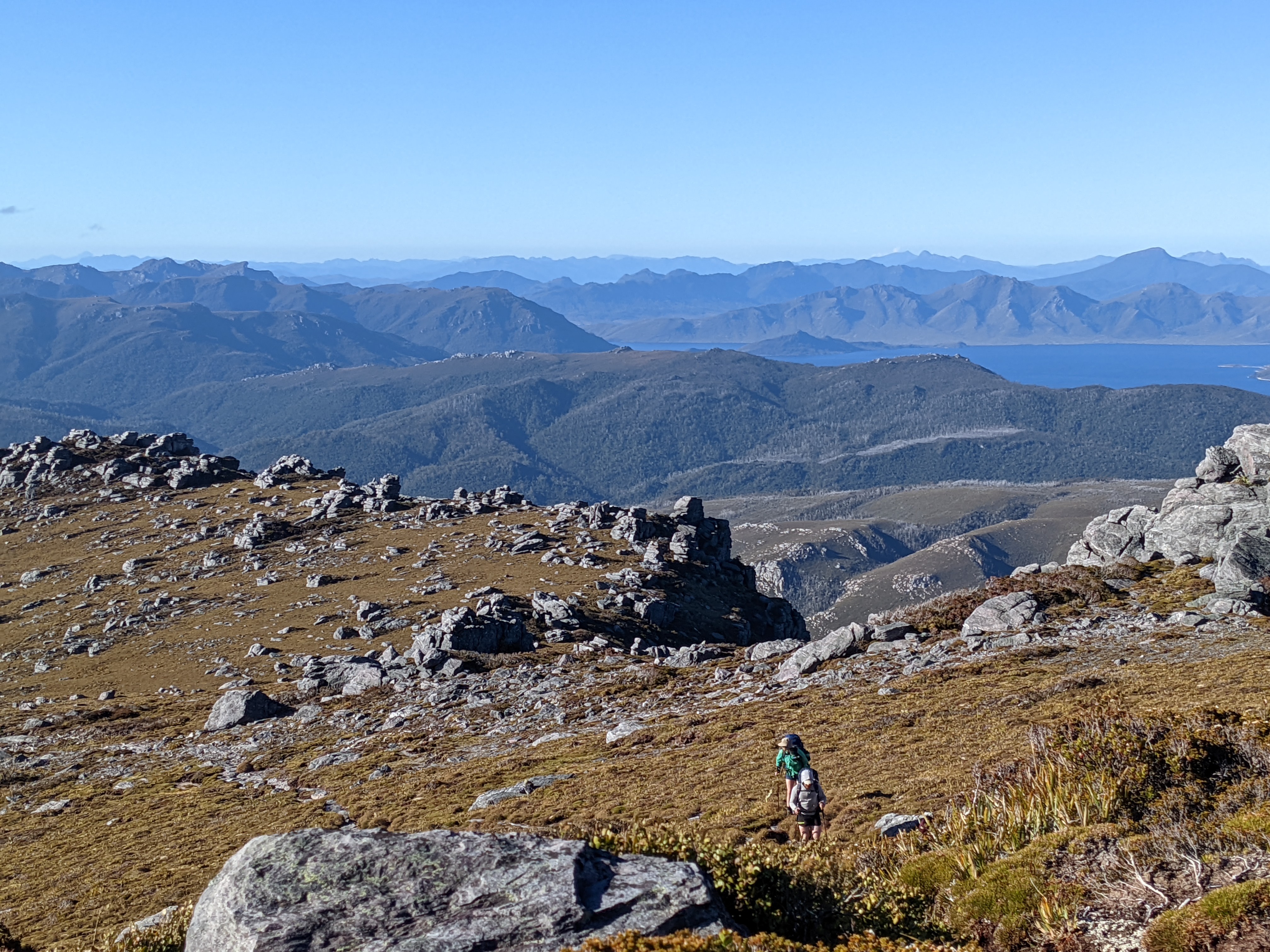 Up the hill and onto the top, with lake Pedder and Scotts peak in the background
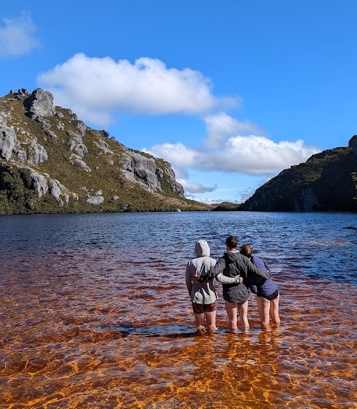
We decided that the following day was going to be a shorter one. Going from lake Cygnus to the famous lake Oberon. Oberon was as stunning as we had been lead to believe. A small plane with an orange delta running into this dark coffee lake. The bush was spiky and harsh and only broken by the giant grey rock protrusions. We got our first ideas of the terrain to come scrambling down a steep gully of wet rock. Camp was usually made up of small wooden platforms, tucked back from the lake and surrounded by shrubs. The toilets had no walls or roof, only screened from view by the thick growth. Meg really didn’t like the idea of pooping in the rain.
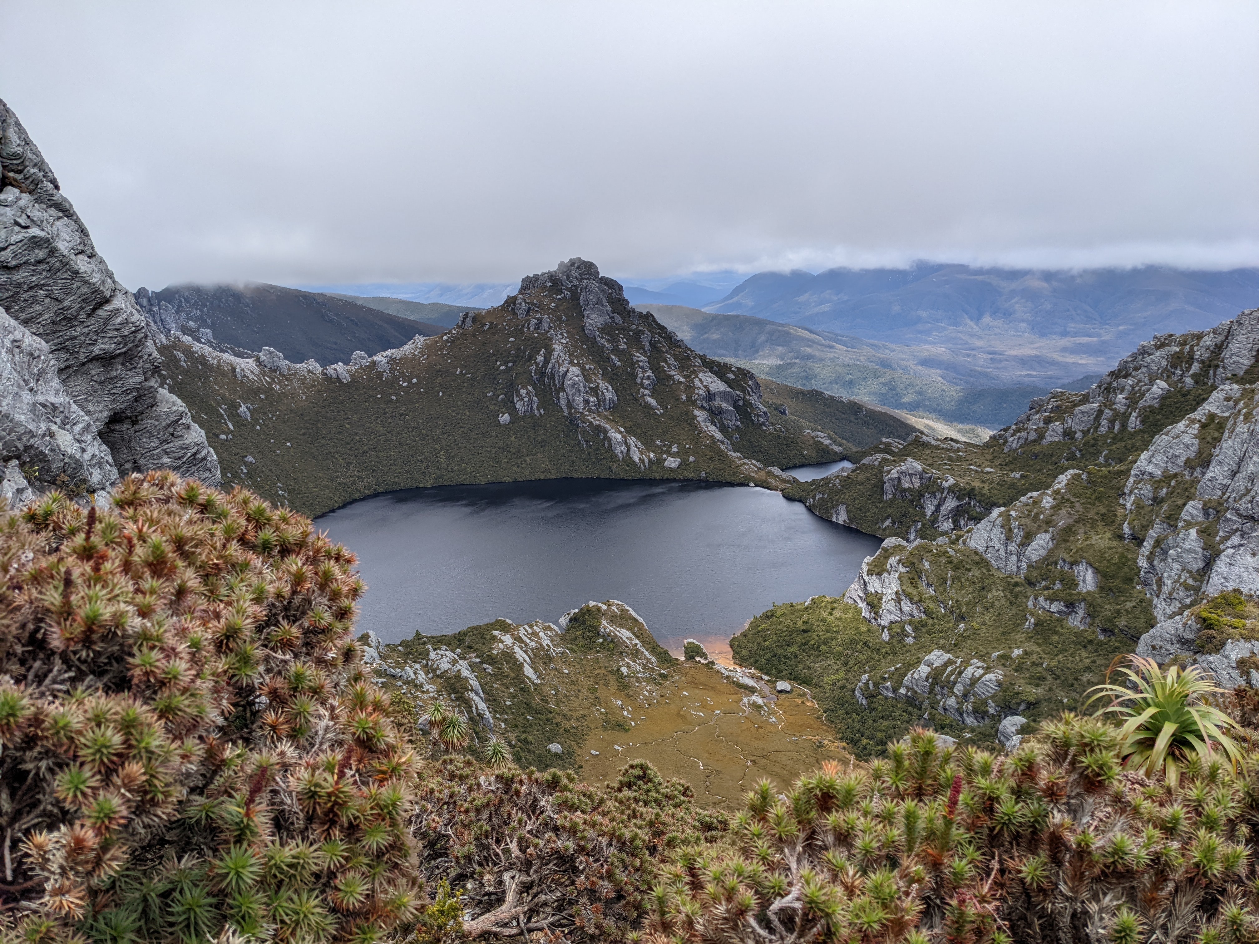 In the way into the scenic Lake Oberon
 Glenn, James and I soaking the mud off our legs in lake Oberon
We had heard that Oberon is the last turning point before committing to the hard section of trail. You need a good weather window and more preparation to make it past here. A ranger at Oberon had checked the weather and it looked good. We had a section of 4mm cord for hand liners or dropping packs and of course we had a PLB. Still, the following morning we heard reports (maybe a bit exaggerated) of what was to come from a couple who had turned back and my anxiety grew. The first section of rock we encountered was hard and it suddenly stalled us. But as the day went on, it didn’t get worse. Mostly a section of up and up and then a steeeeep scramble down. Sometimes we would drop our packs down to James and one by one guide each other down. At one point we reached a section that is described in the Chapman guide as seriously eroding and may become impassable in a few years. I understood why. We could see the path in front of us, winding along a saddle. It looked about 50m in flat distance away but we were still 200m above it. Over the years steps had been cut out of the muddy earth, held together by roots. The structural integrity and slippery-ness of it scared me. It was so steep that at each section the person in front of you would disappear and you would be left looking at the 1000m drop to the valley floor. Exposure, after years of climbing it still gets you. But bit by bit we made it down.
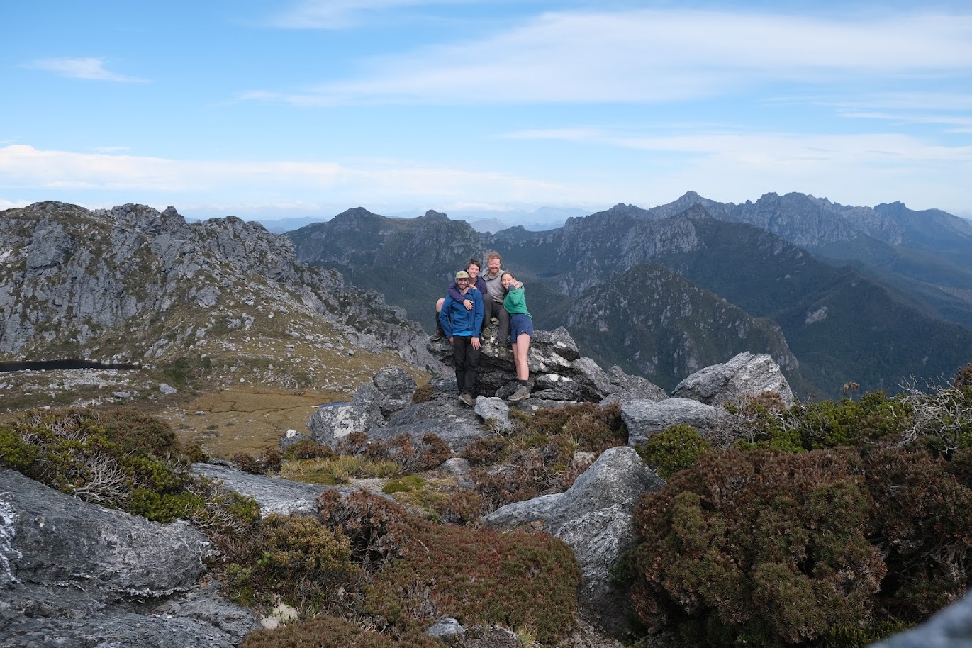
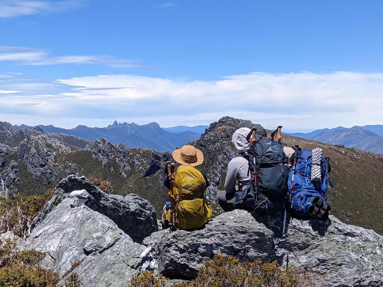 Glenn, Meg and I looking out towards Federation peak.
We made it to camp High Moor that night to find we had traveled only 4km from Oberon but it had taken us all day. Water was more scarce here but we still had enough and after dinner we climbed a short hill and had stunning views of the whole Arthurs range including federation peak. It was breathtakingly stunning, I will always remember that view. It was worth the walk. We could also see tomorrow’s obstacles, the beggary bumps and the dragon. Apparently that was the hardest bit.
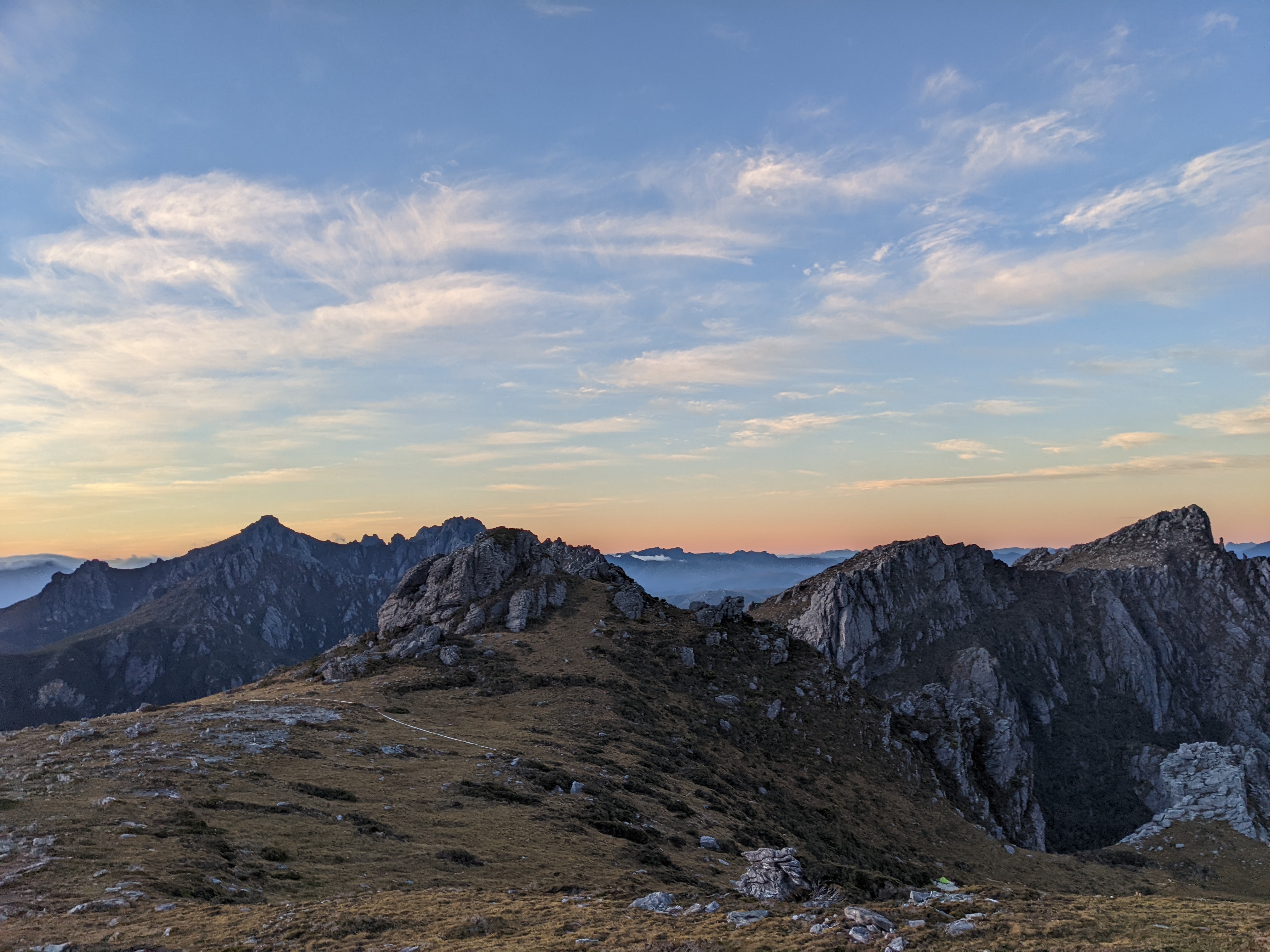 Looking back along the traverse at sunset.
There were many other people on the trail. It was just after Christmas, the first time Tassy had been open and the weather was perfect. Each night we squished in and filled all the platforms and lakefronts. We started seeing friendly faces of the people that moved at a similar pace to us. Kashka and Yan (sorry about the spelling), the polish couple from Sydney, Michal, Harriet and Harriets dad Tim and later that night we were joined by a mother daughter duo who had just powered through our last two days in one. We started looking out for each other, making sure there was enough room for the slower groups and cheering them on when they made it to camp.
After all the bit of build up of what was to come, it went relatively smoothly. James continues to ferry packs up and down sections that were too hard for us mere mortals to do with the extra weight. We used the rope to drop packs once (although we would have used it a lot more if it weren’t for James). We had lunch under the second dragon where James left his knife under a bush (so if anyone is going on the trail keep an eye out for it!) and pushed on to camp at haven lake. The day was warm and cloudless and we all jumped in the water at haven lake. It was New Year’s Eve so we drank hot chocolate with whisky and Glenn set an alarm for midnight so we could sleepily pul our heads out of the tents and wispier happy new year and look at the glorious stars. 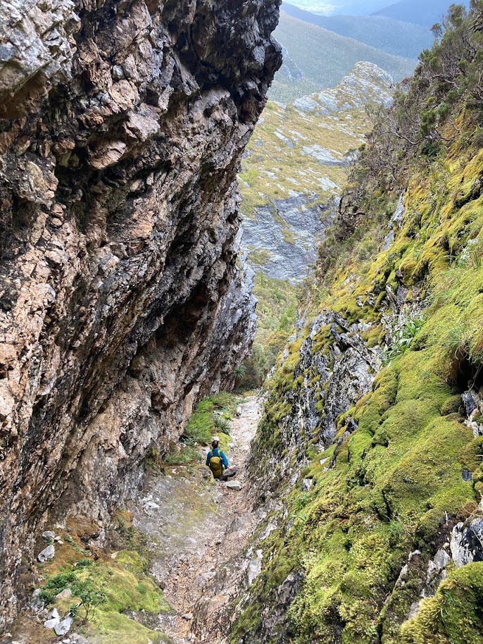 Making my way down the tilted chasm.
 Glenn, Meg and I on a small ridge between the Beggery bumps
There was a small section of scrambling left and some uphill to mount Scorpio where we looked back at the whole traverse that we had just done. Glorious. And then started knee braking descent. This day was long, because after the mornings scrambling and then the 800m descent you have 14ishkm of flat, sometimes muddy plan. We saw a snake and plenty of flowers and were occasionally rewarded with a creek. But ultimately we played would you rather for many hours while tramping down the km, orienting ourselves with the range that we were walking parallel with. And finally we made it back to junction creek for our last night on the trail, dreaming of the burgers we could eat the following day.
 All of us before the descent with Lake Sirona and the rest of the traverse behind us.
The way out seemed smaller than the way in. Maybe because we knew where we were or maybe because we didn’t care about getting muddy so we just walked straight though, slipping and sliding and laughing. Half way out we bumped into Jenny and Ash walking in. And excitedly passed on some beta. Where we did the trail in 6 days, they would go on to do it in 4.
THE ENDINGS: Overall I think this trail is utterly amazing. It would probably suck in bad weather and we were incredibly lucky. I think I spend much of the time worrying about whether we would make it through the hard sections and only now after the trail am I fully allowing the beauty to sink in.
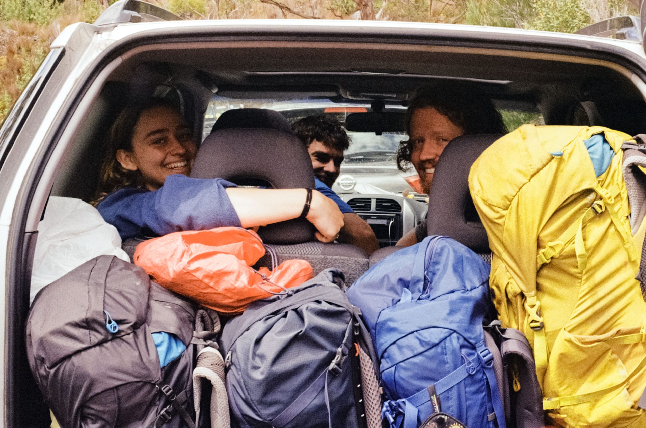 On the way to burgers!!
Thanks to the others for taking lots of nice photos
(Written by Mira about a trip in Dec2021/Jan2022)
LESSONS AND ADVICE:
Take a length of rope, use it and then stop worrying.
Gaiters were amazing. I wore them every day for the mud or the spiky bushes, often accompanied by shorts.w
If you're taking 7 days of food, dehydrating most of it is a good idea.
The western and eastern Arthurs facebook page is a great resource.
And so is Gaia maps (the app)
PS, James and I then continued to go climbing for a week and a half, and here are some routes from the trip I would highly recommend.
Freycinet - Mithras - 18 - trad
Freycinet - antimatter - 23 - sport
Freycinet - cordon bleu - 15 - trad
Moai - blunt instrument/burning spear - 22 (sandbagged) - mixed
Organ pipes - blue meridian - 17 - trad